Curated OER
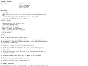
Mission: Possible
Students explore the concept of scale. In this scale lesson, students are given directions scaled in inches and students must convert them to feet. Students take a section of a map and create a bigger scaled model of the section.
Curated OER
Size Small School
Young scholars explore the concept of scale and ratio. In this scale and ratio instructional activity, students work in groups to measure a given space such as a hallway, office, or gym. Young scholars measure their area using a meter...
Curated OER
Civil War Naval Strategy
Students apply critical thinking skills to war strategy. In this Civil War map lesson, students use their knowledge of latitude and longitude as well as scale to respond to questions regarding Civil War battle strategies.
Curated OER
Community Map of The Giver
Middle schoolers read "The Giver" after finishing the unit on inventions and inventors. Using the information in the novel, they develop a geographic map illustrating the community in the story. They identify human and physical features...
Curated OER
Comparing Ratios
In this comparing ratios worksheet, learners solve and complete 3 different problems using the screens shown. First, they write a ratio that compares the shaded part to unshaded part illustrated. Then, students use the same grid to...
Curated OER
Acid Rain And Geology
Learners become aware of the environmental problems caused by acid rain and study the pH scale. They determine acidity of local rain water.
Curated OER
Alberta And Saskatchwan: the View in 1905
Students analyze the differences between maps 1905 and current maps of Alberta and Saskatchewan. They use maps from the Canadian Council for Geographic Education to complete a guided inquiry. This instructional activity also has many...
Curated OER
Reptiles
In this reptiles activity, students use an idea map to compare amphibian and reptile adaptations. Students complete 2 short answer questions based on the idea map.
Curated OER
Cartography
Students follow directions to draw a map of an island. They complete the island map adding their own details using symbols and a legend.
Curated OER
Building a Topographic Model
Learners explore the features of a topographic map. They make paper models that portray, in three-dimensions, features represented by contour lines on a topographic map. Students demonstrate different elevations shown on a...
Curated OER
Gilligan's Island
Students investigate topographical maps and match actual landforms to them. In this topographical maps lesson students create "Gilligan's Island" to scale then answer questions about it such as what the highest elevations is and what...
Curated OER
Ridgerunner
Students jog at the beginning of the class while learning about the Appalachian Trail. They integrate math into the lesson by adding up how many miles they have run, and comparing it to distances on a real trail map.
Curated OER
Shake, Rattle And Roll: Studying the Effects of an Earthquake
Learners gauge earthquake intensity by reviewing firsthand accounts. They use the Modified Mercalli Intensity Scale and newspaper articles to estimate the strength and effects of a past earthquake.
Curated OER
Mathematics of Image Processing
In this mathematics of image processing worksheet, students solve 10 various types of problems related to image processing on a computer. They type in all the commands listed and figure out what is going on. Then, students determine the...
Curated OER
Cookie Topography
Students construct a cross section diagram showing elevation changes on a "cookie island." Using a chocolate chip cookie for an island, they locate the highest point in centimeters on the cookie and create a scale in feet. After tracing...
Curated OER
Measurement and Data Collecting using Image Processing
Students trace the route of the historical event and measure the distance over which the people involved journeyed. A data sheet be constructed outlining the location of events, and the speed with which the journey occurred.
Curated OER
Using the New Zealand plate boundary models
Students examine the differences in the effects of the tectonic plates of New Zealand. In this tectonic plate lesson, students define and explain the process of subduction. Students recognize the difference in the movement of a...
Curated OER
ExplorA-Pond: 4th Grade Perimeter Estimation
Your geometers are used to finding the perimeter of a square or rectangle, so give them something different this time! With this lesson plan, small groups will receive a picture of a shoreline and calculate the perimeter. The website...
Curated OER
Find a Cave
Students locate their own communites and the nearest caves on a United States map. They calculate the distance to the nearest cave using rough scale.
Curated OER
Welina's World
Students living in Hawaii draw a picture of themselves in their neighborhood. They draw their neighborhood in relation to their district and then in relation to the island they are from. They compare their pictures to their classmates'...
Curated OER
Where is Everybody?
Students collect data from different grade levels at their school and develop thematic maps which show population density, and determine how this might affect the school and themselves in the future.
Curated OER
Weather Analysis - Lab Activity
Ninth graders perform research in the subject of weather to answer several key questions to increase comprehension of concepts. Students use weather prediction as an application for the research.
Curated OER
Where is ? ? ? ?
Students explain and explain the concept of a grid system. They define absolute and relative location and develop an imaginary city on graph paper using a grid system.
Curated OER
3D Textured Globe
The earth, our home planet, and the star of Earth Day celebrations everywhere! Celebrate Earth Day or examine Earth's place in the solar system, with a fun and easy craft, perfect for children nine and up. Paper mache ornaments, paint,...
Other popular searches
- Using Map Scale Distance
- Proportions Using Map Scale
- Using Scale on Maps
- Maps Using Scale
- Using a Scale Map


