Curated OER
How Much Water is in That River?
Students practice measurement using the Hudson River. They calculate the discharge measurement at a location on the Hudson River using ingenuity and a topographic map.
Curated OER
Reptiles
In this reptiles activity, students use an idea map to compare amphibian and reptile adaptations. Students complete 2 short answer questions based on the idea map.
Curated OER
Mathematics of Cartography
Students practice their math skills as they explore maps. In this cartography lesson plan, students calculate distance, scale, coordinate systems, and projection as they work independently reading online maps.
Curated OER
Location, Location
Third graders draw and interpret simple scale maps, use maps to move around efficiently or plans to propose actions. They use of a compass to specify and find directions. They display and discuss a map of the local region.
Howard Hughes Medical Institute
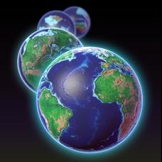
EarthViewer
Can you imagine Washington DC and London as close neighbors occupying the same continent? Learners will be fascinated as they step back in time and discover the evolution of the earth's continents and oceans from 4.5 billion years ago to...
Curated OER
Interior of the Earth
Sixth graders identify and describe the composition and physical properties of the layers of the Earth. They also explain how scientists used the scientific process to know about the center of the Earth. Finally, 6th graders read a...
Curated OER
Off to College
Students jog to where their classroom teacher went to college using a scale that best fits their situation. They log miles on a chart until students reach their destination. Students use the colleges mascot as the graph indicator as to...
Curated OER
Indianapolis Government
Students read about a girl who takes a trip during the time of the State Capital moving to Indianapolis and then write their own essay about a trip that they took. In this Indianapolis Government lesson plan, students use maps and...
Edgate
Great Grids
Learners use grid boxes as a measurement tool and discover how grids are used for mapmaking and scaling down an area. They begin by attempting to draw a model shape drawn by the teacher by using the gridding process. At the conclusion of...
Multieducator
Battle of Gettysburg
On July 1, 1863 the Army of Northern Virginia, under the command of General Robert E. Lee met the Army of the Potomac, under the leadership of Major General George Meade. Considered the turning point of the war, the Battle of Gettysburg...
Curated OER
America’s Early Colonies: John Smith and Jamestown, Va
John Smith's 1616 letter to Queen Anne of England offers ELLs an opportunity to learn about a bit of early American history. The four-page packet includes the full text of the letter. In addition, the packet includes a worksheet that...
Mathematics Assessment Project
Evaluating Statements About Enlargements
Double, toil ,and double linear dimensions. Learners first complete an assessment investigating how doubling linear dimensions affects the area of pizzas and the volume of popcorn containers. They then complete an activity investigating...
Mathematics Assessment Project
Comparing Strategies for Proportion Problems
Having problems with proportions? Then solve these proportion problems with an exercise that asks learners to first individually solve a set of problems involving ratios and proportional reasoning. Groups then discuss provided sample...
Curated OER
Freeform Texas Map
In this Texas map worksheet, learners research, label and discuss the most important cities in Texas, its physical attributes and the states that surround Texas.
Curated OER
Freeform Pennsylvania Map
In this Pennsylvania map instructional activity, students research, study and label twenty important cities, physical attributes and the neighbors that surround Pennsylvania on a Pennsylvania map.
Curated OER
A Thoreau Look at Our Environment
Sixth graders write journal entries o school site at least once during each season, including sketched and written observations of present environment. They can use sample topographical maps and student's own maps. Students can use...
Curated OER
U.S. Geography- The Northeast
Students investigate the geography of the Northeast states. In this map skills lesson, students are shown a map of the Northeast states and identify the state names and borders. Students construct individual maps of the Northeast using...
Curated OER
Teen America Travels New England
Students simulate the role of a travel agent to understand how to read and use road maps. They plan a bus trip through New England for a group of travelers that includes, bus travel, meals and attractions. They plan the distance that...
Curated OER
TOPSY TURVY MAPS
Eighth graders use the data analyzer and motion detector to collect data and measure distances. They create topographic maps drawn to scale of a given setup and relate the concepts to the creation of historical ocean maps.
Curated OER
Globe Skills Lesson 3 Voyage to the New World
Students explore the globe. In this globe skills lesson plan, students use their knowledge of latitude and longitude to respond to questions regarding Christopher Columbus's maiden voyage to the Americas.
Curated OER
Post Roads
Students locate the major cities in the colonies during the Revolutionary War. For this map skills lesson, students use a globe to locate cities such as Charleston and Boston using latitude and longitude coordinates.
Curated OER
Globe Skills Lesson 4 The Colonial Period
Students practice their map skills. In this Colonial geography lesson, students complete an activity that requires them to locate English colonial locations using latitude and longitude coordinates.
Curated OER
Spatial Connections
Students use maps, scales, and describe locations in order to learn about spatial sense. In this spatial sense lesson plan, students participate in many activities for this spatial sense unit that should last throughout the year.
Curated OER
Globe Skills Lesson 6 The Louisiana Purchase
Students explore the Louisiana Purchase territory. In this geography skills lesson, students use map skills in order to plot and note latitude and longitude, measure scale distance, and locate landforms that were part of the Louisiana...
Other popular searches
- Using a Map Scale
- Using Map Scales
- Using Map Scale Distance
- Using Maps to Scale
- Proportions Using Map Scale
- Maps Using Scale


