Curated OER
As the Bird Flies
Students investigate the properties of lines and congruent triangle theorems as well as apply geometric properties and relationships to real-world mathematical problems. Given two different scenarios, they examine maps that have been...
Curated OER
Landforms
Students begin their examination of landforms. Using a map, they locate and identify the major landforms on Earth. They discuss how landforms affect the lifestyle of the community and determine which goods and services the community...
Curated OER
Surface Air Temperature Trends of the Caribbean
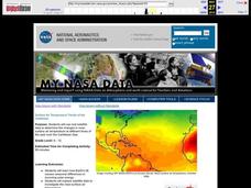
Students investigate the seasonal changes to sea surface and near-surface air temperatures near the equator. They use actual satellite data to track and graph the differences in air and sea temperatures during different seasons in the...
Curated OER
Journey Through Earth
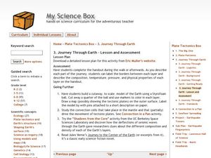
Students study plate tectonics. In this plate tectonics lesson plan students build a cutaway scale model of the Earth.
Curated OER
The Island of The Blue Eagles
Sixth graders read the book CALL IT COURAGE by Armstrong Sperry. They use the Internet to research and work in groups to write ocean chants. They construct dioramas and build a sea turtle withK'NEX.
Curated OER
Plot Current Earthquake Data
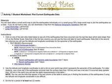
Students review earthquakes larger than 2.5 that have occurred over a span of several days using a given website reference. In this geology lesson, students plot epicenters on a world map and depth of the quake. All necessary websites...
Curated OER
The Distance Between Us and Them: Sea Floor Spreading in the Atlantic Ocean
Students examine how geologists determine rates of sea floor spreading between two tectonic plates. They apply mathematical concepts such as the calculation and use of velocities and conversion from one set of units to another.
Curated OER
Earth Science: The Structure of the Earth
Learners identify and complete activities about the structure of the Earth. In this Earth structure activity, students view a Powerpoint about the Earth's layers and complete a diagram. learners compare temperatures in the Earth's layers...
Curated OER
Down on the Ocean Floor
Students build a map of the Atlantic Ocean floor and mark the different depths. In this ocean floor lesson students identify parts of the ocean floor that they created and discuss patterns that they see.
Curated OER
Native American Music: Call-and-Response
Pupils are introduced to call-and-response form of Native American song and dance. They identify and describe a call-and-response form as used in "0 Hal'Lwe."
Male students will perform "0 Hal'Lwe" in call-and-response style with drum...
Curated OER
The Apollo-11 Landing Area at High-Resolution
In this moon crater worksheet, students use images of craters taken from the Lunar Reconnaissance Orbiter to determine the size of the craters. This worksheet has 6 problems to solve.
Curated OER
Poetic Justice: A Study of Poe's Famous Works
Students explore Edgar Allan Poe's most famous short stories. In this Edgar Allan Poe lesson, students complete a 25 page packet of activities where they recognize the features of genres and literary devices Poe uses. Students read "The...
Curated OER
Marvelous Mathematics
Students make a table on the computer, but create fractions and equivalent fractions through the use of color. They are able to manipulate fractions in order to gain a greater understanding of the meaning of whole number that is broken...
Curated OER
Arrange the Classroom (Part 1 of 3)
Fifth graders arrange the classroom using all the moveable objects and through the exploration of area and perimeter. They determine the area of the classroom, create and label model pieces of furniture using graph paper, and create a...
Curated OER
Refugees
Sixth graders use the internet as well as personal interviews to research refugees and refugee status from a Canadian and international perspective.
Curated OER
Data Sampling
Students discover data sampling. In this science lesson plan, students explore data sampling and turn the data collected into useful information by making graphs and using them to solve problems.
Curated OER
Magellan
Students identify the route of Magellan's voyage. In this map skills lesson, students use a globe to identify various coordinates where Magellan traveled.
Curated OER
Globe Lesson- Early Spanish Settlements
Students use a globe. In this geography and early settlements lesson, students learn about the settlement of missions and haciendas in New Mexico. Students locate Mexico City and San Francisco on the globe and determine the distance...
Curated OER
Our Energy
Fifth graders research energy sources used in the United States. In this energy sources lesson, 5th graders work in teams to research various energy sources. Students complete a worksheet for the research and make a short video of a...
Curated OER
Similar Triangles - Applied Problems
Students differentiate between similar and congruent triangles. In this geometry lesson, students identify the angles of triangles using the similarity theorem. They apply concepts of triangles to the real world.
Curated OER
Give Me Back My School: A Back to Basics Approach to Ecological Restoration
Ninth graders research local geography to create successful, ecological school landscaping. They determine soil type, average weather patterns and temperature graphs and use the information to select ideal plants and plant maintenance...
Curated OER
Idaho Earthquakes
Students examine the types of earthquakes that occur in Idaho. In groups, they compare and contrast the types of energy released and how they affect the movement of the Earth. To end the instructional activity, they analyze a map showing...
Curated OER
Gridding a Site
Students establish a grid system over an archaelogical site. They label each grid unit. They determine the location of artifacts within each grid unit. They construct a scientific inquiry concerning the location of artifacts on the site.
Curated OER
It's Happening, Where? Find the Absolute and Relative Location of News Articles
Young scholars read newspaper articles. In this social studies activity, students locate the latitude and longitude of the location where the news article takes place. Young scholars write a summary of the news article.
Other popular searches
- Using a Map Scale
- Using Map Scales
- Using Map Scale Distance
- Using Maps to Scale
- Proportions Using Map Scale
- Maps Using Scale


