Curated OER
Creating a Database: Africa, Technology, Social Studies
Students use technology to create a database demonstrating their knowlede (in the case) of the African Continent. This project could be applied to almost any other concept studied.
Curated OER
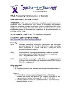
Translating Transformations in Geometry
Students create an image using given coordinates and evaluate how the coordinates change when a slide or rotation takes place.
Curated OER
Arrays Hooray
Second graders write and solve story problems which involve whole numbers, using addition, subtraction, multiplication, or division. They solve multiplication problems by using strategies other than counting all. They interpret and solve...
Curated OER
Ancient China: Student Created Word Search Puzzles
Sixth graders classify and organize information about ancient China. In this Chinese history lesson, 6th graders create word search puzzles and record the processes they used to create them.
Curated OER
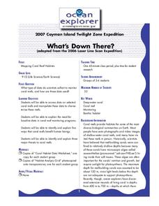
What's Down There?
High schoolers analyze data on coral reefs and use this to help characterize reefs. In this mapping coral reefs lesson students identify and explain the major threats to coral reefs.
Curated OER
Monument Museum
Students design monuments, taking into account what is known about geometric shapes and measuring. Students create a museum complete with monuments and descritions of the monuments. Students provide guides at each monument in order to...
Curated OER
It's Happening, Where? Find the Absolute and Relative Location of News Articles
Young scholars read newspaper articles. In this social studies activity, students locate the latitude and longitude of the location where the news article takes place. Young scholars write a summary of the news article.
Curated OER
Plotting Amish Farmland
Second graders listen to the book, Down Buttermilk Lane by Barbara Mitchell. They discover how to read a grid and then together as a class, plot 2 squares, one yellow and one green. Then they plot the remaining squares independently and...
Curated OER
From Home to School, GPS Style
Students are introduced and increase proficiency in the use of the hand held GPS system. They explore the meaning of longitude and latitude lines, then identify the parts of the map.
Curated OER
Rivers And Capitals
Students become familiar with the use of GIS for research and become aware of the importance of rivers to cities. They also analyze the placement of cities and learn the names of rivers in the United States.
Curated OER
Indiana Tornado Project
Students become familiar with the use of GIS for research, natural phenomena in Indiana, and analyzing collected information.
Curated OER
Got Park? Or if you build it, they will come!
Young scholars use GIS and GPS technology to evaluate, research, locate, and recommend where a new park should be located that benefit the community.
Curated OER
May We Present Planet Earth?
High schoolers draw a map to scale. They illustrate knowledge of how to use DOGS TAILS on a map. Students identify the main parts of a map. They identify and illustrate the major features necessary for sustaining a quality of life for a...
Curated OER
Heritage: Make a Model of a Typical Utah Settlement
Fourth graders examine the different types of settlements used in Utah. They take a community map of Utah past and present and compare the two. They create a model of the early types of settlements used by pioneers in Utah.
Curated OER
Properties of Lines - Parallel and Perpendicular
Sixth graders identify parallel and perpendicular lines in the alphabet. For this line properties lesson, 6th graders use the letters of the alphabet to show parallel and perpendicular lines. Students open a Geogrid Mat on the computer...
Curated OER
Longitude & Latitude
Seventh graders role play as ship's captains to study longitude and latitude.
Curated OER
ExplorA-Pond:3rd Grade Probability
Third graders cut a map of a pond into grid squares. They count the total number of squares and calculate the probability of drawing a pond piece vs. a shoreline piece. They draw 10 pieces and compare the results with the original...
Curated OER
Tailoring Two Cultures to Adapt to Wisconsin's Biotic Zones
Middle schoolers examine the effect of the various ice ages on Wisconsin. In groups, they create a map representing the five geographic regions of Wisconsin. They must write out a description of each region to be placed on a poster...
Curated OER
Possible Causes
Young scholars review any materials from two previous lessons on emissions. As a class, they use a graphic organizer to review their stakeholder's hypothesis. They identify possible causes of global warming and discover how to solve this...
Curated OER
Riemann Sums
In this calculus worksheet, students solve prolbem in which they estimate double integrals by using Riemann sums. The three page worksheet contains four questions. Answers are not included.
Curated OER
Where Can I See The Sea?
Students see how the pieces of the fossil puzzle fit together to allow the paleontologist to imagine the earth as it was millions of years ago. They draw a map showing what environments were present in a certain area more than 70 million...
Curated OER
Fourths of Sets
Students create a set of cards that represent factors of four and use these cards to play a game in which they practice separating numbers into fourths. They first practice separating numbers into fourths with a projected computer...
Curated OER
Research Question - Greenhouse Gas Emissions
Students review information from concept map to identify possible causes of greenhouse gas emissions, choose factor that they feel is largest contributor to greenhouse gas emissions in their town, and write research question on topic.


