Curated OER
Fictional Hereos
Students are introduced to the definition of a hero. As a class, they compare and contrast the difference between non-fictional and fictional hereos they have read about. They read a story, create a story map of one of the heroes and...
Curated OER
How Worldly Are You?
Sixth graders locate and map six components to have a working knowledge of maps. In this map skills lesson plan, 6th graders define the six map components and work in groups to draw a map using the components. Students read a...
Curated OER
Air Masses & Fronts
Students use a set of maps depicting a front passing through the state to identify two distinct air masses and the frontal boundary. They then deterine whether the front is moving in time and in what direction the front is moving.
Curated OER
California Indians
Fourth graders discuss the major nations of California Indians, their geographic distribution, economic activities, legends and religious beliefs. They describe the function of Spanish missions and the influence of Catholicism. In...
Curated OER
Mexico: One Land, Many Cultures
Students research and study the country of Mexico and complete a project about it. In this Mexico lesson plan, students research Mexico's geography, traditions, art, songs, stories, and legends that are native to Mexico.
Curated OER
Country Capitals
Students define the meaning of country capital. In this country capital lesson, students identify the symbol and find country capitals. Students locate and label capital cities on a map and insert the capital symbol.
Curated OER
Harding Black: Taking It To Another Level
Students complete a variety of activities related to the pottery of Harding Black and the uses of clay in San Antonio, Texas. They watch a video about the life of Harding Black, conduct a clay percolation experiment, compare and...
Curated OER
"Now and Then" Comparing Present Day with Medieval Times
Eighth graders compare a present-day social issue with a medieval issue. They use technology tools to conduct their research and demonstrate their new knowledge. Students present their findings to the class in the form of a PowerPoint.
Curated OER
Traveling the Silk Road
Students take a virtual trip down the Silk Road. Using a map, they trace the location of the trade route and others that were developed later. They use different spices and goods to trace how they came to the Americas. They answer...
Curated OER
Native Americans
First graders explore the lifestyles of several North American tribes. They investigate about the homes, food, transportation, and daily living habits of each tribe. Pupils use a map to locate several Native American tribes in North...
Curated OER
Refugees
Sixth graders use the internet as well as personal interviews to research refugees and refugee status from a Canadian and international perspective.
Curated OER
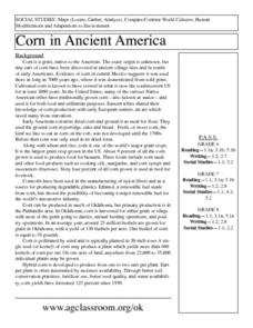
Corn in Ancient America
Students explore the importance of corn to the survival of early civilizations of the Americas. Through research and discussion activities, they read and describe how corn was used as food and currency in early civilizations. They...
Curated OER
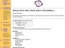
African Art is Alive: Drum, Dance, Storytelling....
Students investigate and experience African culture through various art forms. Students explore the physical and political geographies of Africa through mapping activities. Students, in groups, prepare presentations about different...
Curated OER
Groundhog Day
Learners use the SMART Board to learn about Groundhog day and create a tally chart of predictions for whether he will see his shadow or not. In this Groundhog day lesson plan, students respond to questions throughout the lesson.
Curated OER
Sky Pictures
Students investigate constellations. In this space science lesson, students view transparencies of constellations and identify the zodiac constellations. Students research the legends connected with the constellations.
Curated OER
The Woman Who Outshone the Sun
Third graders read the story "The Woman Who Outshone the Sun" from the Scott Foresman reading series. They create puppets and a setting out of a shoebox and retell the story with props. They research the Oaxaca region and the Zapotecs.
Curated OER
It's Happening, Where? Find the Absolute and Relative Location of News Articles
Students read newspaper articles. In this social studies lesson, students locate the latitude and longitude of the location where the news article takes place. Students write a summary of the news article.
Curated OER
Oregon Rainshadows
Students brainstorm list of possible highest locations in Oregon, identify and label places from list on map using color code, and discuss and identify causes of a rain shadow.
Curated OER
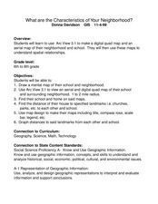
What Are The Characteristics of Your Neighborhood?
Students make a mental map of their neighborhood. Using a software program, they make an aerial and digital map of their school and locate their school on given maps. In groups, they calculate the distances to various locations and...
Curated OER
Social Studies For Elementary School
Fourth graders become familar with maps and work in groups to get an overview of what Europe is like. The real assignment is in the form of students creating their own trip if it could really be taken.
Curated OER
GIS and Agriculture
High schoolers are introduced GIS systems and how they operate. Using a GIS system, they locate and map the various types of agricultural products grown in Oregon. They rank each county based on the amount of agricultural products...
Curated OER
Hoosier Artists
Students examine the paintings of various Indiana artists. Using the internet, they relate the landscapes shown to the history of the state and how it affected Native Americans. Using the information they gathered, they write story...
Curated OER
Star Patterns
Third graders create constellation maps and record their own legends of how constellations came into existence. After observing the sky at night, 3rd graders discuss star maps, read previously recorded legends on the origin of stars. ...


