American Battle Monuments Commission
Liberating Rome: The Anzio and Rome-Arno Campaigns
Follow the liberation of Rome in both time and space with an interactive timeline and map. As class members click on various icons on the map, they can track different countries and their troops during the Anzio and Rome-Arno Campaigns...
Curated OER
Country Capitals
Students locate country capitals on a world map. In this map skills activity, students review the definition of the word country and discuss what a capital is. Students locate and label capital cities on a world map using a map marker.
Curated OER
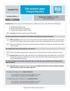
The Weather Page: Comparing Data
Students analyze data from maps. In this comparing data lesson, students use comparative and superlative statements to draw comparisons among the weather in different American cities based on USA Today weather maps.
Curated OER
Water Contamination Mapping Lab
Pupils are introduced briefly to the Biscayne Bay Ecosystem, observed microbe distributions and water current maps are introduced. They measure water current speeds to predict the movement of pollutants based on the type of the tidal flow.
Curated OER
Design an Island
Students make a map of an imaginary island using the topographic symbols provided from a worksheet. Students place lakes, dwellins, reefs, etc. in areas where they would logically be located from understanding how the topography of an...
Curated OER
Absolute And Relative Location
Students create a map that takes someone from school to their home using both relative and absolute locations. They assume the person using the map is unfamiliar with the area.
Curated OER
Nursery Rhymes
Learners recall details of nursery rhyme read by teacher, identify main characters, and demonstrate knowledge of poem by creating concept map about story that includes title, clip art, and changes in font and color.
Curated OER
Globe Skills Lesson 10 Apollo 11
Middle schoolers develop their globe skills. For this geography skills lesson, students use a globe and a softball to replicate distance between the earth and its moon.
Curated OER
Countries of the World
Students identify countries on a world map. In this map skills lesson, students define the word "country" and use post-it notes to locate several countries on a world map.
Curated OER
Mesopotamia
Young scholars map Mesopotamia. In this Geography lesson, students are introduced to Ancient Mesopotamia. Young scholars use an atlas to label the defining features and areas of Mesopotamia on a map.
Curated OER
Legends of the Navajo People
Second graders are read a story in which they begin to examine Native American legends. Using different legends, they discuss how they affected the future people of native peoples. They write a short story on the information they gathered.
Curated OER
Media Center Map Skills
Student demonstrates the ability to locate, retrieve, and handle media and equipment by utilizing the library media center floor plan, symbols, and guides. They then use systems of classification to identify, locate, and retrieve materials.
Curated OER
Mud Maps
Students discuss the location of stores, buildings, and homes in their community. Afterwards, they create a 'mud map' demonstrating the route from one point to another. In pairs, students read travel directions from a brochure, while...
Curated OER
Mapping the Changes
Students research an aspect of life of their choosing of a western state either before the Civil War, after the war or today. They are to write about the aspect they choose and make illustrations.
Curated OER
Using Graphic Organizers to Generate Genre Definitions
Students listen to or read a variety of stories and then work individually or in groups to complete graphic organizers that will help them focus on elements within different types of stories. They write definitions for a variety of story...
Curated OER
MAP UNIT
First graders investigate how maps are used to identify different locations. They will also appreciate how there are different types of maps for their purposes. Finally students study how maps contain symbols that represent real places.
Curated OER
Mapping Your Community
Students define the boundaries of their community by comparing the community's official boundaries with other historical, political, physical, and perceived boundaries of the area and create a community map.
Curated OER
Using a Dictionary- Definitions - Volume 5, #25
In this dictionary worksheet, students use a dictionary to help answer 5 multiple choice questions about the meanings of words. Students are asked the meaning, synonym or antonym of a word in bold type.
Curated OER
The Legend of Sleepy Hollow
Students research the American Revolution through the story of the Legend of Sleepy Hollow. In this American Revolution lesson, students research folktale and The Legend of Sleepy Hollow. Students view illustrations for the story....
Curated OER
Route To School Mapping Assignment
Students create a map showing the route from home to school. Students include a legend, compass, label buildings, and color the map route on the map. They write out specific directions.
Curated OER
Where in the World Am I?
Students participate in mapping activities to explore an area from different spatial perspectives. In this mapping lesson, students define the terms needed to understand a map. Students use representations such as a balloon and a...
Curated OER
Places in My World
Second graders explore where they are located on the globe. In this maps and globes lesson, 2nd graders use a map to show where they live and show the cardinal directions. Students identify characteristics of mountains, flat land,...
Curated OER
Our 50 States
Students identify the location of the 50 states using an interactive map. They practice geography skills by playing a fun game. Pupils become familiar with the state abbreviations for the US states. Students become familiar with the...
Curated OER
Ecozones Project
Learners examine, detail and produce a display about a particular ecozone in Canada. They produce a detailed wall map, written report and a summary sheet.


