T. Smith Publishing
Map Skills
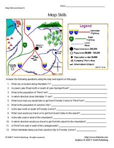
Help younger learners develop their map skills with this simple worksheet, which includes 12 questions utilizing a map legend that involves highway markers, population indicators, and other landmark signs.
abcteach
Street Mapping
What's around the block? Or down the street? Ask your pupils to tap into their map skills by drafting the area around their home and school.
Curated OER
Map Skills
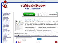
In this history worksheet, students utilize a map and legend to answer eleven comprehension questions. Students check their answers when done.
Curated OER
Map Skills
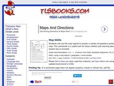
In this history worksheet, students use a map and legend to answer nine comprehension questions. Students check their answers when done.
Curated OER
Map Keys
In this geography worksheet, students identify who a cartographer is and what they do specifically. They study an outline map of a fictitious island and then, respond to the three questions that follow. Finally, students add three more...
Institute for Geophysics
Understanding Maps of Earth
Here is your go-to student resource on primary geography concepts, including facts about the surface of the earth and its hemispheres, latitude and longitude, globes, types of maps, and identifying continents and oceans.
Curated OER
Topographic Mapping Skills
In this geography worksheet, learners read an excerpt about topographic maps and why they are useful for various jobs. They also respond to eleven questions that follow related to the excerpt and locating specific map points on the map...
Curated OER
Map Analysis Worksheet
In this map analysis worksheet, students decipher what type of map they are using based on a complete list of criteria. Students then answer multiple questions based on their discoveries.
Curated OER
The Roman Empire-Map Activity
In this Roman Empire worksheet, students complete a map activity in which they label and color civilizations, countries and physical features as instructed. There are no maps included.
Curated OER
Mapping Exercise
For this mapping worksheet, students are given data of children exposed to health risks and their geographical location. Students plot each child's home and the risk factors using an (x, y) grid. They answer 2 questions about the...
Curated OER
How to Interpret a Map
In this social studies worksheet, learners find all the important facts on a map. Students find any map and fill out the chart and answer 12 questions about what they find.
Curated OER
BOLTSS Map
In this geography worksheet, students identify the six features always used on maps. They identify each of these features by the acronym BOLTSS. Students examine the Melbourne Cricket Ground shown and respond to the 4 questions that follow.
Curated OER
Bermuda Triangle: Map Activity
In this Bermuda triangle worksheet, students complete a set of 4 questions using a given map of the Bermuda triangle. Answers are included on page 2.
Curated OER
Globe Skills Lesson 5
For this map skills worksheet, students read a text selection about locations during the American Revolution and then respond to 8 fill in the blank questions.
Curated OER
Using a Dictionary- Definitions - Volume 5, #25
In this dictionary worksheet, students use a dictionary to help answer 5 multiple choice questions about the meanings of words. Students are asked the meaning, synonym or antonym of a word in bold type.
Curated OER
Knights of the Round Table
As an exploration of the Knights of the Round Table, this activity helps students organize their information and check for understanding by using the comprehension questions. This packet would be a terrific supplement to a unit on this...
Curated OER
Rivers Run Through It
In this mapping practice activity, 5th graders read an informational paragraph and answer 7 questions about the parts of a map along with places shown on a given map.
Curated OER
Hurricane Frequency: Identifying Regions with Similar Numbers of Hurricanes
In this earth science worksheet, students answer 6 questions about the hurricane map and data provided. They create a data table based on the information provided on the map.
Curated OER
Ancient Egypt
In this ancient Egypt worksheet, 6th graders use maps in chapter 5 of a Houghton Mifflin text to label items on an outline map and answer a set of 10 related questions.
Curated OER
Colonial Regions of America 1689 - 1754 Worksheet
In this Colonial America learning exercise, students color and label a map of the 13 colonies. They complete three more maps on which they label the major cities and waterways in New England, the Middle, and the Southern colonies. They...
Curated OER
Worksheet #10: Transportation and Communication
In this transportation and communication worksheet, students answer short answer questions about transportation and communication for the county they live in. Students answer 5 questions.


