Curated OER
Teen America Travels New England
Students simulate the role of a travel agent to understand how to read and use road maps. They plan a bus trip through New England for a group of travelers that includes, bus travel, meals and attractions. They plan the distance that...
Curated OER
An Early American Culture
Pupils identify the locations of the Hopewell culture. In this map skills lesson, students use a globe to mark several locations of the Hopewell culture.
Curated OER
Generate an Accurate Landscape Profile from a Topographic Map
Students enerate an accurate landscape profile from a topographic map. They determine the correct interval needed to accurately graph the change in elevation on a single piece of graph paper.
Curated OER
Exploring the Hudson in 1609
Learners follow the journey of Henry Hudson down the river with his name. Using journal entries and maps, they learn about its exploration. They use maps to identify stages of the journey, and practice converting distances into miles.
Curated OER
Estimating Distances
Middle schoolers investigate distance measurement. In this middle school mathematics lesson, students find the average length of their pace and use their pace to measure various unknown distances in feet and miles. Middle schoolers...
Curated OER
Scale Drawings
Students discuss the importance of scaling drawings. For this math lesson, students create a scaled drawing of circuit boards. They explain why accuracy is very important when scaling.
Curated OER
Topographic Map Unit Plan
Learners examine topographic maps and discover how to decipher contour intervals, use contour lines and apply information to complete a topographic map lab. Working in groups, they identify the scale of the map, latitude and longitude,...
Curated OER
Coordinate Grid: Mapping an Archaeological Site
Students examine how archaeologists preserve context of sites through use of rectangular grid or Cartesian coordinate system, and develop sense of distance by pacing off and estimating distances.
Curated OER
Building a Scale Model
Third graders create a model of the solar system. In this solar system lesson, 3rd graders create a scale model of the solar system. Working in pairs students solve mathematical problems to correctly measure the distance each planet is...
Curated OER
Current Events, Geography
Students read the newspaper to become aware of what is happening in their city, state, nation, and world. They summarize, find locations on a map and ask thought-provoking questions.
Curated OER
Johnny Appleseed Walkabout
Second graders calculate mileage for a journey. In this place value and measurement lesson, 2nd graders read Johnny Appleseed, work in groups to locate his birthplace on a map, locate the other states he stopped in, and measure the...
Curated OER
One Size Fits All?
Students describe the differences between an estimate and a guess. They create reasonable estimates based on comparison and activities. Students explain how estimation is helpful in showing the relative size on a scale. They also...
Curated OER
Plan a Cruise Lesson Plan
Students measure distances and report them in fractions, convert fractions to decimals, and multiply decimals.
Curated OER
Maps, Charts, and Graphs
Students define key geographic terms and track a hurricane on a map. They examine various types of maps and find locations on them,including rivers, cities and mountains.
Science Matters
Earth Shaking Events
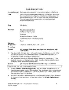
The world's largest measured earthquake happened in 1960 in Chile, reaching a terrifying 9.5 magnitude on the Richter Scale. The second lesson in the 20-part series introduces earthquakes and fault lines. Scholars map where previous...
Curated OER
Separate Vacations
Students plot the migration paths of birds using latitude and longitude data from a table.
Curated OER
The History of Life on Earth
Using meters as years, your class works together to map out the geologic time scale on a football field. Plenty of background information is included in this lesson plan as well as several resource links and a student worksheet. Your...
Curated OER
Measurement and Data Collecting using Image Processing
Students trace the route of the historical event and measure the distance over which the people involved journeyed. A data sheet be constructed outlining the location of events, and the speed with which the journey occurred.
Curated OER
Find a Cave
Students locate their own communites and the nearest caves on a United States map. They calculate the distance to the nearest cave using rough scale.
Curated OER
Geography With Dr. Seuss
Students read the book, The King's Stilts by Dr. Seuss and discuss the geographical information given in the book. Then they discuss and locate on a map the physical features that make up the continent of Africa. They create an original...
Curated OER
The Geologic Time Scale
Students research and explore the earth's past and make comparisons with the earth's present. They map out a timeline that explains how the earth and its organisms have changed over time. Studnets create a scale for their time line, they...
Curated OER
Map Scale and the Pioneer Journey
Fourth graders use a map, ruler and calculato to determine the distance the pioneers traveled from Nauvoo, Ill. to the Salt Lake Valley.
Curated OER
Playground Mapping
Students review their physical models of the objects on their playground at school. Using the model, they convert it into a map with a scale and key. To end the instructional activity, they use the map to locate different objects and...
Curated OER
Math: Checking Scale Drawings for Accuracy
Students critique their own drawings for accuracy and make constructive suggestions prior to reworking them. They discover how scale in maps and drawing relate to relative size and distance. In addition, students comprehend the...


