Discovery Education
Architects in Action
Hands-on and real-world applications are great ways to teach mathematical concepts. Creative thinkers examine how ratios are used to create scale models of buildings and structures. They practice working with ratios by looking at a map...
Curated OER
Help! I Am Lost at Fox Chapel
Sixth graders create a map to locate places on campus and share the map with another student. The other students use the map to locate certain places and validate for accuracy via a checklist. The parents use the completed map at open...
Curated OER
The O Zone-Code Read Alert
What are the effects of an air quality alert? Expert groups receive one component of air quality information resources to study. Pupils then jigsaw into new groups and share their knowledge. Finally, they draft a statement of what they...
Curated OER
Solar Heating in the Himalayas
A fascinating instructional activity on how solar power is utilized by people who live in the Himalayas is here for you. In it, learners perform a case study which will help them understand that solar energy is a renewable resource, that...
Curated OER
Volcano Contour Models Activity
Learners experiment with water levels and plastic topographic volcano models to determine the contour lines that would be used to create a topograpohic map of a volcano. They use the traced lines to actually develop the map.
Curated OER
Cardinal and Ordinal Directions
Students use a compass to locate cardinal and ordinal directions. In small groups, they describe and create a journey for their classmates using their compass. Groups create a scale map for their classmates to follow and relate this...
Curated OER
The Coldest Place at the Bottom of the World
Students examine Ernest Shackleton's journey through the Antarctic and trace Shackleton's Actual Route on a map using longitude and latitude coordinates. Students compare his intended route with his actual and determine how far off...
Curated OER
Lesson on GPS
Students investigate global positioning systems. In this technology and mapping lesson, students view a PowerPoint presentation in which they identify the features of a GPS, state its uses, and follow steps to find a waypoint.
Curated OER
Shipping in the United States in 1835
Students use transportation routes existing in 1835 to plot a shipping route from Boston to Cincinnati. They use the map scale to measure distances and plot a trip.
Curated OER
Cartography Project
A lesson involving mapping, the use of a compass, writing and following directions, and exploring the first two themes of geography is here for you. Learners create original maps that show the routes they take through their own...
Curated OER
How do we measure global earthquakes?
Students examine three seismograms of a recent South American earthquake recorded by USGS stations. They measure the S-P distance and use a P and S wave travel-time graph to find the epicenter distance for each seismogram. In addition,...
Curated OER
GPS Art
Students design their own logo or picture and use a handheld GPS receiver to map it out. They write out a word or graphic on a field or playground, walk the path, and log GPS data. The results display their "art" on their GPS receiver...
Curated OER
Science: Draining the Land - the Mississippi River
Students use topographic maps to identify parts of rivers. In addition, they discover gradient and predict changes in the channels caused by variations in water flow. Other activities include sketching a river model with a new channel...
Curated OER
A Phylogenetic Perspective for the Cladistically Challenged
Young scholars use M&Ms to simulate radioactive decay of elements.
Curated OER
"Now and Then" Comparing Present Day with Medieval Times
Eighth graders compare a present-day social issue with a medieval issue. They use technology tools to conduct their research and demonstrate their new knowledge. Students present their findings to the class in the form of a PowerPoint.
Curated OER
Amelia the Pigeon: As a Pigeon Flies
Learners follow Amelia's adventure on a satellite image. They use measuring and math skills to determine the distance she traveled.
Curated OER
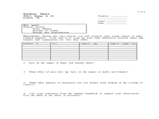
Who's Range is it?
Students investigate the habits of panthers by analyzing radio transmitted data. In this animal life lesson, students utilize computers to view the range of different statistics dealing with Florida panthers. Students...
Curated OER
Pacific Atolls and Island Groups
Young scholars construct, interpret and translate maps and geographic data. Given a worksheet, students identify an island, an atoll, a scale, and a compass rose. Young scholars grid systems, legends, and symbols. They use the map to...
Curated OER
CASTLE ROCK PUEBLO: A TRIP THROUGH TIME
Students use a map to respond to a series of questions. They determine how much time it would take to travel to Castle Rock Pueblo from different pueblos and locate modern pueblos on the Indian Country map.
Curated OER
Mapping The Way With Lewis & Clark
Fourth graders analyze and compare maps used on the expedition of Lewis and Clark. Students write reports about the geography of the land. They answer questions about Lewis & Clark.
Curated OER
Running Water/Rivers-Life Cycle
Students explore the parts of a river system and use topographical maps to determine the stage of the river.
Curated OER
Measurement and Data Collecting using Image Processing
Students trace the route of the historical event and measure the distance over which the people involved journeyed. A data sheet be constructed outlining the location of events, and the speed with which the journey occurred.
Curated OER
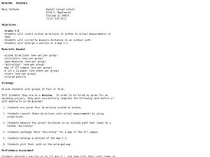
Mission: Possible
Learners explore the concept of scale. In this scale lesson, students are given directions scaled in inches and learners must convert them to feet. Students take a section of a map and create a bigger scaled model of the section.
Curated OER
Magnitude vs Intensity
Learners use a zipcode map to locate earthquake experiences based on the Modified Mercalli Scale. They discuss the difference of the magnitude of an earthquake compared to the intensity of the shaking it causes.


