Curated OER
The Artifact Problem
Students work in small groups and make a map of a familiar room. For this artifact lesson, students decide on a suitable scale for their maps, the tools they will use and how they will make it and decide on strategies they would use to...
Curated OER
COME INTO MY PARLOR
Young scholars interpret a map scale to measure the space in a milking parlor. They reveiw the process of using a map scale to calculate distances. Students are given worksheets, they read the information in the box together. They draw...
Curated OER
Dough Lake Topology
Students practice coordinates and measurements, develop 2D, 3D topological map, construct grid with string on real surface, establish "level" fixed point for measurements, take and record data points of elevation, and enter data on...
Curated OER
A Look at the Population Density of the United States
Young scholars acquire census information and create maps of the population density of the United States on different scales. They role play the roles of workers of a retail company and they use the population data to market to their...
Curated OER
The Dynamic Earth
Learners use the Internet to investigate earthquakes and plate tectonics. In this plate tectonics lesson, students complete a web quest with multiple links and activity types relating to earthquakes and volcanoes. They connect the...
Curated OER
Know Your Area
Young scholars investigate transit by analyzing their school surroundings. In this local geography lesson, students identify their school in relation to the rest of their state, country and globe. Young scholars discuss their personal...
Curated OER
What's Its Slope
Students identify the slope of a lines.In this algebra lesson, students define the meaning of slope and write an equation given the slope. They graph linear functions using the slope and y-intercept.
Curated OER
Volcanoes
Second graders review the characteristics and aspects of volcanoes. Using this information, they write a creative story and draw illustrations to accompany the words. They use geographical terms to describe a location and the physical...
Curated OER
This Land is Your Land - Delaware
Students determine how land was divided and marked for boundaries in the early days of settlement in Delaware. Students mark out land on the playground according to the methods used by the early settlers. Students write a description of...
Curated OER
Medieval Castles
Second graders design a scale model of a medieval castle and its surroundings including the following items: castle, moat, bailey, drawbridge, turrets, dungeon, grounds, and outer walls. A perfect lesson for those kids who are fascinated...
Curated OER
Ocean Currents
Fourth graders work in groups to research ocean currents and create posters with their findings. They locate the patterns and names of major ocean currents and identify them on a map. Students also use red pencil to show ocean currents...
Curated OER
Plant Life of the Rainforest
Students study pictures of tropical rainforests and discuss its stratified character. Students then work with a partner to make a scale drawing of the rainforest strata.
Curated OER
Evaluating an Illinois Earthquake
Students examine the frequency of earthquakes in Illinois. They discover the distribution of earthquakes in the Midwest. They also practice reading measurements from the Richter scale and Mercalli Intensity scale.
Curated OER
Physical and Human Geography Review Worksheet and Study Guide
For this geography skills worksheet, students respond to 30 short answer questions pertaining to physical and human geography.
Curated OER
Finding an Earthquake's Epicenter
High schoolers examine the process used to identify the epicenter of an earthquake. They identify the Richter scale and interpret a seismograph reading. They also view photographs of the aftermath of earthquakes.
Curated OER
Outlandish Landforms
Seventh graders examine landforms. For this world Geography lesson, 7th graders research and create a physical model of a chosen landform. They then draw a 2-d paper map of that model.
Curated OER
Where Did We Go on Holiday This Year?
In this differentiated whole-group activity worksheet, students list all the places they visited over the summer, record the places on a flip chart, calculate the distances on a road map and graph the data they collect.
Curated OER
Globe Lesson- The Revolutionary War
Students discover using globes. In this geography lesson plan, students use a globe to outline the original 13 colonies. Students also use a globe to measure the distance from London to New York City and determine how many days it would...
Curated OER
Measuring Distance and Area in Satellite Images (College Level)
Students are able to download, install, and use Image J image analysis software to quantify change over time in satellite images. They access and download satellite images for specific locations and times. Students set a scale (spatial...
Curated OER
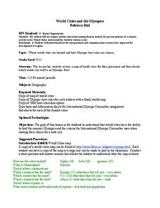
World Cities and the Olympics
Pupils examine the various cities in which Olympics have been held. Using a map, they describe the reasons why those cities were chosen and choose their own city for the Olympics and state the reasons why. They examine information sheets...
Curated OER
Design a Zoo Project
Young scholars research animals to become experts on them. They design a zoo to fit their animal's climate and region. They create a computer drawing of their zoo at the end of the lesson.
Curated OER
Complex Analysis: Linear Transformations
In this linear transformation learning exercise, students find a series of linear transformations and sketch them. This four-page learning exercise contains approximately six problems.
Curated OER
How Healthy is the Wetland?
Young scholars explore wetlands. In this ecology lesson, students visit a wetland site and collect data about the wetland functions. Young scholars record their results and use the data recorded to rate the wetland site on its function.
Curated OER
Families and Neighborhoods
Students distinguish where their homes are in relation to the city of Pittsburgh. In this geography lesson, students read the book All Families Are Specialand find their city on a map of Pennsylvania. Students locate Pittsburgh...


