Curated OER
Proportions and Scale Factor for Measurement
Young scholars explore the concept of proportion. In this proportion lesson, students use google maps to find the distance the their school is from home. Young scholars discuss what a scale factor is through teacher led discussion....
Curated OER
Scale Skills
In this mapping skills worksheet, students read an excerpt that describes three different types of scales and how to calculate distance on a map. They respond to two short answer questions using the map provided on the sheet and to...
Compton Unified School District
How Can We Locate Places?
How can we locate places? Maps, of course! Expose second graders to the tools available in maps and discuss how these tools can help people find locations. Students also look at communities, including what makes a community and the...
Curated OER
Scaled Rubber Band Drawings
Students demonstrate the process of creating a scaled rubber band enlargement of a simple drawing. They observe and discuss a teacher-led demonstration, and create a scaled rubber band enlargement of simple drawings and their invention...
Curated OER
Mapping Puerto Rico
Students use maps to discover where Puerto Rico is located. In groups, they use the internet to research the vegetation. They also compare and contrast the relationship between the United States and Puerto Rico's government.
Curated OER
Rivers, Maps, and Math
Students use maps to locate and label the major rivers of North and South America. Using the internet, they identify forests, grasslands, mountain ranges and other landforms on the continents as well. They compare and contrast the...
Curated OER
Make a Classroom Map
Students map the items in their classroom to explain the importance of coordinate systems.
Curated OER
Mapping the Bone Field: An Area and Scale Exercise
Here is an excellent cross-curricular lesson plan. Learners relate multiplication to area by making a grid on graph paper, and then creating the same grid in real space outside in the school yard.
Curated OER
Exploring Biomes Lesson 4: Mapping Arizona
Once junior ecologists are familiar with Earth's major biomes, they hone in on Arizona's biomes. Using a website about Arizona's natural resources, learners will identify biotic communities. Beautiful maps and worksheets are provided for...
Science Matters
Finding the Epicenter
The epicenter is the point on the ground above the initial point of rupture. The 10th lesson in a series of 20 encourages scholars to learn to triangulate the epicenter of an earthquake based on the arrival times of p waves and s...
Curated OER
Map Scale
Third and fourth graders are introduced to the concept of map scale. Using an illustration, they discuss if it shows the actual size of the object and why scale is used to represent areas. They use some items in the illustration to...
Curated OER
Learning Ratios and Proportions Through Scale Drawings
Middle and high schoolers explore the concept of scale drawings. They discuss what a scale is and that scales provide a ratio. Pupils construct a scale drawing of their classroom using graph paper.
Curated OER
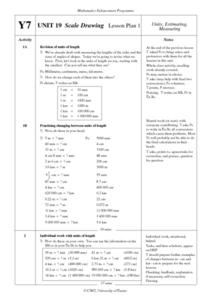
Scale Drawing Lesson Plan
Students calculate actual building measurements from a village map using concepts of ratios and scale in this ten lesson mini-unit. They practice measuring angles, multiplying decimals, estimating height and length, and converting metric...
Curated OER
Maps and the Pictures in Our Heads
Geographers of all ages examine different types of maps. They draw maps of their environment, utilizing both three-dimensional and picture maps. They interpret map information, noting how it can sometimes be misleading. Some good...
Curated OER
Mapping Perceptions of China
Students discuss what types of things are included on a map. They compare and contrast maps of China with a map they create and practice using different types of maps. They write analysis of their classmates maps.
Curated OER
Maps Not Drawn to Scale
In this maps learning exercise, students redraw a map to make it more accurate and drawn to scale in the space given. Students draw 1 map and answer 2 questions.
Curated OER
A Map of the Big Race
Students read a novel and practice putting the events into the correct sequence. Using the text, they create a map showing the events of the race in order and a legend. They must use vocabulary from previous chapters and make their map...
Curated OER
Mapping Central Park
Students use the mapping skills to explore New York's Central Park. They examine a map of Central Park to discover its features. After discussing the characteristics of the park, students design their own dream park and draw it to scale.
Curated OER
Basic Mapping Skills
Establish and study the parts of a map with your class and, then they will work in small groups to create their own detailed map, including a legend. There are specific instructions to follow on what needs to be included.
Curated OER
Exploring Arizona's Biotic Communities Lesson 1: Mapping Biotic Communities
As part of a unit on Arizona's biotic communities, young ecology learners create a map. They describe how humans and animals adapt in their habitat. They take notes and create graphic organizers from articles they read. Beautiful maps,...
Curated OER
We're on the Map!
Young scholars identify a variety of topographic map symbols. They make generalizations about an unidentified community by reading and interpreting map symbols.
Radford University
The Wheels on the Bus
Find a cheaper way to keep buses going round and round. Small groups use their knowledge of ratios and proportions to find ways to save money on school transportation. The teams determine the number of miles buses currently travel by...
Mathematics Assessment Project
Fruit Boxes
Perfect for visual and hands-on learners, an engaging lesson prompts pupils to consider the different-sized boxes they can create from a piece of cardboard. They develop a model to determine the size of the box with the greatest...
Radford University
Earthquake Problem
Shake up things in the classroom. The unit uses earthquakes to bring a real-life connection to finding arc lengths, logarithms, and equations of circles. Small groups determine whether particular towns would have felt an earthquake after...


