Curated OER
Immigration
Students explore the concept of immigration. In this immigration lesson, students read literature, analyze photographs, and evaluate political cartoons that reflect feelings about immigration in America during Industrialization....
Curated OER
Oceanography
Fifth graders study the topography of the ocean floor. They determine its ever changing nature as they examine currents and trade winds. They write paragraph describing how the winds might affect land formations after the discussion of...
Curated OER
The Big O
Learners investigate the characteristics of a community. They investigate the characteristics of the Omaha community through internet research and discussion. Students create books about their community.
Curated OER
Town Planning
Seventh graders consider factors in making road transport planning directions. They write a short speech for a presentation at an inquiry. They debate and analyze the information presented in the debate.
Curated OER
The Geography of Aboriginal Languages in Canada
Students study the relationship between geography and the Aboriginal language communities.
Curated OER
Two Ways About It
Students take an imaginary hike in two opposite directions along a lake. They view and interpret satellite images and discuss the pros and cons of hydroelectric dams.
Curated OER
Translating Traditions
Students analyze art reflective of traditions and cultural heritage. In this art analysis lesson, students complete image based discussion.
Curated OER
New Pen at the Zoo
Students create two drawings for a new animal pen design at the zoo. They must draw the ideas keeping the amount of material available in mind. They compare and contrast their two designs and write how they are similar in perimeter and...
Curated OER
Species and Spaces - At Risk at Home
Eleventh graders explore and compare Canadian biomes and investigate species at risk. They describe population growth and eco-regions in terms of climate and geography. They research and create presentations about the natural history and...
Curated OER
Date a Rock!
Students figure the number of half-lives since the sample solidified, and therefore the "age" of the sample rocks.
Curated OER
It Takes All Kinds!
Young scholars view video clips and observe similarities and differences between animals. They sort animals into groups for a zoo. They make a graph of their observations and review scientific classifications.
Curated OER
No Man is an Island
Students sing the melody of the song, "No Man is an Island," in the Oneida native language. They memorize the song and discuss how the words demonstrate important feelings of the Oneida people.
Curated OER
Alaska's Physical Systems and History
Students read about Alaska's physical systems and determine how Alaska's physical makeup has impacted its history. They create timelines of their particular physical system.
Curated OER
Weather... Or Not
Young scholars observe and discuss the local weather patterns, researching cloud types and weather patterns for cities on the same latitude on the Internet. They record the data for 6-8 weeks on a graph, and make weather predictions for...
Curated OER
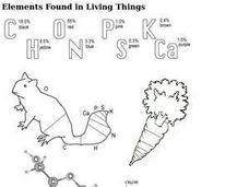
Elements Found in Living Things
In this elements worksheet, students review the most common elements found in living things. Students color in two pictures with the percentages of the elements found in that living thing.
BBC
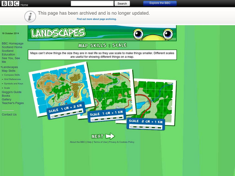
Bbc: Landscapes: Scotland: Map Skills: Scale
Lesson for elementary students on map skills uses a map of Scotland to teach about the concept of scale.
Other
Centre for Topographic Information: Map Scale
This resource uses illustrations to demonstrate scale. Check out the links to the The National Topographic System of Canada and the Aerial Survey Data Base.
CK-12 Foundation
Ck 12: Algebra: Scale and Indirect Measurement Applications
[Free Registration/Login may be required to access all resource tools.] Use map scales and proportions to solve for unknown distances.
TeachEngineering
Teach Engineering: Scaling the Map
Students learn how to determine map distances and areas using the map scale. They get a feel for how much an area represents on the map in relation to the size they are suggesting for their underground caverns to shelter the Alabraska...
University of California
World History for Us All: Getting Our Bearings: Maps of Time, Space, and History
Understanding history requires students to be able to see the big picture. This teaching unit introduces students to tools they can use to investigate history. Topics covered include cartography, chronography, and maps of space, time and...
PBS
Pbs Learning Media: Aiming for the Basketball Hall of Fame
In this video segment from TV 411, two Atlanta Hawks players plan a driving route to reach the Basketball Hall of Fame. They use map scales to estimate their travel distances.
CK-12 Foundation
Ck 12: Measurement: Scale Factor to Find Actual Dimensions
[Free Registration/Login may be required to access all resource tools.] Use scale factor to find actual dimensions from scale models, drawings or maps.
Better Lesson
Better Lesson: Scale Drawings
This lesson will provide students the opportunity to work with scale drawings as they create their own road trip to see how far they go using a map of the United States.


