Curated OER
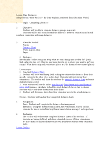
Comparing Distances
Young scholars practice estimating distances by analyzing a map. In this length measurement lesson plan, students view a map with a distance key and use their measurement skills to estimate the distance between two cities. Young scholars...
Curated OER
Civil War Naval Strategy
Students apply critical thinking skills to war strategy. In this Civil War map lesson, students use their knowledge of latitude and longitude as well as scale to respond to questions regarding Civil War battle strategies.
Curated OER
Community Map of The Giver
Middle schoolers read "The Giver" after finishing the unit on inventions and inventors. Using the information in the novel, they develop a geographic map illustrating the community in the story. They identify human and physical features...
Curated OER
Acid Rain And Geology
Learners become aware of the environmental problems caused by acid rain and study the pH scale. They determine acidity of local rain water.
Curated OER
America Will Be
Students work together to research and create different types of maps of the United States to be used as part of a geography trivia game.Groups research North American annual rainfall, climate, mountain ranges major rivers and state...
Curated OER
Cartography
Students follow directions to draw a map of an island. They complete the island map adding their own details using symbols and a legend.
Curated OER
Building a Topographic Model
Learners explore the features of a topographic map. They make paper models that portray, in three-dimensions, features represented by contour lines on a topographic map. Students demonstrate different elevations shown on a...
Curated OER
Gilligan's Island
Students investigate topographical maps and match actual landforms to them. In this topographical maps lesson students create "Gilligan's Island" to scale then answer questions about it such as what the highest elevations is and what...
Curated OER
Ridgerunner
Students jog at the beginning of the class while learning about the Appalachian Trail. They integrate math into the lesson by adding up how many miles they have run, and comparing it to distances on a real trail map.
Curated OER
Mathematics of Image Processing
In this mathematics of image processing worksheet, students solve 10 various types of problems related to image processing on a computer. They type in all the commands listed and figure out what is going on. Then, students determine the...
Curated OER
Measurement and Data Collecting using Image Processing
Students trace the route of the historical event and measure the distance over which the people involved journeyed. A data sheet be constructed outlining the location of events, and the speed with which the journey occurred.
Curated OER
Using the New Zealand plate boundary models
Students examine the differences in the effects of the tectonic plates of New Zealand. In this tectonic plate lesson, students define and explain the process of subduction. Students recognize the difference in the movement of a...
Curated OER
Cruisin' the Counties: Learning Counties and Major Roads in Arizona
Students examine Arizona counties and use the themes of location and movement to develop an Arizona map.
Curated OER
Weather Analysis - Lab Activity
Ninth graders perform research in the subject of weather to answer several key questions to increase comprehension of concepts. Students use weather prediction as an application for the research.
Curated OER
Volcano Contour Models Activity and Tracing the Highs and Lows in San Francisco
Students investigate how to draw topographic contours and read topographic maps.They examine the topography of San Francisco and contrast the elevation of different points within San Francisco.
Curated OER
Through the Looking Glass: Recognizing Developing and Industrialized Countries
Students examine the regions of the world, and identify the basic characteristics of industrialized and developing countries. They conduct Internet research on the economic and population characteristics of industrialized and developing...
Curated OER
Where is ? ? ? ?
Students explain and explain the concept of a grid system. They define absolute and relative location and develop an imaginary city on graph paper using a grid system.
Curated OER
Turtle Legends
Students listen to the legend, Thirteen Moons on Turtle's Back. They create a new moon for the calendar based on this natural part of everyday life in the seasons. They illustrate it under the story using water color paints.
Curated OER
Dinosaurs and Classification
Second graders explore dinosaurs and identify them by their size. They compare the dinosaurs with objects around the school or on the playground. Students predict which dinosaurs are the largest and then measure the length of dinosaurs.
Curated OER
Scale Basketball
Students discuss scale diagrams and maps as well as the use of spreadsheets to find the best scale to use in a model before practicing scale and ratio problems on their own.
Curated OER
Map Scale and the Pioneer Journey
Fourth graders use a map, ruler and calculato to determine the distance the pioneers traveled from Nauvoo, Ill. to the Salt Lake Valley.
Curated OER
Mapping an Artifact
Students copy a present day artifact onto graph paper. In groups, they decide the scale of the drawing and create the picture using specific graphing points. They are also given photographs in which there are no graphing points and they...
Curated OER
Mapping of the Earth's Past
Students create a scale model time linen of the Earth's 4.6 billion year history. They calculate a scale that can fit on a very long register tape then label each geologic era. They use text books to annotate each era with major geologic...
Curated OER
The Tale of Scale
Eighth graders, using a range of data, produce three bar graphs for various scales along the y-axis.


