Curated OER
Earthquakes and Volcanoes
Students explore plate tectonics, earthquake faults, and the types of volcanoes.
Curated OER
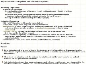
Recent Earthquakes and Volcanic Eruptions
Young scholars study the recent earthquakes and volcanic eruptions. In this recent earthquakes lesson students complete an activity while working in groups.
Curated OER
Volcanoes
Students use the research the different types of Volcanoes. In this Earth Science lesson, students use provided websites to collect information about volcanoes. They work in pairs to review the different types of volcanoes and then...
Curated OER
Crater Lakes and the Volcanoes of the Cascade Mountains
Students study volcanoes. In this Earth science lesson plan, students read, discuss and take notes on the volcanoes of the Cascade Mountains. This lesson also includes an art project.
Curated OER
Earth and Space Science: Exploring Earthquakes
Students explore earthquakes. In this earthquake lesson, students research earthquakes and identify where they take place. Students use map skills to track down earthquake locations. There are internet sites suggested in this lesson.
Curated OER
Volcanoes and Urban Planning
Students analyze satellite image data of Volcan Villarica. In this earth science lesson, students identify dangerous areas surrounding the volcano. They propose a new safe location for the town.
Curated OER
Friendly Volcanoes
Students discuss the benefits of volcanic activity on marine life. They explain the process of tectonic plates.
Curated OER
Los Volcanes Mexicanos
Learners conduct Internet research on Mexican volcanoes. They explore various websites, complete a website worksheet, answer questions in Spanish, and create a timeline of a volcano's eruptions.
Curated OER
Let Me Tell You About...
Students comprehend the differences between flat maps and relief or topographical maps. They recognize how forces such as earthquakes, volcanoes, water, and wind-as well as human actions--have altered the Earth's surface. Students work...
Curated OER
Explosive Ideas!
Students explore the layers of the Earth and the dynamic changes that they cause on Earth's surface. Volcanoes and earthquakes become the focus of the lesson as the Oregon State quarter and its Crater Lake images are linked to the topic.
Curated OER
Plate Tectonic - Volcanoes Pre Lab
Second graders draw and compare parts of volcano. They investigate parts of a volcano and distinguish between magma and lava.
Science Matters
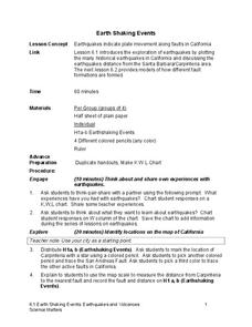
Earth Shaking Events
The world's largest measured earthquake happened in 1960 in Chile, reaching a terrifying 9.5 magnitude on the Richter Scale. The second lesson plan in the 20-part series introduces earthquakes and fault lines. Scholars map where...
Science Matters
Spaghetti Fault Model
Does increasing the pressure between two moving plates provide a stabilizing force or create more destruction? The hands-on lesson encourages exploration of strike-split fault models. The sixth lesson in a 20-part series asks...
Science Matters
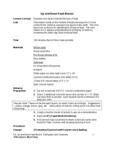
Up and Down Fault Blocks
The Sierra Mountains in Nevada and the Tetons in Wyoming originally formed as fault block mountains. In order to visualize these fault blocks, pupils use construction paper to create layers of earth. They cut the paper models and form...
Curated OER
Volcanic Activity in the U.S.
Students locate and map ten volcanoes in United States, create chart comparing volcanoes by last eruption, type of volcano, location, and interesting fact, and create Powerpoint slide show describing basic
information about volcanoes and...
Curated OER
Plate Tectonic - Volcanoes Post Lab
First graders draw an erupting volcano. They learn the components of an erupting volcano.
Curated OER
Volcano!-Thar She Blows!
Middle schoolers describe how volcanoes are formed. They name the types of boundaries where volcanoes occur. They utilize models to illustrate the occurence of volcanoes and earthquakes along plate boundaries. They compare and constrast...
Curated OER
Deadly Shadow of Vesuvius
Students view a video clip about volcanoes. They collect data and create maps to see the relationship between volcanoes, earthquakes and plates. They share their maps with the class.
Curated OER
Earth Forces
Students use geological techniques such as plate tectonics, mountain building, earthquakes, and volcanoes, in order to explain the earth.
Curated OER
Plate Patterns
Students read about a volcano and use the latitude and longitude information to plot and describe the volcano on the map. They discuss patterns seen on the map. In addition, they color code a map according to zones, plates, etc.
Curated OER
It's Going to Blow Up!
Students discover the major characteristics of volcanoes on the Pacific Ring of Fire. They describe the processes that produce the "Submarine Ring of Fire." students explain the factors that contribute to explosive volcanic eruptions.
Curated OER
2005 Submarine Ring of Fire Expedition: Unexplored
Students compare and contrast submarine volcanoes at convergent and divergent plate boundaries, infer kinds of living organisms that may be found around hydrothermal vents, and describe ways in which scientists may prepare to explore...
Curated OER
My Friend, The Volcano
Young scholars describe the positive impacts of volcanic activity on marine ecosystems. In this volcano lesson students explore the process that causes volcanic activity along the Mariana and Kermadec Island Arcs.
Curated OER
Hazards: Kindergarten Lesson Plans and Activities
The last unit in the series allows kindergarteners to see the dangers and hazards associated with each of the natural disasters learned so far in the series—earthquakes and volcanoes. They listen to sounds associated with the...


