Curated OER
Drifting Continents, Dynamic Results
Students plot earthquake and volcano data using a Compass Rose Plotting. They explain the relationship between plate movement and connection. They draw conclusions that earthquakes and volcanoes occur in predictable locations.
Curated OER
Solid Earth Socratic Questions
Learners participate in a whole class discussion to relate what they know about earthquakes to the processes of plate tectonics. They respond to prompts that lead them to conclusions about the layers of the earth.
Curated OER
A Moving Experience
Students visit Time Machine's San Francisco Earthquake Era. They understand how the Earth's layers interact to cause changes in the Earth's surface. They review information about earthquakes and Earth's layers.
Curated OER
The President Wants YOU!
For this earthquakes worksheet, learners answer short answer questions about earthquakes to provide information to the President. Students complete 8 questions.
Curated OER
What's Crackin' Under New Zealand
Students construct a model of the Earth using clay and oranges. In this earth science lesson, students explain the causes of earthquakes and volcanic activity. They write their findings in their science journal.
Curated OER
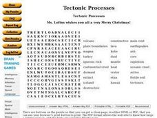
Tectonic Processes
In this earth science worksheet, middle schoolers find the words that help define plate tectonics and the answers are found by clicking the link at the bottom of the page.
Curated OER
Natural Disasters: An Adventure in Non-Fiction
Students study different natural disasters. In this natural disaster lesson students read a nonfiction book followed by a discussion, an experiment, then collect illustrations from their experience.
Curated OER
Causes and Effects of Earthquakes and Volcanoes
Tenth graders discuss the techniques and tools scientists use to study about the earth, including techniques used to determine geological time scales. They share their personal experiences of earthquakes and volcanoes.
Curated OER
What Are Earthquakes And Volcanoes?
In this earthquake and volcano worksheet, students will write down what causes earthquakes and volcanoes to form and how these events are related to one another. This worksheet is a graphic organizer.
National Geographic
Mapping the Americas
Celebrate the geography of the Americas and develop map skills through a series of activities focused on the Western Hemisphere. Learners study everything from earthquakes and volcanoes of the Americas and the relationship...
NOAA
Plate Tectonics II
Mid-ocean ridges, rift valleys, island arcs, mountain ranges, earthquakes, volcanoes ... there are so many features associated with plate tectonics. The 14th installment of a 23-part NOAA Enrichment in Marine sciences and Oceanography...
Curated OER
Roots of the Mariana Arc
Plumb the depths of the Submarine Ring of Fire and explore seismic waves with this lesson. Junior geologists simulate s-waves and p-waves, calculate their speeds, and then apply the data to discover the material that makes up inner...
Curated OER
Plate Patterns
Learners review the patterns they discovered from a previous activity. In this investigative lesson students plot data as a class and color a map.
Curated OER
A Hydrothermal Adventure
Students analyze hydrothermal vents. In this hydrothermal vents lesson plan, students discover the effects of hydrothermal vents on tectonic plates. Students make model hydrothermal vents to understand how they form and operate.
Curated OER
Happy Lesson: The Earth's Crust
This PowerPoint provides a multiple choice and fill-in-the-blank format for reviewing vocabulary and related content following an "earth's crust" science unit. The information is concise and age-appropriate and the font and colors are...
Curated OER
The Earth's Crust
Students use clay to form models of the different landforms and then complete a data table using a map, atlas, or the Internet to locate famous landforms in the United States. Students complete various activities, writing down their...
Oregon State
World Map of Plate Boundaries
Young geologists piece together the puzzle of plate tectonics in an earth science lesson. Given a physical map of the world, they search for land formations that indicate the location of different types of plate boundaries.
American Museum of Natural History
What Do You Know About Earth?
Time to rock and roll! Young scientists test their knowledge about rocks found on Earth and what they tell scientists. A 10-question quiz focuses on the different types of rocks, how they are formed, and what they are made of.
Environment Agency - Abu Dhabi
Plate Tectonics
Young scholars observe a presentation on plate tectonics, layers of the earth, and plate boundaries. They then use the Internet to research major plates and label them on a world map.
Kenan Fellows
Making Connections with Water Quality
What's in your water? And, why is water quality so important? Enhance your class's level of water appreciation through a lesson that demonstrates the necessity of water quality. Environmental enthusiasts explore the EPA's Clean Water...
Lrymple Secondary College
Plate Boundary
Scholars examine diagrams and complete a concept map to discover key details about convergent, divergent, and transform plate boundaries.
NOAA
Plate Tectonics Interactive
Here is a plate tectonics interactive that will really move your class! The first of a 13-part series introduces young geologists to the fundamental concepts and vocabulary they need to understand the interactions between...
Curated OER
TE Lesson: Tsunami Attack!
Learners examine how earthquakes, volcanoes, and landslides can trigger tsunami waves. They determine how engineers use sensors to detect the dangerous wave, and how they help design building that will survive the wave force and water.
Curated OER
Mapping Plate Boundaries
Students discover plate boundaries based on the uneven geographic occurrence of geologic hazards. After discussing geologic hazards, students plot different sets of earthquakes and volcanic eruptions on maps.


