Curated OER
VOYAGE OF THE DAWN TREADER
Learners create and write context sentences leaving a blank for each vocabulary word. Exchange papers with a classmate to fill in the blanks or use vocabulary cards to show answers. Students research the Isle of Wight in books on Great...
Curated OER
Painting With Rocks
Third graders discover that the only inorganic resource available to early cultures for cosmetics was rock and soil. They watch a demonstration showing that rubbing rock on your hand gently doesn't mark the skin very well, but rubbing...
Curated OER
Europe Puzzle
In this geography worksheet, students complete a crossword puzzle in reference to the geography of Europe. They identify the capital cities of various countries and the bodies of water which surround specific countries of Europe.
Curated OER
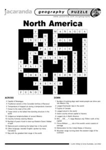
North America Puzzle Answer Sheet
For this geography worksheet, students name the capitals of various countries found in North America. They also identify the various weather patterns across the continent and specific bodies of water. There are 21 descriptions and 21...
Curated OER
Eurasia Physical Map
In this Eurasia physical map activity, students make note of the major landforms and bodies of water located in this world region.
Curated OER
Australia and Oceania: Physical Map
In this Australia and Oceania physical map worksheet, students make note of the major landforms and bodies of water located within this region.
Curated OER
South America: Physical Map
In this South American physical map worksheet, students make note of the major landforms and bodies of water located on the continent.
Curated OER
Europe Physical Map
In this Europe physical map worksheet, students make note of the major landforms and bodies of water located on the continent.
Curated OER
USA: Physical Map
In this United States physical map learning exercise, learners investigate the major landforms and bodies of water located throughout the country.
Curated OER
Americas: Physical Map
In this Americas physical map worksheet, students make note of the major landforms and bodies of water located on the North American and South American continents.
Curated OER
Southeast Asia and the South Pacific: Political
In this Southeast Asia and the South Pacific political map worksheet, students examine boundaries of each of the countries and the placement of the capital cities. The major bodies of water are labeled.
Curated OER
Africa & Asia: Physical Map
In this African and Asian physical map worksheet, students investigate the major landforms and bodies of water located on the African and Asian continents.
Curated OER
Asia and the South Pacific : Political Map
In this Asia and the South Pacific map learning exercise, students examine the boundaries of the nations in this region of the world. Students also note the location of capital cities as they are denoted by stars. Major bodies of water...
Curated OER
Map of Africa
In this Africa worksheet, students analyze a labeled map of Africa. The map shows all the countries and regions as well as the bodies of water. There are no questions to answer.
Curated OER
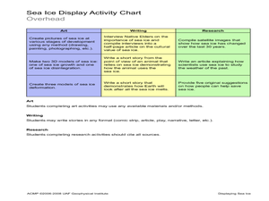
Displaying Sea Ice
Students display their knowledge of sea ice. In this earth science instructional activity, students create displays reflecting their understanding of sea ice.Students research the development of sea ice on a...
Curated OER
Map of Egypt
In this map of Egypt worksheet, learners label the cities, bodies of water, surrounding countries and color the map according to the directions.
Curated OER
Exploring the Map of Morocco
In this exploring the map of Morocco worksheet, students find and label cities, islands, bodies of water, mountains, deserts and other countries around Morocco.
Curated OER
Creating a Map of France
In this crating a map of France worksheet, students find and label important parts of France, bodies of water, mountains and surrounding countries.
Curated OER
Map of Italy
In this map of Italy worksheet, students find, color and label cities, surrounding countries, bodies of water and landforms in the country of Italy.
Curated OER
Exploring a Map of Canada
In this exploring a map of Canada worksheet, students find and label the capital city, bodies of water, the U.S., the provinces and the territories of Canada.
Curated OER
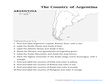
Map of Argentina
For this map of Argentina worksheet, students label key areas, cities, bodies of water and surrounding countries, then color the map according to directions.
Curated OER
Australia Outline Map
In this Australia and Oceania outline map worksheet, learners make note of the major landforms and bodies of water located within this region.
Curated OER
World Map Labels
In this geography skills worksheet, students identify the countries and bodies of water labelled on the maps of the world, Africa, Asia, Canada, Europe, the Caribbean, the Middle East, North America, Australia, and South America.
Curated OER
The Strength of the Muscular System
Seventh graders investigate the strength of the muscular system. They explore voluntary and involuntary muscle movement and discuss the types of muscles: cardiac or heart, skeletal, and smooth. They visit stations to answer questions...
Other popular searches
- Bodies of Water
- Landforms and Bodies of Water
- Major Bodies of Water
- Bodies of Water/rivers
- Bodies of Water Lesson
- Identifying Bodies of Water
- Different Bodies of Water
- Bodies of Water 101
- Bodies of Water Word Scramble
- Landforms and Water Bodies
- Earth's Bodies of Water
- Healthy Bodies Water


