Curated OER
Water Pollution
Examine water pollution and legislation through this reading comprehension worksheet, intended to correspond with a specific text but valuable even without it. Learners read 10 sentences, unscrambling the bold word to complete each (i.e....
Curated OER
Runoff: Intro to Watersheds
High schoolers are taught that a watershed is, what types of basic land cover are impermeable and permeable to water. They trace the flow of water around their school and around their home. Students determine what watershed their school...
University of Wisconsin
Follow the Drop
Young surveyors look for patterns in water flow around campus. Using a map of the school (that you will need to create), they mark the direction of the path of water. They also perform calculations for the volume that becomes runoff. The...
Curated OER
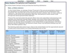
Water Studies: Precipitation and Population
In this water worksheet, students complete the chart about precipitation and population and answer short answer questions. Students complete 14 rows in the chart and answer 4 questions.
Curated OER
Best Management Practices for Water Quality
Fourth graders examine best management practices for water quality. In this water quality instructional activity, 4th graders explore unused land to identify areas of runoff, erosion, and effects of water flow. Students discuss logging...
Curated OER
A Model Aquifer
Students build a model that depicts how water is stored in an aquifer. They examine ways in which groundwater can become contaminated.
Curated OER
"Hard" Data from Space
Students use satellite images to analyze development patterns within Baltimore City. They prepare a land cover map for Baltimore indicating the prevalence of impervious surfaces and explore how these patterns affect water pollution.
Curated OER
Drought
Students gain knowledge about the impact of drought in agriculture. They investigate soil types, water flow, and various erosion conditions which occur during a drought and see how farming practices changed after the 1930's.
Cloud Front
Weathering, Erosion, and Landforms—Student Activities
Tired of your students taking you for granite? Use a unit that offers multiple hands-on weathering and erosion labs and interactive activities. Some of the exciting lessons include planning a tour of Australia, using ice to break glass,...
Curated OER
Hydrology: Flood Mitigation
Twelfth graders discuss the different factors that can contribute to major floods. In this ecology lesson, 12th graders analyze collected rainfall data. They complete a scavenger hunt after the lesson.
Curated OER
Hydrology: Flood Mitigation
Twelfth graders discuss the factors that affect flooding. In this environmental science lesson, 12th graders analyze rainfall data about flooding. They complete a scavenger hunt worksheet using the internet.
Curated OER
The Five Finger Exercise
Students understnad the importance of keeping our rivers and streams pollution free by remembering the major rivers of northeast Kansas. The see how the rivers contain particles of every substance that drains into them.
Curated OER
Acid Rain Keeps Falling On My Head
Students measure the pH of local rain water. Students map the location of the collected rain water according to pH levels.
Curated OER
Acid Rain Keeps Falling on My Head
Students examine the pH level of rain water in their local community. They locate each location on a map. They analyze the data and draw conclusions.
Curated OER
Land Development and the Environment
Students examine the relationship between land development and the environment. In this environmental stewardship lesson, students explore how population density, land development, transportation, and impervious surfaces take their toll...
Science Education Resource Center at Carleton College
Serc: Investigating Ponds and Streams: How Clean Is Our Water?
In this field lab, students investigate the differences in three city ponds. Students will compare pond life, temperature, pH, Ammonia, dissolved oxygen, and Nitrate. The student use the pond sheets (Flinn Scientific Catalog 2007) to...
US Geological Survey
U.s. Geological Survey: Rain
At this site from the U.S. Geological Survey you can find out what makes rain such a valuable resource. Included is a chart that tells how much rain different cities in the United States receive. Click Home to access the site in Spanish.


