Curated OER
Pangaea Puzzle
Students explore plate tectonics and the formations of the Earth's surface and why maps are distorted. In this Earth's surface lesson plan students complete a lab and answer questions.
Curated OER
Weather Predictions
Fourth graders explore meteorologists. They explore symbols on a weather map and make five day forecasts.
Curated OER
El Nino
Explore the properties of water and the affects of El Nino. Middle schoolers will learn about the devastation an El Nino can cause as well as the definition of El Nino. Additionally, they will discover the cause of El Nino along with the...
Curated OER
How Mountains Shape Climate
Students use raw data to make a climatograph; they explain the process of orographic precipitation and the concept of a rain shadow.
Curated OER
Quilt? What Quilt? I Don't See a Quilt!
Students analyze maps and cultures of major cities in the state of Arizona and designate different regions within the state according to geography and economy.
Curated OER
What is a Tornado? How are Tornadoes Created? How are Tornadoes Measured?
Explore the concept of tornadoes with your class. They will research what to do during tornadoes and how to measure tornadoes. Multiple resources are included.
Curated OER
Where Is That Place?
Students choose a school in their state to compare their weather to. They also describe the differences between country, state, and a city. They can make flashcards to help them remember the important terms and concepts.
Polar Trec
Global Snow Cover Changes
Snow is actually translucent, reflecting light off its surface which creates its white appearance. Pairs or individuals access the given website and answer questions about snow cover. They analyze graphs and charts, examine data, and...
Curated OER
Infrared-Hot
Students describe how the sun heats the Earth, explain the nature of infrared light, explain how thunderstorms are formed and use infrared maps to predict severe weather.
Curated OER
El Nino
Students explain what El Nino is, where it is located and how it is created. They describe the weather changes caused by El Nino. They draw the patterns of El Nino on a world map. They predict economic effects El Nino has on the areas it...
Alabama Learning Exchange
The Sun and the Earth
Third graders study and diagram the positions of the Earth and sun during the four seasons. They predict weather for cities in the northern and southern hemispheres.
Curated OER
Teaching The Personality Profile
Young scholars write a comprehensive personality profile feature that demonstrates knowledge of the Wall Street Journal formula of feature writing and the concept of show, don't tell. They experience a press conference interview situation.
NOAA
Currents
Learn how ocean currents are vital to humans and marine life. The eighth installment of a 23-part NOAA Enrichment in Marine sciences and Oceanography (NEMO) program, focuses on ocean currents and how they affect global climate. The...
Curated OER
Meet Meteorology
Students explore meteorology, discuss Earth's atmosphere, create drawings of the water cycle, create meteorology journals, and role play forecasters. Nine lessons on one page; includes unit test.
Curated OER
European Climates
Ninth graders study the climate regions of Europe. In this geography skills lesson plan, 9th graders determine how weather and climate are influenced as they research the climate zones of specific locations and write about the ways that...
Curated OER
Troical Atlantic Aerosols
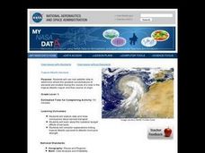
Students explore the effect aerosols have upon he weather and climate. They observe NASA satellite images to explore and draw conclusions about aerosol transport. From studying the images, students track the path of aerosols. They...
Curated OER
Balancing the Scales: Understanding Ratios
Students are introduced to the concept of ratios. In groups, they convert sets of numbers into a ratio. After practicing, they use the ratios and proportions to solve story problems. They also calculate map distances and discover map...
Curated OER
PLATE MOVEMENTS AND CLIMATE CHANGE
Pupils label three geological maps with continents provided to analyze the relationships between the movement of tectonic plates and the changes in the climate. In small groups, they discuss their findings and form hypotheses about the...
Curated OER
Watercolor Ways
Students investigate the concept of being part of a global community. For this global community lesson, students learning the definition of stewardship as it relates to taking care of the Earth. They listen to the lyrics of the song,...
Curated OER
Global Climates and Seasons
Students look at the differences that exist in all four seasons. The resources of animation are available to be used to illustrate scientific concepts in a media that is engaging to students.
Curated OER
Climate in Our Back Yard
Students construct a "A Year in Pennsylvania" poster on which they creatively describe at least three examples of how the climate they live in shapes their lives during every season of the year.
Curated OER
Stratigraphy -- Layers of Time in the Earth
Students are introduced to the process of stratification. Using the internet, they read about the Richard Beene archeological site near San Antonio. Using a map, they color code the different layers present at this site and answer...
Curated OER
Adapted to Fire
Fourth graders explore forest species' adaptations to fire by participating in a scavenger hunt and mapping a burned forest. Students create maps and explore how indigenous species adapted to living with fire.
Curated OER
Landforms All Around
Students create a "Landform Dictionary". They develop an overlay map and participate in hands-on activities to identify the key characteristics of landforms. They discuss the plant and animal life of these areas. Handouts for the lessons...


