National Wildlife Federation
It's All in the Name: Weather Versus Climate
What goes up when rain comes down? An umbrella! Activity eight in the series of 12 explores weather and climate. In pairs, participants analyze maps, watch a short video, create a weather forecast, and complete a reading to determine the...
Teach Engineering
Weather Forecasting
According to the Farmers' Almanac, the weather will be nice today. Class members examine how weather forecasting plays a part in their lives with a resource that provides information on the history of forecasting, from using cloud...
Office of the New Jersey State Climatologist
Play Ball! – Or Not…Making a Decision Using Weather Data
Should the game go on or not? An engaging lesson asks small groups to make a decision using weather data. After analyzing a map, an updated forecast, and radar information, groups have to decide whether to cancel a baseball game. They...
Curated OER
Weather Watchers WebQuest
Students explore a variety of weather websites, and complete a Weather WebQuest worksheet. They read and analyze weather data, prepare a weather forecast and daily weather report, and predict the weather for the next two days.
Kenan Fellows
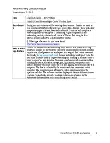
Sensors, Sensors…..Everywhere! Middle School Meteorologist Create Weather Bots!
My forecast is that you'll want to use the resource. Pupils design and create a weather bot as part of a project-based unit. These bots should be able to measure temperature, humidity, barometric pressure, wind speed and direction, and...
Curated OER
Cloud and Weather Patterns
Fourth graders examine how weather patterns generally move from west to east across the United States, and how clouds are formed and are related to the water cycle. They view and discuss a PowerPoint presentation of the types of clouds,...
Curated OER
Weather Reporting
Students locate a weather map on the internet and explain or predict the weather for the following day. Students interpret the information on the weather map and pick the correct clothing to wear for that day. Students chart and graph...
Curated OER
What's The Weather?
Students explore the role that remote sensing plays in predicting our weather. Students investigate weather websites, and read about the three kinds of clouds. Students record and draw their observations in science journals.
Curated OER
Weather Lesson Five
Students define a weather forecast, make a forecast using a weather map, identify three prediction guidelines, and explain how computers help to make forecasts. Students make a 24-hour forecast for each of the thirteen states targeted.
Curated OER
EWOC2006-Make your own weather forecast - WEST
Students explore making their own weather forecast. They view and discuss a forecasting PowerPoint presentation. Students analyze radar and satellite imagery. They compile many ways to observe clouds.
Curated OER
Weather Forecasting
Pupils describe how weather forecasting has evolved. In this forecasting instructional activity students study the different types and ways that people forecast weather.
Curated OER
Using the Synoptic Code for the Prediction of Weather
Young scholars interpret the synoptic code. They construct a thermoscreen with an anemometer. Students identify different types of clouds and understand and read barometric pressure. Young scholars predict weather pattern as they apply...
Curated OER
Weaving Weather Maps with the World Wide Web
Students access the Internet and use real time data from the American Meteorological Society to create a detailed weather map. They make weather predictions based on the data collected.
Curated OER
Thunderstorm Outflow I
Students study the characteristics of thunderstorms. They view an animation of radar reflectivity that depicts a thunderstorm and its outflow to locate the thunderstorm's outflow. Afterward, they explain what physical process occurs in a...
Curated OER
Trends Forecasting
Students practice trends forecasting to predict the weather. In this forecasting lesson plan, students learn how meteorologists predict the weather by looking at weather trends. They then predict their own forecast, analyze the results,...
Teach Engineering
Air Under Pressure
Introduce your class to air masses and how they affect the weather with a lesson that focuses on the differences between high and low air pressure systems. The class explores actual weather data using archived weather data.
Curated OER
The Science of Weather: How Doppler Radar reads weather
Students read about how radar detects changes in the weather. In this lesson on weather reporting, students read a diagram that shows how radar reads weather. This lesson includes discussion questions and an individual activity that can...
Curated OER
Tracking the Weather Using Technology
Fourth graders explore the use of technology to monitor and forecast weather. They investigate the different types of weather monitoring and forecast tools. Students interpret radar images and discuss the traditional types of weather...
Curated OER
The Forecast Factory
Students role play weather forecasting activities. They investigate weather forecasting processes such as equations, data analysis, announcing by role playing in a large lecture hall.
Curated OER
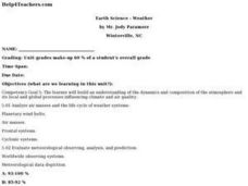
Earth Science - Weather
Young scholars build an understanding of the dynamics and composition of the atmosphere and its local and global processes influencing climate and air quality. They analyze air masses and the life cycle of weather systems.
Curated OER
Too Heavy For Me
Students explore the different arrangement of air molecules in high and low air pressure masses. They compare the temperature of high and low pressure masses and discover how a barometer works.
Curated OER
Explore: 4th Grade Beaufort Wind Speed
Fourth graders measure wind speed, air pressure, humidity, temperature, and wind direction. They compare their observations with those of actual weather forecasts.
Curated OER
How Do We Forecast Weather?
Third graders investigate how scientists collect weather data in order to forecast the weather. They work in small groups in order to research one type of weather technology such as, satellite images, radar, surface observations, or...


