Curated OER
Water Sources in Cape Verde and West Africa
Young explorers study the scarcity and importance of a continuous supply of fresh water in Cape Verde. They research the five main ways that fresh water is obtained in these countries. Each research group prepares a presentation, and...
Curated OER
Cyberspace Safari
Middle schoolers go on an information gathering hunt on the Internet to study West African empires. They work in teams; meteorologists, bankers, writers, and archaeologists. They collect data on all sorts of topics related to West...
Curated OER
Trekking to Timbuktu: The Geography of Mali -Teacher Version
Learners investigate the geography of Mali. They locate Mali on a satellite map, explore various websites, describe the landscape and climate, label a map, and write an essay about the Niger Riger.
Curated OER
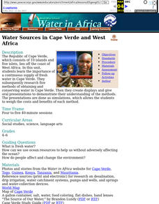
Water Sources in Cape Verde and West Africa
Learners analyze the importance of a fresh water supply in Cape Verde, researching five methods of obtaining and conserving water there. Young scholars create and present displays demonstrating their understanding of the methods of water...
Curated OER
Passport to Africa
Middle schoolers begin the lesson by reading a novel about the diversity of geography in Africa. They are to create an oral report based on information they research. They also communicate with someone through email about the situation...
Curated OER
Trekking to Timbuktu: Trade in Ancient West Africa
Students research how trade in Timbuktu was affected by geography. Students conduct online research to determine the major trade routes, main products of trade, plus how and why trade spread across Africa.
Curated OER
West African Art
Students engage in a lesson that is concerned with the concept of West African Art. They conduct research using a variety of resources. They focus upon the history, geography, economics, and political systems. The information is used to...
Curated OER
The Holy Land
Explore the culture, geography, and religion of Ethiopia. Learners complete a viewing guide while watching a film on Ethiopia as the first Christian country in Africa. Additionally, they create group presentations and write paragraphs...
Curated OER
Tears of Joy Theatre Presents Anansi the Spider
Accompany the African folktale, Anansi the Spider, with a collection of five lessons, each equipped with supplemental activities. Lessons offer multidisciplinary reinforcement in English language arts, social studies, science, and arts...
Curated OER
Examining What Sharing Really Means
Learners read "The Senegalese Miracle". They discuss the amount of sharing the author finds in Africa. They examine the relationship the author has to the locals.
Curated OER
Gullah People of the Sea Islands
Students examine the history and culture of the Gullah people. They study the geography, impact of industrialization and effects of tourism on the people of Gullah. They view films, use a large map of West Africa,. Students will listen...
Curated OER
The Cultural Geography of Africa South of the Sahara "Kente Cloth"
Students read several articles about West African strip weaving of Kente cloth. They explore the cultural context in which strip weaving occurs. They answer four comprehension questions and compose a magazine article about strip weaving.
Smithsonian Institution
Braiding Rhythms: The Role of Bell Patterns in West African and Afro-Caribbean Music
Africans transported to the Caribbean as part of the transatlantic slave trade brought with them a rich tradition of music and dance. Four lessons teach young musicians the rumba clave rhythm, cascara rhythm, and the 6/8 bell patterns...
Curated OER
Drake’s West Indian Voyage 1588-1589
Students examine the exploration routes of Sir Francis Drake. In this American exploration lesson, students investigate primary sources to trace the routes and contact with the natives that Sir Francis Drake experienced on his voyages in...
Curated OER
Africa 1500-present: The Big Picture
In this African history study guide worksheet, students read a brief overview pertaining to the history of Africa from 1500 to the present.
Curated OER
Africa 1500-present: The Big Picture
For this African history study guide worksheet, students read a brief overview pertaining to the history of Africa from 1500 to the present and fill in the blanks with the appropriate words. Students also respond to 18 short answer...
Curated OER
West Indies and The Caribbean: Sugar & Slavery
Students study the state of the world before the slave trade. They explain the geography and economics of the slave trade. They explore primary sources and how historians use these sources to create historical interpretations.
Curated OER
What is Currency?
Students study the history of currency and the monetary system of historic Akan people, who lived on the Atlantic coast of Africa. This outstanding series of lessons is multi-disciplinary and contains many activities for different...
Curated OER
Family Sells House to Help the Hungry
Students compare their wants and needs, then read a news article about a family that downsized their home to help African villagers. In this current events and poverty in Africa lesson, the teacher introduces the article with a...
Curated OER
Adinkra Cloth
Students explore traditional African culture, symbols and symbol making and printing, and create class adinkra cloth.
Curated OER
Weather and Water in Ghana
Students research the rainy and dry season to investigate Africa's weather. In this African weather lesson, students use the given websites to research the rainy and dry seasons of Ghana in Africa. Students then read stories about life...
Curated OER
East to West: Africa's Influence on Mexico
Your historians and social anthropologists study the relationship between peoples of ancient Africa and ancient Mesoamerica. They relate in written or verbal form the African presence in the ancient Americas. They create their own...
Institute for Geophysics
Understanding Maps of Earth
Here is your go-to student resource on primary geography concepts, including facts about the surface of the earth and its hemispheres, latitude and longitude, globes, types of maps, and identifying continents and oceans.


