Film Education
The Jungle Book
Accompany a viewing of Disney's live-action feature film, The Jungle Book, with a packet equipped with several activities focused on story elements. Scholars discuss and complete diagrams and charts about the movie's characters, setting,...
Curated OER
The Bozeman Trail
Eighth graders are introduced to the Bozeman Trail. Using the internet, they research the trail to discover the forts located on its path. They must also locate and label landmarks on a map using symbols they create. They answer...
Curated OER
Lesson 2: Mapping With Words
Students demonstrate an understanding of the personal relationship that Wabanaki peoples had with the land by analyzing selected Wabanaki place names. They practice map-reading and map-making skills.
Curated OER
Knowing Where You Are
Students work together to research the names of places in their state. They divide up their state so that each group can research a different section and complete a chart of the different names. They create a key for the map to explain...
Curated OER
Our Friends the Trees
Students explore trees and learn about their importance to the environment. In this tree study lesson, students work in groups to complete a tree survey, a map for the survey, and several worksheets about the tree topics. students make a...
Curated OER
The Silk Road, An Ancient Internet
Students examine how goods and ideas moved along an ancient trade route between China and Europe. They make charts of items, ideas, etc. that were transported along the Silk Route.
Curated OER
Geography: African Floor Maps
Students explore the African continent and identify the various countries there. They examine the history, geography, environment, and inhabitants of the countries. Students create maps of Africa using a variety of materials.
Curated OER
Australia Cities Map Quiz
In this online interactive geography quiz worksheet, students respond to 17 identification questions regarding Australian cities. Students have 3 minutes to finish the timed quiz.
Curated OER
Oceania Map Quiz
In this online interactive geography quiz worksheet, students respond to 14 identification questions about Oceania. Students have 2 minutes to complete the quiz.
Curated OER
Chinese Cities Map Quiz
In this online interactive geography quiz instructional activity, students respond to 10 identification questions about Chinese cities. Students have 3 minutes to complete the quiz.
Curated OER
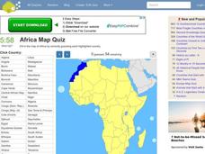
Africa Map Quiz
In this online interactive geography quiz worksheet, students respond to 53 identification questions about the countries of Africa. Students have 6 minutes to complete the quiz.
Curated OER
Spanish Cities Map Quiz
In this online interactive geography quiz worksheet, students respond to 11 identification questions about Spanish cities. Students have 3 minutes to complete the quiz.
Curated OER
Population Density
Students examine world population density and population distribution. They create pie charts showing population distribution and analyze population patterns in the United States and major regions of the world. They identify...
Curated OER
Literature Study Guide: Gulliver's Travels
Although the title suggests this resource is devoted to Gulliver’s Travels, the materials and templates can be used with any work of literature. Readers fill out a reading schedule chart, write a summary, keep a vocabulary word list, and...
Curated OER
Exploring Wyoming Species Habitats
Learners are introduced to the concept of species habitats and ranges. They introduced to ArcView GIS as a tool for mapping. Pupils use query data for species withina county, elevation, range, rivers and streams, land cover, and etc....
Curated OER
Five Utah Indian Tribes
Fourth graders trace the emergence and development of culture in Utah. They study the five Utah Indian Tribes and review several names of physical features of Utah that are derived from Indian words. They discuss how many cultures have...
Curated OER
Christopher Columbus, The Explorer
Students brainstorm important facts about Christopher Columbus, input information into Kidspiration or Inspiration, watch United Streaming Video on Christopher Columbus and New World to gather information, research online to find...
Curated OER
Volcanic Activity in the U.S.
Students locate and map ten volcanoes in United States, create chart comparing volcanoes by last eruption, type of volcano, location, and interesting fact, and create Powerpoint slide show describing basic
information about volcanoes and...
Curated OER
My Family Tree
Students create a family tree. In this ancestry lesson, students research a country that one of their ancestors is from. Students interview a grandparent and map out a family tree.
Curated OER
It’s a Big, Big World
Students examine the role of the explorers. In this explorers and conquistadors, students create word puzzles (Wordles) regarding the time period in history. Students conduct research regarding a particular explorer and create foldables...
Safe Drinking Water Foundation
Water Pollution
An introductory instructional activity to a unit on water pollution, young environmentalists are asked to brainstorm examples of pollutants in water. This instructional activity will help develop a sense of what water pollution is and...
Curated OER
Carbondale: The Biography of a Coal Town
Students use a brief history of the growth and decline of the anthracite region in the state to create a photograph and map "peak shaped" time line. They practice map and photo analysis strategies to "read" photographs and maps.
Curated OER
Canadian Provinces Quiz
In this online interactive geography quiz activity, students examine the map that includes 13 Canadian provinces. Students identify the names of the provinces in 3 minutes.
Curated OER
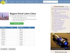
Great Lakes Cities Quiz
In this online interactive geography worksheet, students examine a map of the Great Lakes region and identify the 20 noted cities on the map using a pull down menu within 4 minutes.


