Curated OER
Discovering Prehistoric People of Wisconsin
Young scholars list the characteristics of the four main groups of prehistoric people of Wisconsin. They compare the characteristics of the groups of to determine the chronological order of existence in Wisconsin.
Curated OER
Moving West
Students research the Westward Movement and struggles encountered by the pioneers as they moved from Nebraska, Westward along the Oregon Trail. In this Westward Expansion lesson, students read an Oregon Trail poem and visit 5 different...
Curated OER
Why do People Migrate?
Second graders examine the reasons for human migration. In this human migration lesson, 2nd graders make lists of reasons why people migrate. Students view pictures of people who have migrated and discuss why. Then the students watch a...
Curated OER
Underground Railroad
Learners navigate the Scholastic Underground Railroad site and listen to journey of the Underground railroad. In this Underground Railroad lesson, students use maps and compare and contrast the differences between the North and South...
Curated OER
Executive Government: Executive Decision Making
Learners explore executive decision making in the federal Cabinet. They are able to explain the need for executive decisions. Students explore how executive decisions are implemented through government departments.
Curated OER
Branches of US Government
Learners research the responsibilities of the legislative, executive, and judicial branches. In this U.S. government lesson, students research the jobs of those in each branch and present their finding to their classmates.
Curated OER
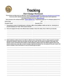
Tracking: merit badge
In this tracking worksheet, students fill out short answer questions using their workbook about finding tracks of animals in order to get a merit badge. Students complete 5 questions total.
Curated OER
South America Map Quiz
In this online interactive geography quiz worksheet, students examine the map that includes all of South America's countries. Students identify the 13 countries in 2 minutes.
Curated OER
Middle East Map Quiz
For this online interactive geography quiz worksheet, students examine the map that includes 26 Middle Eastern countries. Students identify the names of the countries in 4 minutes.
Curated OER
Central America Map Quiz
In this online interactive geography quiz worksheet, students examine the map that includes 22 Central American countries. Students identify the names of the countries in 3 minutes.
Curated OER
UK Cities Map Quiz
In this online interactive geography worksheet, learners examine a map of the United Kingdom and identify the 25 noted cities on the map using a pull down menu within 3 minutes.
Curated OER
Countries w/ Biggest Armies Quiz
In this online interactive military quiz worksheet, students examine the chart that includes details about the number of troops in 20 countries. Students identify the names of the countries in 4 minutes.
Curated OER
Canada Map Quiz
In this online interactive geography quiz worksheet, students examine the map that includes 13 Canadian provinces and territories. Students identify the names of the provinces and territories in 2 minutes, 30 seconds.
Curated OER
Canadian Provinces Quiz
In this online interactive geography quiz activity, students examine the map that includes 13 Canadian provinces. Students identify the names of the provinces in 3 minutes.
Curated OER
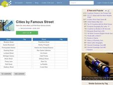
Famous Streets Quiz
For this online interactive geography quiz worksheet, learners examine the chart that includes the names of 18 famous streets in the world. Students have 4 minutes to identify the names of the cities where the streets are found.
Curated OER
State Nicknames Quiz
In this online interactive geography quiz worksheet, students examine the chart that includes the names of 49 states. Students identify the nicknames of the states in 6 minutes.
Curated OER
Biggest Cities in Canada Quiz
In this online interactive geography quiz worksheet, students examine the chart that includes the population of 20 Candian cities. Students identify the names of the largest cities in Canada in 4 minutes.
Curated OER
Highest Mountain Countries Quiz
In this online interactive geography quiz worksheet, students examine the chart that includes the elevations of 20 world mountains. Students identify the names of the mountains in 4 minutes.
Curated OER
Biggest Cities in Each State Quiz
In this online interactive geography quiz activity, students examine the chart that includes the names of 50 U.S. states. Students identify the names of the two largest cities in each state in 8 minutes.
Curated OER
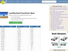
Landlocked Countries Quiz
In this online interactive geography quiz worksheet, students examine the chart that includes details about the population in 44 landlocked countries. Students identify the names of the countries in 5 minutes.
Curated OER
USA National Parks Quiz
In this online interactive geography quiz worksheet, learners examine the chart that includes 58 state names. Students identify the names of the national parks in the listed states in 5 minutes.
Curated OER
Famous Lakes Quiz
In this online interactive geography quiz worksheet, students examine the chart that includes details about 15 famous world lakes. Students identify the names of the lakes in 3 minutes.
Curated OER
Regions of Countries Quiz
In this online interactive geography quiz worksheet, students examine the chart that includes details about 20 world regions. Students identify the names of the countries where the regions are located in 4 minutes.
Curated OER
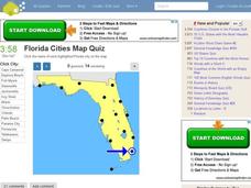
Florida Cities Map Quiz
In this online interactive geography instructional activity, learners examine a map of Florida and identify the 12 noted cities on the map using a pull down menu within 3 minutes.


