Curated OER
Map Analysis Worksheet
In this map analysis worksheet, students decipher what type of map they are using based on a complete list of criteria. Students then answer multiple questions based on their discoveries.
Curated OER
Making Maps
In this map making worksheet, students learn about the science of making maps, which is cartography. They then answer the 11 questions on the worksheet. The answers are on the last page.
Curated OER
Introduction To Topographic Map Activities
Young scholars discuss different types of maps, their similarities and differences. Using a Topographical Maps CD-rom program students create their own map.
Curated OER
Understanding Topographic Maps
Students are introduced to the characteristics and uses of topographical maps. Using a worksheet, they examine the use of specific terminology and use cutouts to create their own topographical map of an area. They answer discussion...
Curated OER
Worksheet for Analysis of a Map
For this primary source analysis worksheet, students respond to 6 short answer questions that require them to analyze the maps of their choice.
Curated OER
Topographic Maps Worksheet
For this geography skills worksheet, students respond to 37 multi-part questions that require them to read and interpret topographic maps.
Curated OER
Geographical Skills-- Map Scale
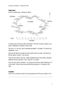
In this maps worksheet, students study a simple map and the scale in kilometres. Students read the directions and answer one question. Students then look at a sketch map of a town and answer 2 questions. Students also read how to show...
Curated OER
Melody II
In this music worksheet, young scholars identify melody as a string of notes that has a rhythm. They identify which notes given are melody and/or harmony. Students also map the contour of "Sweet Georgia Brown."
Curated OER
Mapping The Ocean Floor
Young scholars explore and analyze the bottom structure of underwater habitats. They describe and explain what can't see through the collection and correlation of accurate data. Learners assess that technology is utilized as a tool for...
Curated OER
Viewing Earth and Sky
In this earth and sky learning exercise, students review terms associated with map reading. Students also review topographic maps and how contour lines represent elevation. This learning exercise has 5 matching, 5 true or false, 5 fill...
Curated OER
Design an Island
Students make a map of an imaginary island using the topographic symbols provided from a worksheet. Students place lakes, dwellins, reefs, etc. in areas where they would logically be located from understanding how the topography of an...
Curated OER
Take a Hike
In this geography skills instructional activity, students respond to 9 questions that require them to read topographic maps and interpret them. The topographic maps are not included.
Curated OER
Mapping the Ocean Floor
Students study the bottom structure of underwater habitats and how they can be mapped.
Curated OER
Design an Island
Young scholars explore islands. They create a two- or three-dimensional map of an island. They explain how the topography of an area influences the location of water sources, ecosystems, and human settlements. Lesson includes adaptations...
Curated OER
Tooling Around Arizona: Reading Arizona Maps
Learners study geography. In this Arizona maps lesson, students develop their map reading skills. They have class discussions and work independently with various copies of Arizona maps to practice those skills. This lesson mentions...
Curated OER
Vocabulary for Dimensions of the Earth
In this Earth dimensions worksheet, students define 24 terms associated with contour maps, latitude, longitude, and time zones.
Curated OER
Science Review for Grade 5 (5.2)
In this science review for grade 5 (5.2) worksheet, 5th graders answer 25 earth science questions in a standardized test format, including reading maps and diagrams.
Curated OER
Topo Triangulation
Students investigate how to read a topographical map and triangulate with just a map. They convert a compass measurement to a protractor measurement, reverse a bearing direction, and using a worksheet take a bearing of certain landmarks...
Curated OER
Hurricane Impact: Storm Surges and Elevation Transitions
In this hurricane worksheet, student answer 6 multiple choice questions and 8 short answer questions about hurricanes. They color the map to show flooded areas.
Curated OER
Geology Word List
In this science worksheet, students review the vocabulary words for the separate categories related to the concept of geology.
TeachEngineering
Teach Engineering: Getting to the Point
For this lesson, students learn how to determine location by triangulation. We describe the process of triangulation and practice finding your location on a worksheet, in the classroom, and outdoors.


