Curated OER
Food on the Map
Students work together to examine the tastiest towns in the United States. After discovering the names of the equipment, they identify the seven continents. They take a survey and locate the cities and states of the foods mentioned.
Curated OER
Urbanization As Seen Through Late 19c - Early 20c Architecture
Incorporating the cultures, architecture, and ethnic populations of several American cities (namely Chicago and New York), this presentation displays vivid photographs of buildings and people in 19th - 20th century urban America. The...
Curated OER
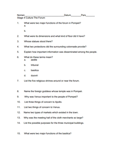
Culture of Pompeii
In need of a activity that focuses on the government and culture of the ancient Roman city of Pompeii? Here you'll find 16 questions related to the government, religion, society, and culture of Pompeii, prior to the eruption of Mr....
Curated OER
Canada: History Review
How much do you know about Canadian history? If you're from Canada you may know a lot! Review major Canadian battles, famous politicians, and provinces with your class. You'll find simple yet informative information, images, and a...
Curated OER
MAISA and the REMC Association of Michigan
Students complete online research to study geography's impact on weather. In this geography and weather lesson, students research weather in their city for ten days using an online website. Students bookmark the site, enter data into a...
Scholastic
The Rise of Railroads: California
Railways are an integral part of the history of California. Using a timeline format, class members connect major historical events to the rise of the railroads and their impact on the state. Activities include a mix of independent and...
Scholastic
The Rise of Railroads: Illinois
Railways not only cross the US, but they are also intertwined with the history of America. Using a timeline format, individuals explore the connections between major events in American history—such as the Civil War—and the rise of the...
Curated OER
Bradford England
Students explore the locality and diversity of culture within the Bradford District of England. Through map activities and discussion, they identify the major forms of transport, people and places in the region. Students compare and...
Curated OER
The Fall of Rome and the Beginning of the Middle Ages
A major turning point in world history is the focus of this presentation. Rome has fallen, and with its descent comes the Dark Ages. With pictures, maps, and important information about the Middle Ages, this slideshow would be a great...
Curated OER
Rivers Run Through It
Using a relief map of New York State, learners answer questions about the distance between different cities, identify bodies of water, and more. First, they discuss vocabulary related to the Hudson River area. Then, they complete a...
Garden of Praise
George Washington Carver Test
This is a standard multiple-choice assessment on the life and ideas of George Washington Carver. It includes 20 questions on topics covering information about his birth and education, major career moves, teaching principles, ethics, etc.
Curated OER
Grades 6-8 Lesson Plan - Cities as Transportation Centers
Students examine maps of the 1800's and 1900's. In this geography skills lesson, students collaborate to read core maps and identify transportation centers and travel networks.
Curated OER
Italian Renaissance
Fifth graders explore the Italian Rensissance in this six lessons unit. The prominent citizens, the ideas, values, art, philosophy, and literature of the are seen as a rediscovery of Ancient Greek and Roman times.
Curated OER
Travel Brochure
Students, in groups, gather information on German regions and their major cities. Each group of students is responsible for reporting on their region,its major cities, and sights.
Curated OER
Louisiana Parishes
Students research a parish in Louisiana. They research things such as: what makes that parish different from others, major cities, what is the land like there, are there any bodies of water, what is the population, are their any colleges...
Curated OER
Exquisite Excursions
Students locate 6 cities, one on each of the 6 major continents. They find distance for each leg of their journey, convert to percents, use a time zone map, and convert to foreign currencies.
Curated OER
Canada: A Land Rich in Beauty and Culture
Third graders in groups research the different regions of Canada. They create a timeline to put the major events of Canada's history in order.
Curated OER
Mapping South America
Learners explore South America. For this South American lesson, students use their geography skills to create population, terrain, biomes/vegetation, and major exports maps. Learners present their finished maps to their classmates and...
Curated OER
United States Identifier
Fifth graders examine and research a major region of the Unites States in groups of four. In addition, they locate the states, capitals, mammals and two bodies of water or mountain ranges found within their region. After the research,...
Curated OER
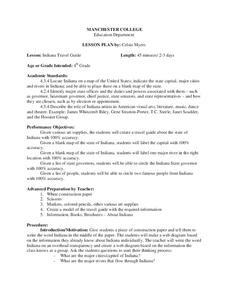
Indiana Travel Guide
Fourth graders, after exploring and researching the state of Indiana, create a travel guide about the state of Indiana including its capital, major rivers, governors and two famous people from the state. They utilize a variety of art...
Curated OER
Getting to Know Austria- Map Skills
In this Austria map skills worksheet, students apply map skills to answer 14 fill in the blank questions about the country. They determine border countries, identify regions, find the capitol, and name rivers. They draw a map of Austria...
Curated OER
Ask Your Mummy
Students explore the scribes, pharaohs, and pyramids of Ancient Egypt. They also locate ancient cities on a map and explain religious traditions.
Curated OER
Travel Club Unit
Seventh graders participate in a classroom travel club while they research Latin American cities. They research the city finding the pertinent information provided in the directions. They write a letter to other travel club members that...
Curated OER
Freeform Rhode Island Map
In this free form Rhode Island map worksheet, students study, locate and memorize key cities, physical attributes and surrounding states for a quiz. Students fill out the major cities on a blank map of Rhode Island.


