Curated OER
Growth in A City Neighborhood
Students take the "role" of city planner. They overlay a map of one area of the city in the past, present, and projected future project. Students discuss reasons for selecting the special features of the area. The lesson refers...
Curated OER
City Bound
Fifth graders identify the reasons for people migrating to cities after the Civil War. Using population data, they discover why populations in cities rose while rural populations fell during 1860 to 1900. They discuss the impact a...
Curated OER
Dreaming of a Healthy City
Ninth graders design a healthy city. They identify the essential elements of a city and describe how climate and geography can determine the layout of a city. They create a blueprint of their design and share in small groups.
Curated OER
Growth of a City
Students discuss the needs of any city. They view and analyze a 1923 aerial picture of Beverly Hills and discuss possible needs for the city. They draw in facilities to meet the needs they have listed and then compare these needs to a...
Civil Rights Movement Veterans
Timeline of Events: 1960’s Civil Rights Movement of St. Augustine, Florida
A timeline can be a powerful learning tool because it reveals a pattern in events. While few would consider St. Augustine, Florida a hotbed of the 1960s Civil Rights Movement, a selection of background information and a timeline of...
Smithsonian Institution
Black Diamond
Score a home run with this packet of information on the very first player of the Negro League to be elected into the National Baseball Hall of Fame — cultural groundbreaker and sports legend Satchel Paige. These worksheets include a...
Space Awareness
The Climate in Numbers and Graphs
Weather versus climate: weather relates to short time periods while climate averages the weather of a period of many years. Scholars learn about average temperature and precipitation in various climate zones and then apply statistics...
Curated OER
Athens Versus Sparta
Young scholars examine the characteristics of the Greek city-states, Athens and Sparta. They compare and contrast the city-states and compose an essay which includes any similarities and differences of Athens and Sparta.
Curated OER
Ubi Est Mantua?
Students chose Latin authors, their birthplace, life and works. They examine pictures of an Italian city and decide which Latin author it could be related to. They answer questions in Latin.
Curated OER
Greek Geography
A riddle and a class lecture kick off this lesson on Greek Geography and city features. Learners use a worksheet to answer questions related to what they learned in lecture and complete a homework assignment. Note: This is a lesson...
Curated OER
Connecticut Map
For this state maps worksheet, students identify the state of Connecticut, and fill in the state capital, major cities, and other major attractions.
Curated OER
Michigan Map
In this state maps instructional activity, students identify the map of Michigan. Students then fill in the capital city, major cities, and other state attractions.
Curated OER
Maine Map
In this state maps worksheet, students identify the map of Maine. Students fill in the capital city, major cities, and other state attractions.
Curated OER
Montana Map
In this state maps worksheet, students identify the state map of Montana. Students fill in the capital city, the major cities, and other state attractions.
Curated OER
Quilt? What Quilt? I Don't See a Quilt!
Students analyze maps and cultures of major cities in the state of Arizona and designate different regions within the state according to geography and economy.
Curated OER
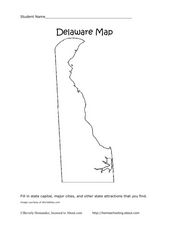
Delaware Map
In this state maps worksheet, students identify the state of Delaware, and fill in the state capital, major cities, and other attractions in the state.
Curated OER
Idaho Map
In this outline state map of Idaho worksheet, students fill in the map with the state capital, major cities, and other state attractions or teacher created directions. Students draw at least 7 answers.
Curated OER
Colorado Map
In this state maps worksheet, students identify the state of Colorado, and fill in the state capital, major cities, and other attractions for the state.
Curated OER
North Carolina Map
In this state maps activity, students identify the state map of North Carolina. Students fill in the state capital, the major cities, and other state attractions.
Curated OER
New Mexico Map
In this state maps worksheet, students identify the state of New Mexico. Students fill in the state capital, major cities, and other state attractions.
Curated OER
Ohio Map
In this Ohio worksheet, 4th graders explore the state of Ohio. Students look at the map of Ohio and fill in the state capital, major cities, and any other important landmark or site on the map.
Curated OER
South Dakota Map
In this South Dakota map worksheet, students fill in the state capital, major cities and other state attractions in an outline map of South Dakota.
Curated OER
Vermont Map
In this state maps instructional activity, students identify the map of Vermont. Students fill in the state capital, the major cities, and other state attractions.
Curated OER
Wyoming Map
In this blank outline map worksheet, students fill in the state capital, major cities, landforms, and other places of interest on this map of Wyoming.


