Curated OER
Making a Colorado Brochure
Students create brochures reflecting the state of Colorado. In groups, they write about tourist attractions, important people, major cities, and statistical information. After writing, they create their brochure importing clip art and...
Curated OER
Exploring Countries and Cultures
Fifth graders choose a country associated with a family member and research its location, government, language, economy, history, holidays, foods, sports, and famous people. They write to inform using this data and draw a map identifying...
Houghton Mifflin Harcourt
Renaissance and Reformation Chapter Test
This simple textbook assessment begins with a series of five short answer questions on major ideas from the Renaissance and Reformation. Then, young historians use their knowledge of artistic styles and developments from the period to...
Curated OER
Charlie and the Cell City
Students identify the major components of the cell and their functions. They compare and contrast the major components and functions of animal and plant cells
Curated OER
Finding River Cities
Using a wall map, students will find major rivers in the four regions of the United States. Then they answer questions about how people use natural resources, such as rivers.
Curated OER
Jerusalem: The Holy City
For this Jerusalem worksheet, students respond to 9 short answer questions about the holy city after they read the attached reading selection about the city.
Curated OER
Hello Mexico City
Students research and explain the functions, characteristics, and cultural aspects of Mexico City and analyze how they have affected development and settlement. Students work in groups to gather information and report back to the class.
Curated OER
Cities as Transportation Centers
Learners work in small groups to identify some of the major transportation centers, recommending two as possible sites for a national political convention, based on population density and the travel networks available in 1835.
Curated OER
Building a Healthy City (Final Project)
Students construct a scaled model of a city that provides for the economic and cultural needs of a community while maintaining high quality air and water to protect the public health. They articulate, in a presentation, the locations of...
Curated OER
Growth of a City
Students evaluate aerial photographs of Beverly Hills taken in 1923 and 1932, and examine the effects of rapid growth of a region. They discuss the needs of city planning, compare the two photographs, and answer discussion questions.
Curated OER
Oregon Cities
Students research one 20th century Oregon city, focusing on its population changes and the reasons for the changes. They write an expository essay which includes graphs/charts.
Pace University
Urban Communities
Urban communities are the focus of a series of lessons created to meet specific needs using differentiated instruction. A pre-assessment designates scholars into three groups based on their ability level. Small groups take part in...
Curated OER
What State Are You In?
Students identify the major U.S. cities. In this U.S. geography lesson, students work in pairs and use game cards to name various cities in the United States.
Curated OER
A Classical Maya News Report
Students research the culture of the Mayans. In this early civilizations lesson, students research selected Maya city-states including Tikal, Clakmul, Piedras Niegras, and Uaxactun. Students use their research findings to present news...
Curated OER
Amidst the Rubble of Ruined Cities
Students, in committees, develop and propose solutions to rebuild various elements of Colombia's infrastructure in the wake of the January 25, 1999 earthquake, as well as compare and contrast the earthquake's affects on Colombia to an...
Curated OER
Where in the World? The Basics of Latitude and Longitude
Learners are introduced to the concepts of latitude and longitude. In groups, they identify the Earth's magnetic field and the disadvantages of using compasses for navigation. They identify the major lines of latitude and longitude on a...
Curated OER
Alabama Map
In this Alabama worksheet, students explore the state of Alabama. Students are given a blank map of Alabama where they are to label the capital city, other major cities, and any other important state attractions on the map.
Curated OER
Indiana State Map
In this state maps worksheet, students identify the state of Indiana and fill in the state capital, major cities, and other attractions in the state.
Curated OER
New York Map
In this state map learning exercise, students identify the state map of New York. Students fill in the state capital, major cities, and other state attractions.
Curated OER
Nebraska Map
In this Nebraska worksheet, students explore the state of Nebraska. Students are given a blank map of the state of Nebraska and are to fill in the capital, major cities, and any other state attractions on the map.
Curated OER
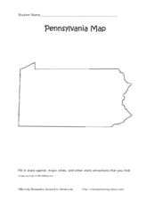
Pennsylvania Map
In this state maps worksheet, students identify the map of Pennsylvania. Students fill in the state capital, the major cities, and other state attractions.
Curated OER
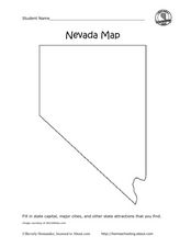
Nevada Map
In this state maps activity, students identify the state of Nevada. Students then fill in the state capital, major cities, and other state attractions for the state.
Curated OER
Wisconsin Map Activity
In this Wisconsin map worksheet, students fill in the capital, major cities and other state attractions on a blank map of Wisconsin. A reference web site is given for additional activities.
Curated OER
The Cold War Era (1945 - 1991)
Provide learners with an excellent resource focused on the Cold War Era. Starting in 1945 and going all the way to 1991, the Cold War Era included major historical events, such as the Berlin Wall, Warsaw Pact, the Korean War, and the...


