Curated OER
Hurricanes
Eighth graders gather information on hurricanes that are affecting the world at the time of the lesson. They work together in groups to collect the data and record their information in a table. They are asked questions to finish the lesson.
Curated OER
The Rain Forest of Costa Rica
Fifth graders examine and discuss the topography, climate, natural resources and artwork of Costa Rica. They develop a diagram of the layers of the rain forest, and design a tourist brochure or advertisement promoting Costa Rica's...
Curated OER
(S-1B) Global Climate, Global Wind Flow
High schoolers discuss how the horizontal transport of heat from equatorial regions polewards drives global wind systems.
Curated OER
The Geophysics And Cultural Aspects of the Greater Antilles
Students determine location by using longitude and latitude. They measure to the minute longitude and latitude of a place and select a body of land and determine its location. They approximate time zones by using every 15 degrees of...
Curated OER
Tracking Narwhals in Greenland The Ocean Unicorn
Students study the ecology, habitats, geographic range and feeding habits of narwhals. They determine at least three reasons for the decline in the narwhal populations and complete the accompanying worksheets.
Curated OER
Is Temperature Effected By How Close You Are to the Equator
Students collaborate with other schools to gather temperature data from a large number of locations. They determine how the average daily temperature of a location is affected by how close you are to the equator.
Curated OER
Message in a Bottle
Sixth graders write a short story about being stranded on a deserted island. After a brief geography review of locations at various latitudes and longitudes, 6th graders draft their story about being stranded. They use sensory and...
Curated OER
Globe Skills Lesson 8 Dust Bowl Travelers
Students develop their globe and map skills, For this geography lesson, students examine the Dust Bowl as they complete an activity that requires them to plot latitude and longitude.
Curated OER
Location of Cities 201
Students work in pairs to locate the ancient cities on a world atlas using the longitude and latitude measurements. They examine the physical and human futures that explain their locations.
Curated OER
Ozone Layer
Seventh graders develop an understanding of the ozone layer, it's affect on Earth, and the effect of human activity on the ozone layer. They then interpret data from satellite pictures and develop an understanding of longitude/latitude...
Curated OER
GEOGRAPHY OF FOOD & FIBER
Students will explain the ways geography determines the crops grown in the United States and other countries, and the resulting trade relationships.1. Discuss trade routes, both ancient and current. Discuss why the most direct route from...
Curated OER
Earth's Weather
Seventh graders learn how solar radiation, latitude, and other factors affect weather. They break into six groups and are assigned a topic to research and to present their findings orally.
Curated OER
Five Themes of Geography
Learners conduct research to determine why geography is important and how it provides information regarding many aspects of the world. They investigate the hemispheres, longitude, latitude and absolute location.
Curated OER
In The Shadow of Angkor
Students are introduced to basic historic and geographic facts about Cambodia. They understand the spiritual component of Cambodia's art. They identify Cambodia on a map of the world. They construct a graphic representation of a film...
Curated OER
Turin, Geography, Culture And Sports
Students study why certain locations are suitable to host the Winter Olympics. They research the characteristics of Turin, Italy, plan a trip and create a multimedia scrapbook of the trip.
Curated OER
Natural Disasters and the Five Themes of Geography
Have your class do research on natural disasters and create a presentation using this resource. In completing this activity, learners apply the five geography themes to their research. They write a paper describing their results. It's a...
Curated OER
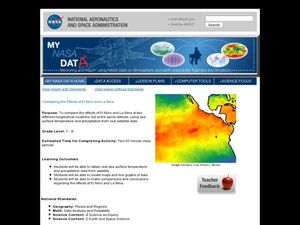
Comparing the Effects of El Nino and La Nina
Students examine the differences between an El Nino and La Nina year. For this investigative lesson students create maps and graphs of the data they obtained.
Curated OER
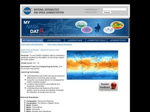
Earth's Energy Budget - Seasonal Cycles in Net Radiative Flux
Learners attempt to understand seasonal variation by viewing images of the energy received by the earth. In this weather activity, students view images from NASA of the influx of energy from the sun and make predictions about resulting...
Curated OER
The Solstices
Compare surface temperatures when the solstice occurs in the different hemispheres. Young scientists draw conclusions from their investigation of data collected using spreadsheets and a globe.
Curated OER
How Does the Earth's Energy Budget Relate to Polar Ice?
Students use satellite data to see how radiation budget relates to the ice that is present in the North. In this energy lesson students correlate data to see a relationship.
Curated OER
MAISA and the REMC Association of Michigan
Students complete online research to study geography's impact on weather. In this geography and weather lesson, students research weather in their city for ten days using an online website. Students bookmark the site, enter data into a...
Curated OER
Earth's Biomes
Tenth graders examine characteristics and animals of terrestrial biomes. In this Earth's biomes lesson plan, 10th graders view a PowerPoint, take noes, sort pictures, research biomes, and create a diorama of a biome for presentation.
Alabama Learning Exchange
The Sun and the Earth
Third graders study and diagram the positions of the Earth and sun during the four seasons. They predict weather for cities in the northern and southern hemispheres.
Curated OER
Local Weather And Location
Students explain how uneven heating of Earth affects wind and water currents. They describe the limits on current technology in predicting weather and how the Water Cycle is related to local weather.


