Curated OER
World Geography - Climate Notes
A challenging activity helps young geographers explore the temperatures around the world! They study how the Earth's land temperatures are affected by their proximity to an ocean, as well their latitude and their altitude. A very...
Center Science Education
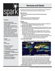
Hurricanes and Climate
Feeling under the weather? This instructional activity on hurricanes can whip things up! With professionally designed maps and handouts, teach your future weathermen (or women) where, when, and how hurricanes occur. They identify...
NOAA
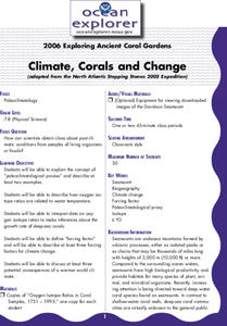
Climate, Corals and Change
Global warming isn't just an issue on land; deep ocean waters are also showing troubling signs. Young scientists learn more about deep water corals and the many recent discoveries researchers have made. Then they examine data related to...
Curated OER
Eastern European Studies
One worksheet, three projects. Learners explore Eastern Europe and mark Eastern European countries on a map. They then collect and record census data on thirteen different countries, and write a 3-5 page expository essay on one of the...
Curated OER
Weather Versus Climate
Students research on the internet to understand the difference between weather and climate. In this weather versus climate lesson plan, students research the internet, read a climate zone map, look into the climate zones, and present...
Columbus City Schools
Constructive and Destructive Geologic Processes
Show the class the world as they've never seen it before—from way above! Learners try to unravel the mysteries presented by rich satellite imagery, learn to interpret topographic maps, and study erosion by constructing their very own...
Curated OER
Places in My World
Second graders explore where they are located on the globe. In this maps and globes lesson, 2nd graders use a map to show where they live and show the cardinal directions. Students identify characteristics of mountains, flat land,...
Curated OER
World Geography: Global Interdependence
Students are able to discuss the theory of climate change. They identify examples of how climate change impacts the earth's geo-spheres. Students are able to use the example of climate change to describe the interdependence of the...
Curated OER
Using Vegetation, Precipitation, and Surface Temperature to Study Climate Zones
Students begin their examination of the climate zones found around the world. Using a software program, they identify the relationship between the vegetation, climate and temperatures of the different zones. They also plot coordinates...
Curated OER
Physical Geography- Climate
Sixth graders explore different climates. For this compare and contrast lesson, 6th graders look at the differences in climates of America and Europe. Students use KWL charts and graphic organizers to record information about different...
Montana State University
What's the Weather?
How many jackets do you need to stay warm and climb Mount Everest? An informatie resource covers the topic of Mount Everest, the resource helps young scientists discover the difference between climate and weather. Activities include...
Curated OER
Climate
Young scholars explore climate and weather conditions. Using the Internet, and other activities, students examine climate maps and the factors that affect climate. They examine how climate affects clothes, shelter, food,...
Curated OER
Africa: Introduction, Geography and Mapping
Students study the geography of Africa through the use of maps. They locate, distinguish, and describe the relationships among varying regional and global patterns of geographic phenomena such as landforms, climate, and natural resources.
Curated OER
Is Portland, Oregon Experiencing Global Warming?
Students use data to determine if the climate in Portland has changed over the years. In this weather lesson students complete line graphs and study long wave radiation.
Curated OER
The World's Last Great Wilderness (Antarctica)
It's a shame that there are no photographs in this presentation because the information is fascinating! Each identically fashioned slide contains bullet points of information about Antarctica that will enhance an earth science...
Global Oneness Project
The Value of Ancient Traditions
Imagine having to give up cell phones, computers, and TV? What would be lost? What gained? An examination of the Drokpa, a nomadic people who live in the grasslands of Tibet, provides class members an opportunity to consider how access...
Curated OER
Where in the World Is That Volcano?
Identify the Earth's major volcanoes with an earth science lesson. Elementary and middle schoolers locate major volcanoes on a world map. Then, in groups, they research how the volcano affects the region in which it is located.
Polar Bears International
Top of the World
Learn about polar bears and the Arctic circle with a instructional activity about the countries and conditions of the region. After examining how the area differs from Antarctica, kids explore climates, animals, and geographical position...
Curated OER
Tread Lightly: Our Changing Climate
Students examine the concept of climate change. In this environmental studies lesson, students research Internet and print sources regarding global warming and discuss their research findings as well as their impressions.
Curated OER
Climate Change in Canada
In this Canada worksheet, students read a 6 page detailed informational text about climate change in Canada. Students then complete 10 essay/short answer questions.
Curated OER
Fall Around the World
What is autumn like in Shanghai? How much rain falls during September in Sydney? Is Moscow cold in October? Take a virtual trip around the world with a research assignment on autumn in different countries. After learners answer questions...
Curated OER
European Climates
Ninth graders study the climate regions of Europe. In this geography skills lesson, 9th graders determine how weather and climate are influenced as they research the climate zones of specific locations and write about the ways that...
Curated OER
Climate Characteristics of Canadian Localities
Tenth graders match the climate data to a Canadian city. They justify their choice, referring to factors that affect climate. They use the Atlas of Canada's Advanced Search to locate specific communities.
Curated OER
World Map and Globe-Equator, North Pole, and South Pole
Students identify the Equator, North Pole, and South Pole on a map. For this geography lesson, students use a world map and circle the North and South Pole. Students locate the Equator on a globe and use a map marker to highlight it.


