Curated OER
Beyond Demographics
Students study the Dominican Republic through watching and discussing a video about the country and its people. They explain life in the Dominican Republic and describe the emerging picture of the Dominican Republic as viewed through...
Curated OER
Are You an Energy Efficient Consumer?
In this energy consumption activity, students use on line resources to explore the energy use by different countries around the world. Students compare the amount of light emitted by different countries and their carbon dioxide...
Curated OER
How Does Your Garden Grow? Discovering How Weather Patterns Affect Natural Cycles
For the warm-up in this cool climate lesson, you will need to click on "Mapping" and then "US Mapping" once you arrive at NOAA's "US Climate at a Glance" page. Earth science explorers realize that 2012 was a warm winter for us. They read...
Curated OER
Rising Temperatures Threaten Penguins
Students examine the continent of Antarctica, then read a news article about the decline in the Antarctic penguin population. In this current events lesson, the teacher introduces the article with a discussion and vocabulary activity,...
Curated OER
Where is the Trail? The Journey of Lewis and Clark
Students explore the trail followed by Lewis and Clark on their journey across the United States. In this United States History instructional activity, students complete several activities to establish the Lewis and Clark Expedition,...
Curated OER
Meet Meteorology
Students explore meteorology, discuss Earth's atmosphere, create drawings of the water cycle, create meteorology journals, and role play forecasters. Nine lessons on one page; includes unit test.
Curated OER
Polar Bear Panic!
Students identify the three realms of the Arctic Ocean, and describe the relationships between these realms. They graphically analyze data on sea ice cover in the Arctic Ocean, and recognize a trend in these data.
Curated OER
The Great Continental Drift Mystery
Students stud the concept of Pangaea by using Wegener's clues to construct a map of the continents joined together. They determine how fossil distribution can be used to enhance the study of continental drift. They locate the...
Curated OER
Why Here? Why Not There?
Middle schoolers analyze a map and graph information on eleven countries. Using the characteristics of the countries, they determine if they should host the summer or winter Olympic games. After viewing a video, they locate the...
Curated OER
"The Drum"
Second graders read and discuss the folktale "The Drum" from India. They also answer story comprehension questions, complete an adjectives and verb worksheet, and label a map of India. Students sequence events from the story and make...
Curated OER
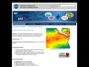
Comparing the Effects of El Nino and La Nina
Students examine the differences between an El Nino and La Nina year. In this investigative lesson students create maps and graphs of the data they obtained.
Polar Trec
The Amazing Antarctic Trek
This resource provides two ways to engage learners in using latitude, longitude, and research skills. In pairs, or on their own, learners will locate several Antarctic regions on a map. They will write the name of the place and a few key...
Curated OER
A Contouring We Go
Students examine the built environment and infrastructures of their community by constructing contour equipment, using the equipment, and comparing their results to current topographical maps of the same area
Curated OER
NIGHT AND DAY: DAILY CYCLES IN SOLAR RADIATION
Students examine how Earth's rotation causes daily cycles in solar energy using a microset of satellite data to investigate the Earth's daily radiation budget and locating map locations using latitude and longitude coordinates.
Curated OER
Geography/Current Events Project
Using the Balkan region as an example, fourth graders review the five themes of geography as a class. They identify the physical and human characteristics of a region before labeling the countries and landforms on a map. They then...
Curated OER
Trekking to Timbuktu: The Geography of Mali -Teacher Version
Students investigate the geography of Mali. They locate Mali on a satellite map, explore various websites, describe the landscape and climate, label a map, and write an essay about the Niger Riger.
Environmental Education in Wisconsin
Biome Travel Guide
In a perfect marriage of social studies and science, groups work together to research and create a travel guide presentation to share with the class. Not only do kids learn about the climate and geography of a biome, but also the...
Curated OER
The Geography of the Indian Subcontinent
Gloriously adorned with a glimpse of the Taj Mahal, these slides detail important facts and characteristics of South Asian cultures, such as India, Pakistan, Afghanistan, and several other surrounding countries. Slides cover the...
Curated OER
Brochures
Students discuss how the climate in their area affects they way they live their life. In groups, they identify the climate zones throughout the world and research one country of interest to them. To end the lesson, they make a brochure...
Curated OER
Geology and it’s Influence
Students compare current geological map and the one from 1800's. In this earth science lesson, students discuss differences between the two and explain the factors that caused the change. They write an essay about how these changes...
Curated OER
What Causes Irregular Temperature Patterns?
Students examine common trends in climate across the U.S. They identify the anomalies in hot-cold temperature differences in the U.S and locate them on the map using latitude and longitude coordinates.
Curated OER
What Is CLIVAR and EPIC?
Students conduct Internet research to analyze climatic conditions. They answer questions by conducting Internet research about CLIVAR and EPIC and write an essay about why climate research is an international issue.
Curated OER
Hurricanes
Eighth graders gather information on hurricanes that are affecting the world at the time of the lesson. They work together in groups to collect the data and record their information in a table. They are asked questions to finish the lesson.
Curated OER
Great North
Students view a video about the Arctic Circle, North Pole and Northern Europe. They locate areas using a map. They create a drawing of the countries where the Inuit live.


