Curated OER
Earthquake Epicenter
Students use chart data to determine the location of the epicenter of an earthquake. This task assesses students' abilities to generalize and infer, organize data, interpret data, and apply mathematical concepts.
Polar Trec
The Amazing Antarctic Trek
This resource provides two ways to engage learners in using latitude, longitude, and research skills. In pairs, or on their own, learners will locate several Antarctic regions on a map. They will write the name of the place and a few key...
Curated OER
Tracing Our Own Family Pilgrimages
The Pilgrims may have arrived in North America by way of the Mayflower, but chances are, your class members' ancestors came to the United States in another way. Guide them through an exploration of their own heritage, countries of...
Curated OER
Paper Mache Globes
Third graders create a paper mache model of the earth. At the conclusion of a discussion about the earth, they are given paper mache materials, they create their globe and appropriately draw and label landforms, bodies of water and the...
Curated OER
The Making of a Coat
Young scholars read the story A New Coat For Anna and discuss their knowledge on how to make a coat. In this reading and coat making lesson plan, students discuss coat making and listen to a speaker that spins thread to make coats.
Curated OER
Lights On ! Lights Off! Exploring Human Settlement Patterns
Third graders write informational paragraphs based on the settlement patterns of the United States. In this settlement lesson plan, 3rd graders read about population and how it affects where people settle next.
Curated OER
The Fault Line
Students use cardboard models of the North American and Pacific plates and sand to investigate what happens when there is an earthquake or movement along the boundaries of the plates.
Curated OER
Canada, O Canada
Students study the similarities and differences between Canada and the United State in this unit. They examine geography, government and culture as they "travel" through Canada.
Curated OER
Where Am I, and How Do I Get Where I am Going?
Students describe geographical places through art, music, writing, and math. They compile information in booklets which may be published.
Curated OER
A Line Graph of the Ocean Floor
Students develop a spreadsheet and import the information into a line graph. In this spreadsheet and line graph lesson, students develop a spreadsheet of ocean depths. They import the information into a word processed document. They...
Curated OER
High Up in the Himalayas
Have your class supplement their knowledge on the Himalaya mountain range. In a brief handout, they read about the land masses that collided to form the Himalayas and other mountain ranges. It also touches briefly on the Earth's crust...
Curated OER
Yo-ho, Yo-ho a Viking's Life for Me
Students complete a unit of lessons on the Vikings. They analyze maps, read and discuss myths, summarize the main ideas from resource materials, watch videos, sing a song, draw a picture to illustrate Norse mythology, and define key...
Curated OER
Exploring Plate Tectonics
In this plate tectonics worksheet, students answer questions about plate movement, the types of boundaries, the history of Earth's crusts and plate tectonics. They use an on line source to get their answers.
Curated OER
Mapping West Virginia
Fourth graders explore West Virginia. In this Unites States geography lesson, 4th graders discuss the type of land and the cities in West Virginia. Students create two overlays, with transparencies, that show the natural land and the...
Curated OER
Water and Land 207
Students examine maps of different projections, mathematically calculate distortions, and note the advantages and disadvantages of each map. They study the different maps and transfer the map to graph paper.
Curated OER
Statue of Liberty
Students discuss aspects of the Statue of Liberty and create their own personalized statue. Students use symbols to represent themselves in their own drawings of the Statue of Liberty.
Curated OER
Tooling Around Arizona: Reading Arizona Maps
Students study geography. In this Arizona maps lesson, students develop their map reading skills. They have class discussions and work independently with various copies of Arizona maps to practice those skills. This lesson mentions...
Curated OER
Shake, Rattle and Erupt
Students study myths regarding four earthquakes myths. They receive a list of supplies each family should have at home to prepare for an earthquake and construct an "Earthquake Preparation" poster showing some of the most important items...
Alabama Learning Exchange
Forces that Change the Land
Students conduct Internet research find information about the following landforms: mountains, canyons, and valleys. They create travel brochures of their findings.
Curated OER
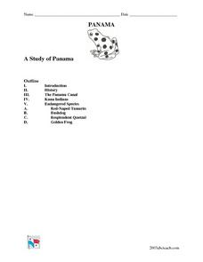
A Study of Panama
In this worksheet on Panama, students read an introduction about Panama, then read about its history, The Panama Canal, the Kuna Indians and the Endangered Species of Panama. After each selection, students answer a set of related questions.
Curated OER
How Islands Form
Students how islands form, rising water levels, growth of coral, and volcanoes. They complete Island Investigation worksheets after researching island formation on various Internet websites.
Curated OER
Adjectives Of Quantity (How Much?)
In this on-line language arts worksheet, students complete 10 multiple choice questions where they identify the adjective of quantity in each sentence. Students can check their answers at the end of the worksheet.
Curated OER
Country: Austria
Pupils access a variety of Austria themed websites. They locate information about history, geography, climate, people and culture. They view a live webcam of different parts of Austria and read about famous personalities from Austria.
Curated OER
Earth: The Water Planet
Students elicit data on the water cycle, ocean topography, and island formation in this six lesson unit. The ocean floor and the properties of water are examined through a variety of discussions and hands-on experiments.


