Curated OER
The Arctic Ocean
For this Arctic Ocean worksheet, students read a 2 page passage, then complete 10 true/false questions. Answers are included on page 4. A reference web site is given for additional activities.
Curated OER
The Pacific Ocean
In this Pacific Ocean worksheet, learners read 2 pages about the Pacific Ocean and answer true and false questions. Students answer 10 questions.
Curated OER
Traveling Through North America
Students identify places and landmarks in North America, specifically Canada and the United States, by using and constructing maps. Six lessons on one page; includes test.
Curated OER
Happy Lesson: The Earth's Crust
This PowerPoint provides a multiple choice and fill-in-the-blank format for reviewing vocabulary and related content following an "earth's crust" science unit. The information is concise and age-appropriate and the font and colors are...
Curated OER
Memorable Maps
Students draw an assigned map from memory about the United States or any other region they are studying. For this maps lesson plan, students draw a map from their memory at the beginning of the year, and do the same assignment at the end...
Curated OER
Exploring Plate Tectonics
In this plate tectonics worksheet, students complete 8 fill in the blank questions on plate boundaries, 9 short answer questions on the Earth's crust and 5 fill in the blank on continental drift. There are 3 follow questions at the end.
Curated OER
Observing Sea Ice
Students study and observe types of sea ice found in Alaska. In this sea ice lesson, students use the student network for observing weather to study the different types of sea ice. Students study sea ice depicted in Alaskan art.
Curated OER
Antics in Antarctica
In this ESL editing worksheet, students will focus on error correction and editing. Students will read a short passage correcting any spelling mistakes or omissions from the article.
Curated OER
What's Holding Up the Water?
Students read about the history and locate dams in Arizona. In this Arizona dams lesson plan, students write a summary about what they read focusing on word choice, ideas, conventions, and geography content.
Curated OER
Landforms All Around
Students create a "Landform Dictionary". They develop an overlay map and participate in hands-on activities to identify the key characteristics of landforms. They discuss the plant and animal life of these areas. Handouts for the lessons...
Curated OER
Social Studies and Children's Literature
Young scholars write a journal in response to literature. The story that is read is about prairies. The subject of prairies becomes an object for research. The culminating activity is the making of a map where prairies exist in the...
Curated OER
Mechanics Help Using the Comma with Formal Letters
In this worksheet, students analyze different parts of a letter and insert the appropriate punctuation including a comma, period, colon, question mark and semicolon.
Lizard Point Quizzes
Lizard Point: World Oceans and Continents Quiz
Test your geography knowledge by taking this interactive quiz over the world's continents and oceans.
Utah Education Network
Uen: The World Game
Play the World Game to become familiar with continents, oceans, countries, and states.
Houghton Mifflin Harcourt
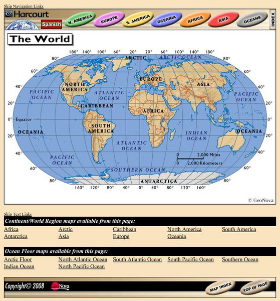
Harcourt: School Publishers: World Atlas: The World
Provides continent, country, and ocean floor maps from all over the world. Click on a continent's name to access the detailed maps which also include statistical facts on each available country.
National Geographic
National Geographic: My Wonderful World: World Wall Maps (Pdf)
Make your own full color or black and white mosaic wall map on your own printer. World maps, continents, Asian regions, and oceans are available for downloading, printing, and assembling.
SMART Technologies
Smart: World Map
This lesson features a world map with labeled countries, a global map, and an interactive map of the seven continents.
ClassFlow
Class Flow: Name the Continents
[Free Registration/Login Required] This flipchart will allow students to label the continents and the oceans on a world map.
Geographyiq
Geography Iq
Detailed geographical information on any country is available at this site. Within the World Map section, you can get facts and figures about each country's geography, demographics, government, political system, flags, historical and...


