Curated OER
Geography And The Gulf War
Young scholars develop maps, tables, graphs, charts, and diagrams to depict the geographic implications of current world events, and analyze major human conflicts to determine the role of physical and cultural geographic features in the...
Curated OER
Making Sense Of A Round World On A Flat Surface
Students engage in a lesson that is concerned with the development of geography skills. They take part in a number of activities that center around finding and traveling to different locations. The lesson has resource links that can be...
Curated OER
World Continents
Students identify the continents of the world. In groups, students create a three-dimensional clay representation of their assigned continent. Using KidPix software, they draw and color their continent. Students research their continent...
Curated OER
Foods and Languages of the World
Students explore cultures around the world. In this cross-curriculum geography lesson, students listen to This is the Way We Go to School , a Book about Children around the World , and locate various countries on the globe and a map....
Curated OER
Where in the World is Mr. Fultz?
Students use maps and other geographic resources to learn about their world while problem solving. They read clues each day and use classroom resources to narrow down where the prize is located.
Curated OER
2nd Grade - Act. 22: The World Game
Second graders play World Game to become more familiar with continents, oceans, countries and states.
Curated OER
What in the World Is a Watershed?
Students discover the role of a watershed. In this geography lesson, students are shown a diagram of a watershed and discuss the definition of a watershed. Students demonstrate the role of a watershed by using an umbrella and spraying it...
Curated OER
Geography, Ecology, and Folklife
Students identify how do geography and ecology influence a region's folklife. Then they investigate this question and consider how an outsider might view their own region in this lesson. Students also identify how the natural world, even...
Curated OER
Where in the World?
Young scholars locate famous landmarks around the world. They identify the location of natural and manmade landmarks using a worksheet that provides ten clues.
Curated OER
California Geography
Fourth graders explore geography of four distinct regions of California: mountains, coast, central valley, and desert. They locate California on map, identify state's boundaries and borders, and explore agriculture, a major economic...
Curated OER
If the World Were a Village Activities
Sixth graders complete activities about the book If the World Were a Village by David J. Smith. For this interdisciplinary lesson, 6th graders complete a math activity converting fractions into decimals and percentages and a geography...
Curated OER
New Year Celebrations Around the World
Young scholars share their New Year's traditions, then read a news article about how people around the world celebrate the start of a new year. In this current events lesson, the teacher introduces the article with a discussion and...
Curated OER
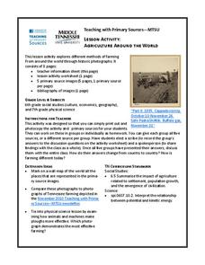
Agriculture Around the World
Students explore various kinds of farming methods around the world. In this history lesson, students view pictures of farming methods, then compare and contrast them in a class discussion with the methods of farming that are used today.
Curated OER
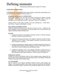
Defining moments from the past with lessons for a post-9/11 world...
Students examine extension ideas concerning 9/11, Defining Moments. They analyze a variety of Supreme Court cases, the U.S. Constitution, Mass Media Interpretations, Racism, Immigrant groups and U.S. geography. Many questions are asked...
Curated OER
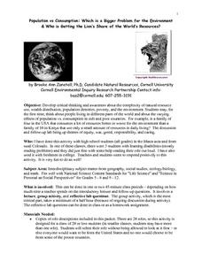
Population Vs Consumption: Which is a Bigger Problem for the Environment & Who is Getting the Lion's Share of the World's Resources?
Students develop critical thinking and awareness about the complexity of natural resource use, wealth distribution, population densities, poverty, and the environment. They think about people living in different parts of the world and...
Curated OER
Alaska Virtual Field Trip
Students participate in an on-line virtual field trip to the state of Alaska. In this U.S. Geography lesson, students research several Internet sites dealing with travel to Alaska and activities to participate in. Students create story...
Curated OER
Where in the World? Your Relative Location
In this geography worksheet, learners complete a graph showing their location on the planet earth. Students determine what percent of all people on Earth are on their continent, in their country and part of their town.
Curated OER
What I Did On My Summer Vacation
Students use the internet to research the location of their summer vacation trip. Given the demographics, they plot the location on a world map. They create a brochure using the information they collected. Using PowerPoint, they develop...
Curated OER
Rivers Worksheet
In this geography worksheet, young scholars answer 12 multiple choice questions about rivers of the world. They identify wild life that is found near rivers, how rivers can be used, and about landforms near river banks.
Curated OER
Developing, Developing, Developed!
Students differentiate among and explain various levels of economic development around the world. They see that levels of economic development vary greatly in different countries according to many different measures.
Curated OER
Peace Corps Challenge Game-National Trees
Students explore trees around the world. In this world geography and tree lesson, students compare familiar local trees and discuss similarities and differences. Students give opinions about why the oak tree was chosen as our national...
Curated OER
Geography, Climate, and Community in the Dominican Republic
Students examine primary source materials on the Dominican Republic in an exploration of how environment influences lifestyles. They compare and contrast life in the Dominican Republic with life in the United States.
Curated OER
Where in the World War? Mapping the Geography of D-Day
Students examine how to read maps for historical information. They listen to a lecture on the history of D-Day, analyze a historical map of the invasion of Normandy, and answer discussion questions.
Curated OER
World Map and Globe- Introduction to Symbols
Students investigate picture symbols. In this symbols lesson, students define symbols and discuss symbols that they see in everyday life. Students identify symbols on maps by using post-it notes.
Other popular searches
- World War I Map
- Mapping Penny's World
- Map of the World
- World Outline Maps
- Blank Maps of World
- World War 2 Map
- World War 1 Maps
- World War I Outline Map
- Map of World
- World Climate Map
- Blank World Outline Maps
- World Biomes Map


