University of Oregon
Mapping History: American History
Interactive and animated maps and timelines of historical events and time periods in American history from pre-European times until post-World War II.
University of Texas at Austin
The Perry Castaneda Library Map Collection
This collection contains more than 250,000 maps covering all areas of the world, and ranging from political and shaded relief maps to the detailed and the historical. Select from a region of the world or an area of highlighted interest.
PBS
Pbs: Geography of Music the World in the Age of Revolutions
This interactive map helps illuminate the relationships among the various composers as well as connections between music and its historical and cultural context. It also illustrates the importance of the physical and cultural...
Central Intelligence Agency
Cia: World Factbook: Jamaica
This resource from the CIA World Factbook provides a detailed fact sheet of Jamaica. The content covers the country's geography, people, government, economy, communications, transportation, military, and transnational issues. It includes...
Central Intelligence Agency
Cia: World Factbook: Japan
This resource from the CIA World Factbook provides a detailed fact sheet of Japan. The content covers the country's geography, people, government, economy, communications, transportation, military, and transnational issues. It includes...
Latimer Clarke Corporation
Atlapedia Online
This site provides both physical and political maps of countries of the world in full color. Also contains key facts and statistics.
Central Intelligence Agency
Cia: World Factbook: Russia
This resource from the CIA World Factbook provides a detailed fact sheet of Russia. The content covers the country's geography, people, government, economy, communications, transportation, military, and transnational issues. It includes...
Central Intelligence Agency
Cia: World Factbook: Austria
See a map of Austria and read about the country's geography, government. people, economy and more.
University of California
Ucla: Manas: History and Politics of the Mughal Empire
This article surveys the Mughal Empire of India (1526-1857) and traces its origins, names its rulers, and provides historical illustrations and a map.
Central Intelligence Agency
Cia: World Factbook: Angola
This resource from the CIA World Factbook provides a description of Angola's location, people, political information, and economy, including summary statistics. It includes a map and flag.
Central Intelligence Agency
Cia: World Factbook: Czechia
This resource from the CIA World Factbook provides a detailed fact sheet of the Czechia. The content covers the country's geography, people, government, economy, communications, transportation, military, and transnational issues. It...
Other
World Statesman: Ecuador
This site is a complete encyclopedia of Ecuadorean leaders. Also provides detailed chronologies, flags, national anthems, maps and indexes.
Other
World Statesman: Peru
This site is a complete encyclopedia of Peruvian leaders, beginning with the arrival of the Spanish conquistadors. Also provides detailed chronologies, flags, national anthems, maps and indexes.
Other
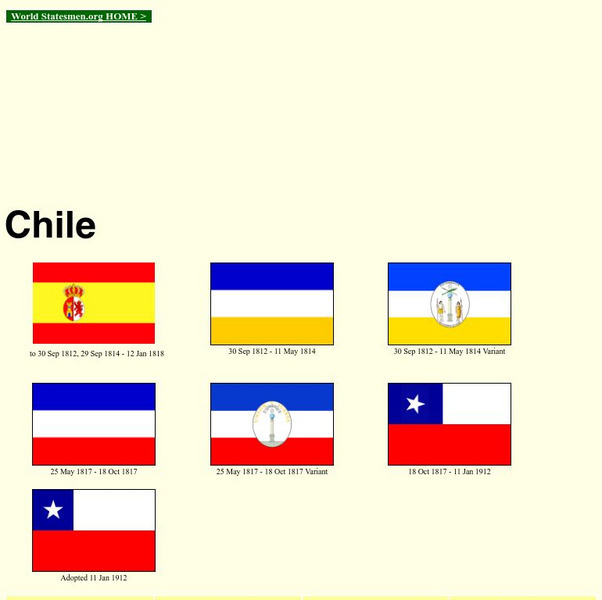
World Statesman: Chile
This site is a complete encyclopedia of Chilean leaders. Also provides detailed chronologies, flags, national anthems, maps and indexes. There is also a section devoted to Easter Island.
Other
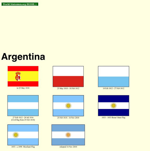
World Statesman: Argentina
This site is a complete encyclopedia of Argentinean leaders. Also provides detailed chronologies, flags, national anthems, maps and indexes.
World History Encyclopedia
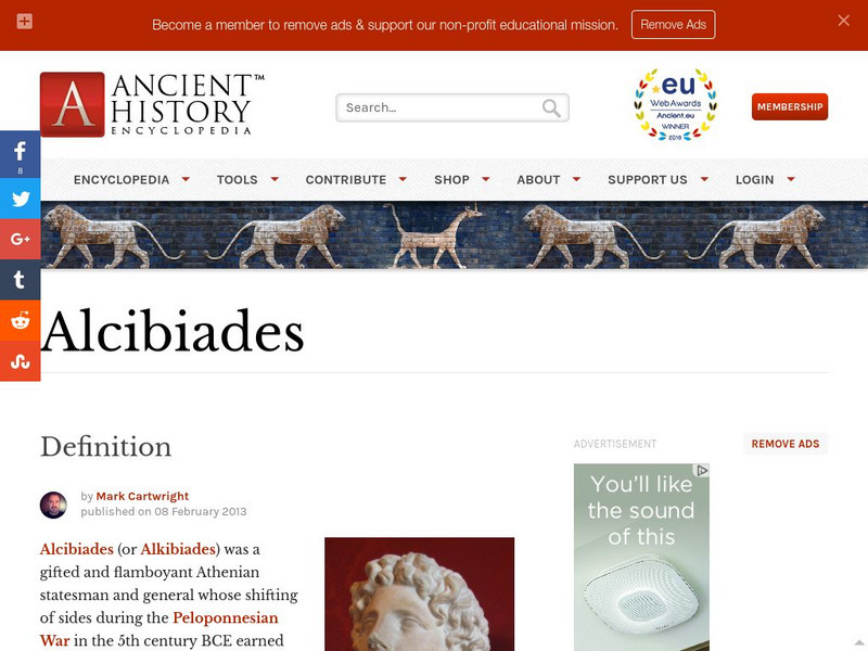
World History Encyclopedia: Alcibiades
Encyclopedia entry on the gifted Athenian statesmen, Alcibiades. Includes map, photos, timeline and links to related material.
Curated OER
Kazakhstan Political Map
Check out this great satellite image of Kazakhstan from Google Earth. Scroll past the informative political map to see the image. There is more information about the country below the satellite map.
Curated OER
Kyrgyzstan Political Map
Check out this great satellite image of Kyrgyzstan from Google Earth. Scroll past the informative political map to see the image. There is more information about the country below the satellite map.
Curated OER
China Political Map
Check out this great satellite image of China from Google Earth. Scroll past the informative political map to see the image. There is more information about the country below the satellite map.
Curated OER
Kuwait Political Map
Check out this great satellite image of Kuwait from Google Earth. Scroll past the informative political map to see the image. There is more information about the country below the satellite map.
Curated OER
Albania Political Map
Check out this great satellite image of Albania from Google Earth. Scroll past the informative political map to see the image. There is more information about the country below the satellite map.
Curated OER
Angola Political Map
Check out this great satellite image of Angola from Google Earth. Scroll past the informative political map to see the image. There is more information about the country below the satellite map.
Curated OER
Botswana Political Map
Check out this great satellite image of Botswana from Google Earth. Scroll past the informative political map to see the image. There is more information about the country below the satellite map.
Curated OER
Lesotho Political Map
Check out this great satellite image of Lesotho from Google Earth. Scroll past the informative political map to see the image. There is more information about the country below the satellite map.
Other popular searches
- Political Map of World
- Blank World Political Map
- World Political Map Labeled
- Political Map of the World


