Curated OER
Parthenon
Ninth graders explore he purposes of the Parthenon. For this World History lesson, 9th graders create a complete picture of the Parthenon. Students research one aspect of the structure and report their findings back to the...
Curated OER
We Live in an International Community
Pupils locate the different countries from which their clothing originates. Using a blank map, they identify and color in those areas.
Curated OER
Hungary: The Landscape
Pupils work in small groups to create a topographic map of Hungary. The map will include labeled line drawing of the bordering countries. Hungary should be three dimensional, made of salt and flour clay. The mountains, plains and...
Constitutional Rights Foundation
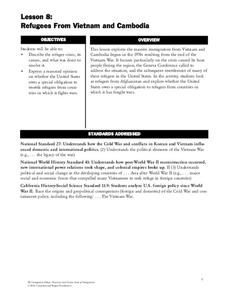
Refugees From Vietnam and Cambodia
The United States may have pulled its troops from the Vietnam War in 1973, but the conflict was far from over for the citizens living in Asia at the time. An informative resource lets learners know about the wave of over 220,000...
Curated OER
The Role Of NATO
Students examine the role of the North Atlantic Treaty Organization (NATO). In this NATO lesson, students research the Truman Doctrine, the Marshall Plan, Winston Churchill's "Iron Curtain" speech, and the Berlin airlift and how they...
Curated OER
Louisiana and Canada: Understanding Acadian Cultural connections
Ninth graders investigate why Acadians moved to Lousiana. In this geography lesson, 9th graders research the migration of Acadian to Louisiana and how that influenced the culture. Students analyze a list of cultural and...
Curated OER
Overcoming Censorship Through Art
Young scholars create an art piece that expresses their opinions while circumventing hypothetical government restrictions in this lesson on art and government censorship. Emphasis is placed upon historical instances of censorship around...
Curated OER
Country Capitals
Students define the meaning of country capital. In this country capital lesson, students identify the symbol and find country capitals. Students locate and label capital cities on a map and insert the capital symbol.
Curated OER
Colonization: Africa
Students analyze maps of Africa. They label physical features, tribal kingdoms, and European settlements, among other topics on the maps. They write reflective paragraphs on their work.
Curated OER
Let's Spice It With Pepper
Pupils identify and locate the areas in which pepper and spices orginated. On a map, they locate the areas and write the name of the spice that is found there. They use historical events to trace its route to the Americas. They answer...
Curated OER
A Trip Back In Time
Students develop an understanding of Ancient Greek life. Students explore cultural, political, and social processes that shape different city-states. Students discover people such as Socrates and Alexander the Great.
Curated OER
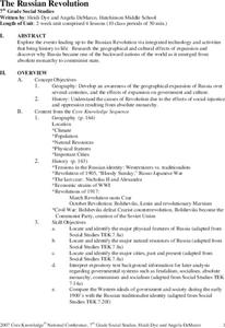
The Russian Revolution
Students complete a matching game based on geographic features of Russia and label a map with these features. In this geography and politics lesson, students identify resources and populations in Russia and complete a T-Chart on a video...
Curated OER
European Union Governance
Become familiar with the structure and functions of the European Union. As they conduct internet research, young historians use an attached worksheet to categorize the five main institutions of the EU. A flowchart worksheet also gives...
Curated OER
How Do You Get To Korea?
Students examine the differences between Korea and the United States. In groups, they identify the physical and political characteristics of Asia and discuss how the geographic features in Korea affect the activities performed there. ...
Curated OER
The European Union
Ninth graders construct a timeline depicting the development of the European Union and label and color countries on a map belonging to it. They write essays about how the Union affects the United States.
Curated OER
Indigenous People
Learners examine what foods are indigenous to America and how Western European expansion impacted indigenous communities. They identify indigenous foods that they themselves eat, and label maps and identify ethnic groups in the Americas.
Curated OER
On the Road Again": Moving People, Products, and Ideas
In this lesson students learn how to identify modes of transportation and communication for moving people, products, and ideas from place to place. Students also study the advantages and disadvantages of different modes of...
Curated OER
May We Present Planet Earth?
Students draw a map to scale. They illustrate knowledge of how to use DOGS TAILS on a map. Students identify the main parts of a map. They identify and illustrate the major features necessary for sustaining a quality of life for a society.
Curated OER
How Are Boundaries Made, Kept, Broken?
Young scholars perform raps and analyze issues among the rich and poor. They explore how countries are labeled as "third world" and "first world." They create a dialectical journal and examine the country of Nigeria through the reading...
Curated OER
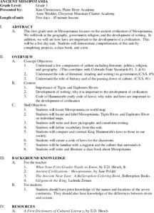
Ancient Mesopotamia
Students locate ancient Mesopotamia on a map. They examine the religion, government and the development of writing. They write and draw pictographs and cuneiform writing. They create a class book based on their investigations.
Curated OER
Elections in America
Eleventh graders examine the election process in America. In this US Government instructional activity, 11th graders analyze the problems with the Electoral College. Students research a specific state and create a state flash...
Curated OER
Conflicting Views
Students complete a Venn diagram comparing the United States and Afghanistan. They research the history of the Taliban and how they relate to the United States and its foreign policy. They write a paper on possible solutions.
Curated OER
Physical and Human Geography Review Worksheet and Study Guide
For this geography skills worksheet, students respond to 30 short answer questions pertaining to physical and human geography.
Curated OER
Central And South America And Their Ancient Civilizations
Fifth graders listen to lectures on the ancient civilizations of the Aztecs, Incas and Mayans. They construct a mask base and then decorate it in thirds with symbols meaningful to each of the three cultures being studied.


