Curated OER
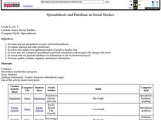
Spreadsheets and Database in Social Studies
Fifth graders create/use spreadsheets to solve real-world problems, explore patterns and make predictions, select/explain most appropriate types of graph to display data, and enter data into a prepared spreadsheet to perform calculations.
Curated OER
Cities as Transportation Centers
Students work in small groups to identify some of the major transportation centers, recommending two as possible sites for a national political convention, based on population density and the travel networks available in 1835.
Curated OER
A Data Processing Lesson for Statistics -- Reading a Table or Chart
Students identify the structure and key parts of tables and charts. They determine which data is meanjngful and make comparisons with the data. They describe the scope of the AIDS plague throughout the world.
Curated OER
Every Grain Counts
Young scholars research a variety of facts about rice. They read books, access information on the Internet and use maps to determine major rice growing areas in the world and the patterns of distribution for this crop. Students create...
Curated OER
Pennsylvania Dutch Hex Signs
Sixth graders recreate Pennsylvania Dutch hex signs using pre-cut wood or cardboard, compass, acrylic or tempera paints, and paintbrushes in this 6th grade Art activity. The activity is an excellent idea for use in the Social Studies...
Curated OER
Postcards from the Edge: Endangered Species
Students use the internet to identify the endangered species in their state. Using this information, they create a postcard with a picture of the animal along with facts. They discuss the main reasons to protect the endangered species...
Curated OER
Impact of Exotic Species on Lake Ecology
Students examine the effect of foreign species on various habitats. In groups, they identify the population dynamics of the zebra mussel. They calculate averages and graph data from Seneca Lake in New York. They develop hypothesis...
Curated OER
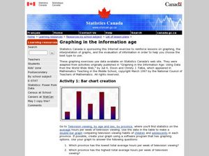
Graphing in the Information Age
Students create a variety of graphs based on population data. In this statistics instructional activity, students use data that can be gathered on-line to make a bar chart, line graph, and circle graph.
Curated OER
The Counter Reformation
In this Counter Reformation study guide worksheet, students read a brief overview pertaining to the time period in world history and then respond to 3 reflection questions.
Curated OER
The Napoleonic Era
In this online interactive world history worksheet, learners answer 21 fill in the blank questions regarding the Napoleonic Era. Students may submit their answers to be scored.
Curated OER
Dust Bowl Exodus: How Drought and the Depression Took Their Toll
Students examine the migration of refugees. In this California history lesson, students listen to their instructor present a lecture regarding the details of how the Dust Bowl and Great Depression led to a California population...
Curated OER
A Passport to Asia
Middle schoolers explore Asia. In this geography skills lesson, students design travel brochures that market Asia by highlighting its location, population, capital, landforms, famous places, and food.
Curated OER
Oh Panther
Learners play a game that replicates the balance of prey and predators in an ecosystem. In this physical education lesson plan, students follow the instructions to play "Oh Panther!" Learners collect data regarding the game and discuss...
Curated OER
Another Perspective on Modern Civilization
Students consider the impact of current issues on the world population. In this global studies lesson, students discuss the pros and cons of modernization after they listen to a lecture about Gandhi's opinion of modern civilization....
Curated OER
Countries with Most Land Area Quiz
In this online interactive geography quiz activity, students respond to 20 identification questions about the countries in the world with the most land area. Students have 4 minutes to complete the quiz.
Curated OER
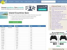
Island Countries Quiz
In this online interactive geography quiz worksheet, students respond to 48 identification questions about island nations in the world. Students have 5 minutes to complete the quiz.
Curated OER
Countries w/ Biggest Economies Quiz
In this online interactive geography quiz instructional activity, students respond to 20 identification questions about the economies of countries in the world. Students have 4 minutes to complete the quiz.
Curated OER
Most Expensive Cities Quiz
In this online interactive geography quiz instructional activity, students respond to 20 identification questions about the most expensive cities in the world. Students have 4 minutes to complete the quiz.
Curated OER
Top Oil Producing Countries Quiz
In this online interactive geography quiz learning exercise, learners respond to 20 identification questions about the world top oil producing countries. Students have 4 minutes to complete the quiz.
Curated OER
Top Wine Producing Countries Quiz
In this online interactive geography quiz instructional activity, students respond to 20 identification questions about wine producing countries in the world. Students have 4 minutes to complete the quiz.
Curated OER
Country Superlatives Quiz
In this online interactive geography quiz instructional activity, students respond to 20 identification questions regarding world country comparisons. Students have 4 minutes to complete the quiz.
Curated OER
Richest Countries Quiz
In this online interactive geography quiz learning exercise, students respond to 20 identification questions about the richest countries in the world. Students have 4 minutes to complete the quiz.
Curated OER
Famous Festivals Quiz
In this online interactive geography quiz learning exercise, students respond to 12 identification questions about famous festivals that occur in the world. Students have 3 minutes to finish the timed quiz.
Curated OER
Most Livable Cities Quiz
In this online interactive geography quiz worksheet, students respond to 20 identification questions about the most livable cities in the world. Students have 4 minutes to complete the quiz.


