Curated OER
Image From World War One Trench Virtual Tour
In-depth look at World War I. Includes summaries of the war years; sound clips of eye-witness accounts; virtual tours of trenches on the Western Front; maps; articles and overviews; and similar resources.
Curated OER
Image From World War One: Misrepresentation of a Conflict
In-depth look at World War I. Includes summaries of the war years; sound clips of eye-witness accounts; virtual tours of trenches on the Western Front; maps; articles and overviews; and similar resources.
Curated OER
Image From the Ending of World War One, and the Legacy of Peace
In-depth look at World War I. Includes summaries of the war years; sound clips of eye-witness accounts; virtual tours of trenches on the Western Front; maps; articles and overviews; and similar resources.
Ibis Communications
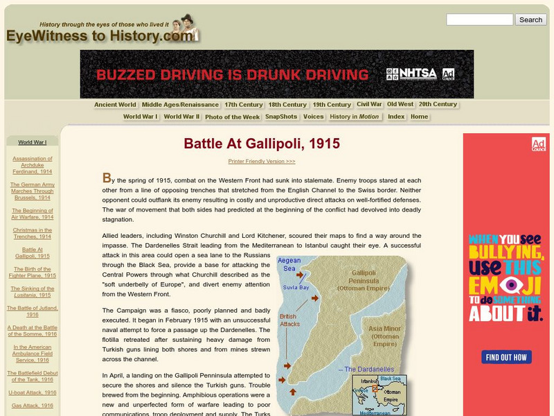
Eye Witness to History: Battle at Gallipoli, 1915
This article offers a detailed description of the Battle at Gallipoli in 1915 during WWI. Includes maps and photos.
Virtual Museum of Canada
Virtual Museum of Canada: Community Stories: Wwi a Commemoration of Residents From Trinity & Area
Primary documents, images,audio clips and maps help to reveal the role Newfoundland, as the oldest British Colony, had during the First World War.
Boise State University
Boise State: World at War: Set the Stage
This 1815 map of Europe is a result of the Congress of Vienna creating a balance of power between the five most powerful countries in Europe. The countries competed in nearly everything, which made it almost inevitable that war would come.
PBS
Pbs: The Great War: Maps and Battles: The Battle of the Somme 1916
Brief account of the Battle of Somme that includes a captioned animated map showing the battle along with links to further resources.
Other
League of Nations: 1920 1946 Map
A color-coded map from Matthew White's Homepage showing which countries were a part of the League of Nations during specific times in history.
Georgia Department of Education
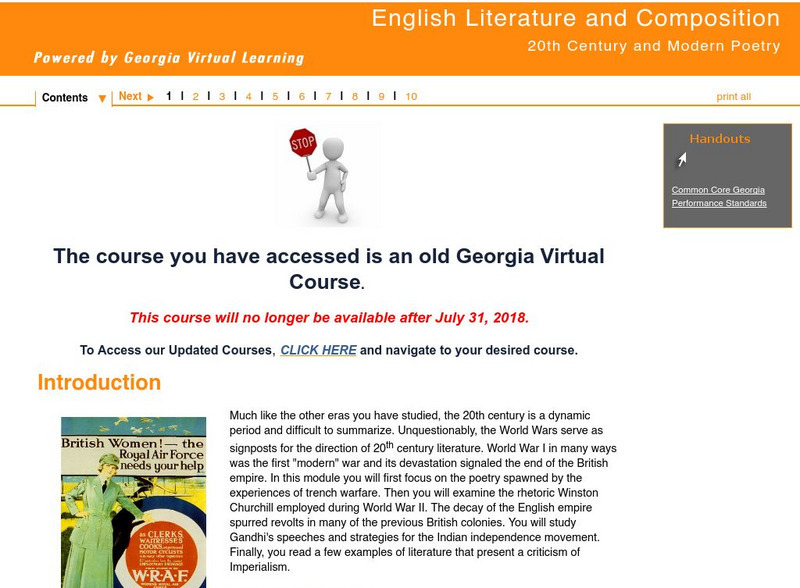
Ga Virtual Learning: 20th Century and Modern Poetry: Introduction
This is an introduction to 20th Century and Modern Poetry. It focuses on disillusionment in British attitudes, World War I's influence on the literature, changing role of women in British society, and major writers of the time and their...
Curated OER
Image From War and Revolution in Russia 1914 1921
In-depth look at World War I. Includes summaries of the war years; sound clips of eye-witness accounts; virtual tours of trenches on the Western Front; maps; articles and overviews; and similar resources.
Curated OER
Image From the Human Face of War
In-depth look at World War I. Includes summaries of the war years; sound clips of eye-witness accounts; virtual tours of trenches on the Western Front; maps; articles and overviews; and similar resources.
World War 1
Worldwar1.com: Trenches on the Web: The Trenches at Messines 1916 17
Shows British maps of trench warfare and gives a brief explanation.
Brigham Young University
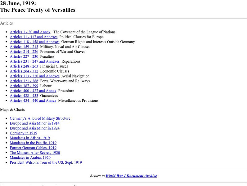
Byu: Wwi Document Archive: The Peace Treaty of Versailles: Articles 1 30
This site provides the complete texts of the Peace Treaty of Versailles as completed on June 28th, 1919. Also provided at the bottom of the page are many links to charts and maps that are associated with the Treaty.
E Reading Worksheets
E Reading Worksheets: The War of the Worlds
In this learning module, students will engage in a deep study of H.G. Wells' The War of the Worlds. Worksheets, tests, and map projects are provided to reinforce comprehension of The War of the Worlds. This module is designed to support...
World War 1
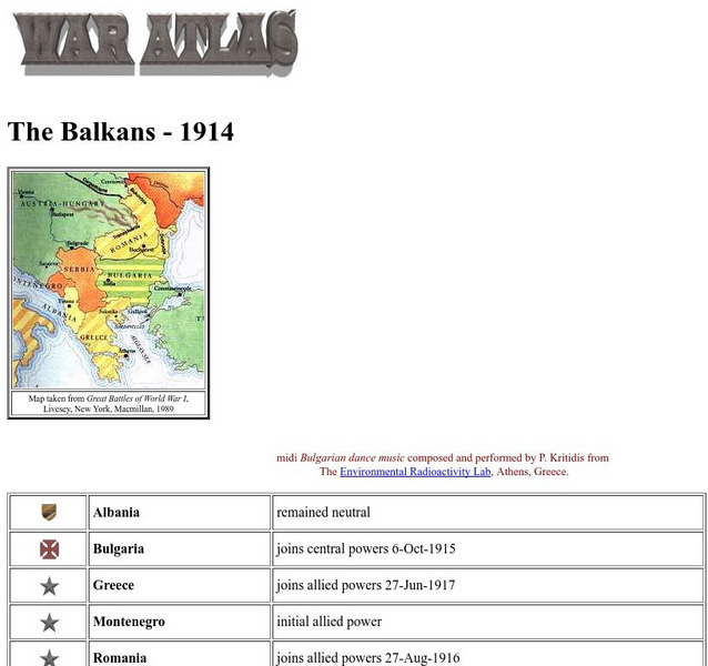
Worldwar1.com: Trenches on the Web: War Atlas: The Balkans 1914
Contains a map of the Balkans, a list of the countries there, and their political positions in World War I.
Curated OER
Image From a New Enemy
In-depth look at World War I. Includes summaries of the war years; sound clips of eye-witness accounts; virtual tours of trenches on the Western Front; maps; articles and overviews; and similar resources.
Curated OER
Image From From Disaster to Victory: The British Army From 1916 1918
In-depth look at World War I. Includes summaries of the war years; sound clips of eye-witness accounts; virtual tours of trenches on the Western Front; maps; articles and overviews; and similar resources.
Curated OER
Image From the German Front Experience
In-depth look at World War I. Includes summaries of the war years; sound clips of eye-witness accounts; virtual tours of trenches on the Western Front; maps; articles and overviews; and similar resources.
Curated OER
Image From Life in the Trenches Virtual Tour
In-depth look at World War I. Includes summaries of the war years; sound clips of eye-witness accounts; virtual tours of trenches on the Western Front; maps; articles and overviews; and similar resources.
Curated OER
Image From the Western Front: Lions Led by Donkeys?
In-depth look at World War I. Includes summaries of the war years; sound clips of eye-witness accounts; virtual tours of trenches on the Western Front; maps; articles and overviews; and similar resources.
Curated OER
Image From Versailles and Peacemaking
In-depth look at World War I. Includes summaries of the war years; sound clips of eye-witness accounts; virtual tours of trenches on the Western Front; maps; articles and overviews; and similar resources.
World War 1
Worldwar1.com: Great War Society: Doughboy Center: Cantigny: First Battle of the Aef
A description and first-person account of the battle of Cantigny, the first major battle of the AEF. Includes photographs and maps.
Virginia History Series
Virginia History Series: Virginia State History 20th Century (1900 1920) [Pdf]
Delve into Virginia's pivotal role in America's early 20th century through this slideshow. Students can visualize WWI, Virginia's naval bases, and other events such as the suffrage movement and prohibition in Virginia. The slideshow...
Curated OER
Educational Technology Clearinghouse: Maps Etc: Post Wwi Africa, 1918
This map is of Africa after World War I. The scramble by Italy, Belgium, and Germany to create colonies in order to keep up with the British, French, and Spanish Empires was played out in Africa, the last remaining continent yet to be...


