The Newberry Library
Newberry Library: Historic Maps: Revolutionary Boston: Old North Church
"One if by land, two if by sea." This famous quote was the direction Sexton Robert Newman was to follow by shining a lantern from the Old North Church steeple to warn the patriots that the British were coming. The church is the oldest in...
The Newberry Library
Newberry Library: Historic Maps in K 12 Classrooms
Great resource for teachers of geography and American history for all levels. You will find lesson plans based on the use of maps for all ages.
The Newberry Library
The Aztecs and the Making of Colonial Mexico: Europeans Invade the Aztec Empire
Spanish conquistador Hernan Cortes invaded the Aztec empire in the 16th century. This conquest led to the colonization of Mexico. The Newberry Library provides an in depth look into this period of Mexican history through photos,...
The Newberry Library
Newberry: Exploration and Encounter: Map 2: Indian Map of the Southeast, 1721
K-12 lessons using historical maps from Newberry Library presents an Indian map of the Southeast, ca. 1721. Students use maps to understand how spatial relationships are represented. Links to supplemental resources and reference material.
The Newberry Library
Newberry Library: Representing the American Revolution, 1768 to 1893
Primary source documents and learning excercises for student exploring the American Revolution. Lesson on how events of the American Revolution were interpreted in the 18th and 19th centuries and how the meaning has changed over time.
The Newberry Library
Newberry: Environmental History: Map 7: Distribution of Woodland in u.s., 1873
Lesson plans for K-12 using maps that show the distribution of wooded land in 1873. Students examine the impact of humans on the environment.
The Newberry Library
Newberry: Exploration and Encounter: Map 1: The World Columbus Knew in 1482
Newberry Library presents historical map on the Age of Exploration with lesson plans for all ages k-12. Includes curator notes and a wealth of supplemental resource material.
The Newberry Library
Newberry: Migration and Settlement: Map 5: Fremont Survey: Missouri Oregon, 1843
Lesson plan on migration and settlement in the U.S. ca. 1843, uses primary source map of the Missouri-Oregon survey done by Fremont and supplemental resources.
The Newberry Library
Newberry: Environmental History: Map 8: Mining in South Dakota, 1878
Lessons for K-12 based on a series of maps teaches students about the environmental changes resulting from mining in South Dakota, 1878.
The Newberry Library
Newberry: Environmental History: Map 9: Conservation, Yosemite Ntl. Park, 1935
Lessons for learners K-12 in which they study original map of Yosemite National Park, ca. 1935 and explore appropriate human uses of the environment.
The Newberry Library
Newberry: Historical Geography of Transportation: Map 10: United States, 1835
Lessons K-12 examining the role of transportation systems in the development and settlement of the lands between the Appalachian Mountains and the Mississippi River.
The Newberry Library
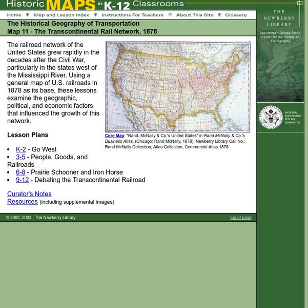
Newberry: Historical Geography: Map 11: The Transcontinental Rail Network, 1878
Lesson for K-12 using historical maps examine the geographic, political, and economic factors that influenced the growth of railroads.
The Newberry Library
Newberry: Geography of Transportation: Map 12: Auto Trails of Florida, Ca. 1924
Lessons for students K-12 using historical maps teach students about the history of travel and tourism by car, identifying the technological and economic changes taking place in the 20th Century.
The Newberry Library
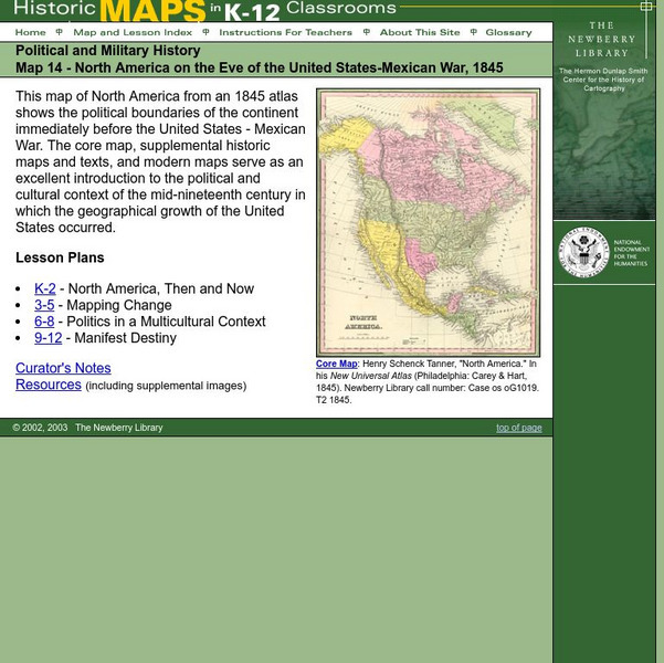
Newberry: Political and Military History: Map 14: u.s. Mexican War, 1845
Lessons for students in K-12 depicting North America prior to the United States and Mexico War, 1845. Students explore the mid-century political and cultural context in which the U.S. experienced growth and expansion.
The Newberry Library
Newberry: Political and Military History: Map 15: The World at War, 1944
Lesson for K-12 using historical map teaches students about the relationship between perspectives of the world and map projections.
The Newberry Library
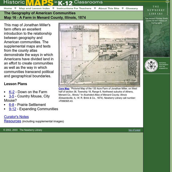
Newberry: Geography: Map 16: A Farm in Menard County, Illinois, 1874
Lessons in which students K-12 explore an 1874 map of an Illinois farm and supplemental material to gain a sense of the relationship between the geography and American communities.
The Newberry Library
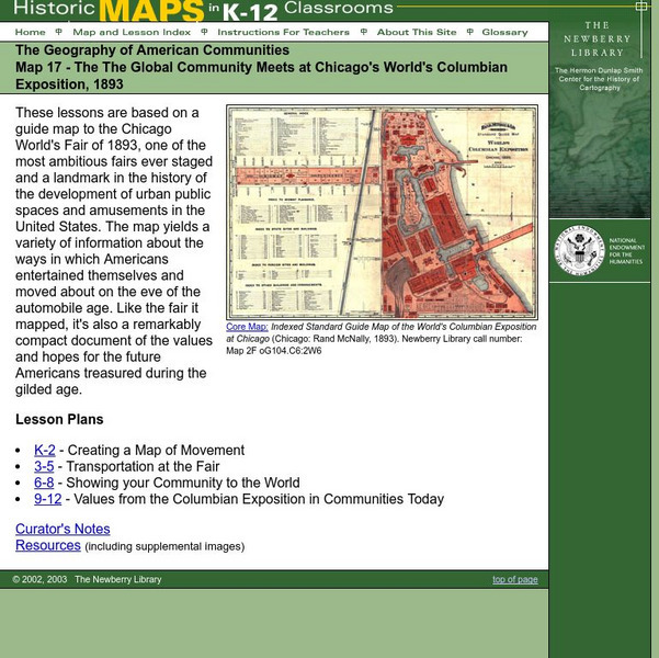
Newberry: Map 17: Geography: Chicago's World's Columbian Exposition, 1893
Students K-12 explore a map of the Chicago World's Columbian Exposition, 1893, to get a sense of how Americans entertained themselve prior to the automobile.
The Newberry Library
Newberry: Geography: Map 18: Metropolitan Los Angeles, 1979
Lessons for K-12 in which students use a 1979 Rand McNally highway map to explore the cultural, historical and physical geography of metropolitan Los Angeles.
The Newberry Library
Newberry: 1893: Chicago and the World's Columbian Exposition
Historical photos of Chicago during the Columbian Exposition, also known as the Chicago World's Fair, gives viewers a sense of the image Chicago was trying to portray through the ideals expressed in the architecture.
The Newberry Library
Newberry Library: Anti Statism in u.s. History
Newberry Library digital collections presents a lesson using primary sources from which students explore the concept of "anti-state" sentiment and examine the reasons writers and politicians protest the authority of the federal...
The Newberry Library
Newberry: Aphra Behn's Oroonoko: Slavery and Race in the Atlantic World
Newberry Library lesson using digitized primary source explores how Aphra Behn's novel, Oroonoko, compares to other representations of race, slavery, and colonialism in the seventeenth and eighteenth centuries. Questions to consider are...
The Newberry Library
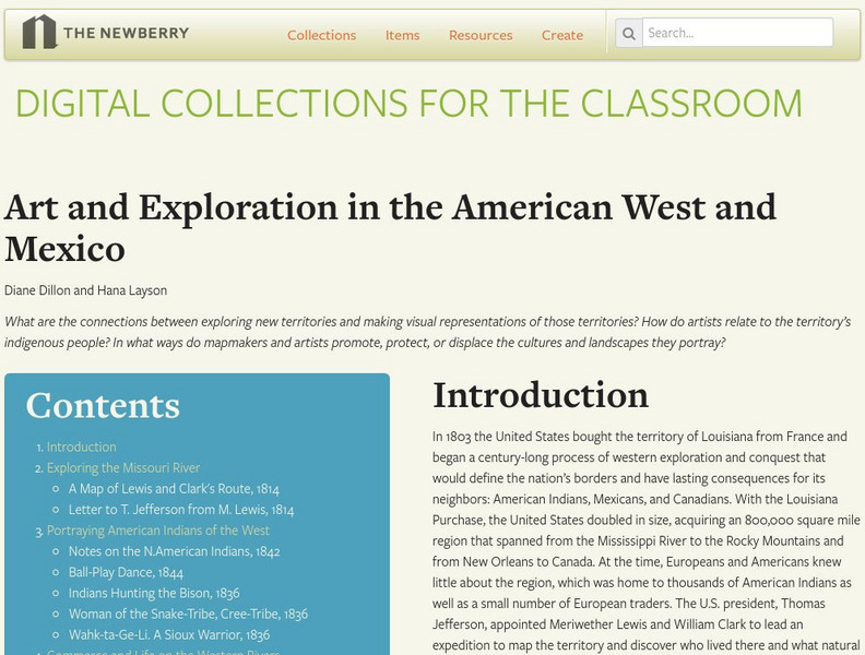
Newberry Library: Art and Exploration in the American West and Mexico
Lesson on the 19th Century representation through art and maps of indigenous population and territory of the American West and Mexico. Primary source documents and questions for discussion are included.
The Newberry Library
Newberry Library: Art and Exploration of the Poles
Resource with lesson and primary source documents examines the connections between exploration of the North and South Poles and their visual representation.
The Newberry Library
Newberry Library: Art of Conflict: Portraying American Indians, 1850 to 1900
Lesson uses digitized primary source material to examine the portrayal of American Indians in art between 1850 and 1900. Classroom activities and questions for discussion included.


