Curated by
ACT
This Union College: North Atlantic Trade, 1770 graphic also includes:
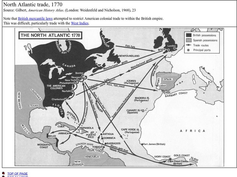
This is a map that shows the trade routes, principal ports, goods being traded, and the areas possessed by the British and the Spanish.
3 Views
3 Downloads
Concepts
Additional Tags
Classroom Considerations
- Knovation Readability Score: 3 (1 low difficulty, 5 high difficulty)

