Curated OER
Cypress/Tupelo Swamps
Students study the geologic history of terrain, soils, and drainage patterns. They recognize ecological processes that determine the dynamic nature of habitats. They investigate the influence of human activity on the landscape.
Curated OER
Water, Rivers & Topography
High schoolers explore the topography of Idaho and the importance of surface water and drainage. using digital maps, they inspect the courses of major rivers, Yellowstone Hot Spots, and the natural landscaping of Pocatello. Students...
Curated OER
Take Me to the River! Using the Black River for Earth Science Review
Ninth graders use maps to identify landscape regions and drainage patterns producing the Black River. They create PowerPoint presentations pertaining to the Black River watershed, its geologic history and highlighting safe rafting...
Curated OER
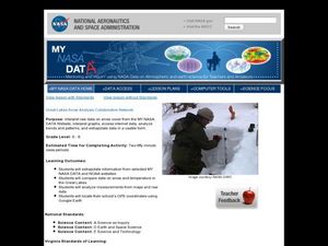
Great Lakes Snow Analysis Collaborative Network
Middle schoolers interpret data on snow cover and analyze trend patterns. In this snow lesson students compare data and locate their school's GPS coordinates.
Curated OER
Science: Draining the Land - the Mississippi River
Students use topographic maps to identify parts of rivers. In addition, they discover gradient and predict changes in the channels caused by variations in water flow. Other activities include sketching a river model with a new channel...
Curated OER
Water-Is There Going to be Enough?
Students research the availability, usage and demand for water in the local area historically and use projections of the availability, usage and demand for water up to the year 2050. They gather data and present the information in...
Curated OER
Can You Catch the Water?
Students work together to construct a model of a water catchment basin. They survey water patterns and complete experiments to see where rain travels and collects. They discover how engineers design structures that help with drainage.
Curated OER
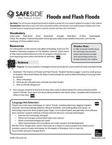
Floods and Flash Floods
Junior geologists, hydrologists, or meteorologists simulate what happens during the flooding of a river and demonstrate factors that contribute to flash flooding. This outstanding resource provides a vocabulary list, online resources,...
Curated OER
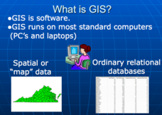
Applications of GIS
Don't be concerned that the title slide of this presentation mentions Virginia's Geospatial Extension Program; this slide show is very informative for any technology-focused curriculum when considering global information systems. It...
Curated OER
PA Watersheds, Many Ways to the Sea
High schoolers examine the water cycle and the factors that interact with watersheds. In this watersheds lesson students describe the purification process, trace the flow of infiltrate water through aquifers, and research the...
Curated OER
The Mussels Are Coming
Students work together to identify and describe the various types of mussels. Using a color-coded system, they plot the arrival date of zebra mussels in North American waters. They discuss the increase in their population with the class.
Curated OER
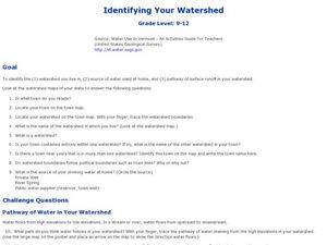
Identifying Your Watershed
Students identify the watershed where they live and how it is related to their own water consumption. In this watershed activity students locate their watershed on their town map. The students find the source of their water that they use...
Curated OER
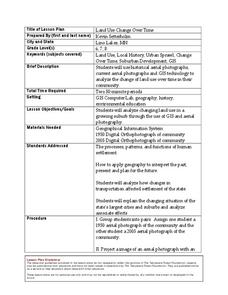
Land Use Change Over Time
Learners use historical aerial photographs and current aerial photographs to compare the change over time to the land. In this land changing lesson plan, students analyze, compare, contrast, and list the land change in their own community.
Curated OER
Animals Finding Rice Paddies
Fourth graders examine the animals who live in rice paddies and create a chart. In this rice lesson, 4th graders link the types of animals living in each ecosystem with a bar graph. Students use colored bars to show...
Curated OER
My Water's Place in Space
Young scholars discover their absolute and relative place in space relative to water and create a book sequencing that space from most specific to most general.
University of Oregon
Streams and Stream Dynamics/evolution of Drainage System
Drainage basis and drainage patterns, in addition to the three stages of stream development(youthful, mature, old age).
Curated OER
Etc: Maps Etc: Drainage Lines of the Eastern Adirondacks, 1911
A contour map from the vicinity of Elizabethtown showing the rectangular pattern of relief and drainage lines in fault-block mountains of the eastern Adirondacks.
Curated OER
Etc: Maps Etc: The Lake Region of North America, 1911
A map from 1911 showing the lake region of the Laurentian Plateau and adjacent areas, primarily north of the International boundary in the region known as the Canadian Shield. Only the principal lakes are shown. As indicated in the text,...
Curated OER
Etc: Trans Pecos Highlands, Texas, 1911
A contour map from 1911 of a fault-block mountain in the Trans-Pecos Highlands, Texas, showing typical relief and drainage patterns.
Curated OER
Educational Technology Clearinghouse: Maps Etc: South China, 1971
"South China comprises the drainage basins of the middle and lower Yangtze River, the basin of the His Chiang (West River) in Kwangtung and Kwangsi; and the mountainous coastal provinces of Fukien and Chekiang. The division between the...


