Curated OER
Geography: Puerto Rico
Take a trip to Puerto Rico! Learners engage in a web quest, identify Puerto Rico on the map, and gather information related to physical features and cultural factors. Their efforts culminate when they design a brochure comparing the...
Curated OER
Puerto Rico: The 51st State?
Learners research the history of Puerto Rico, its culture, and geography. In this Puerto Rico lesson, students find Puerto Rico on a map and find specific regions or cities. Learners discuss Puerto Rico's statehood and listen to salsa...
Curated OER
Puerto Rico: The 51st State?
Students examine the political status of Puerto Rico. In this global studies lesson plan, students explore Puerto Rico and consider the feelings of Puerto Ricans regarding their unique political status.
Curated OER
Puerto Rico . . . Its Land, History, Culture, and Literature
Students examine Puerto Rico's location and from its geographic location, reflect on its culture and people. They also read a play by a Puerto Rican author. This is an excellent cross-curricular unit, including history, geography, and...
US Mint
Absolutely and Relatively: The Puerto Rico Quarter Reverse
How much does your class know about Puerto RIco? How much can they learn from the back of a 2009 quarter? Use the coin, part of a series of quarters that depict US territories, to teach learners about the geography, culture, and history...
Curated OER
Island Culture: Puerto Rico
Students explore the culture of Puerto Rico. They create maps of Puerto Rico and the Caribbean. They work in small groups to research a decade in history and add drawings and pictures to a timeline of their decade. They practice...
Curated OER
Point Me to Puerto Rico
Students research the physical features and geography of Puerto Rico as well as locate it on a world map and identify its major characteristics. Pictures and postcards are shown to each class for a visual connection to Puerto Rico as...
Curated OER
Mapping Puerto Rico
Pupils use maps to discover where Puerto Rico is located. In groups, they use the internet to research the vegetation. They also compare and contrast the relationship between the United States and Puerto Rico's government.
Curated OER
What And Where is Puerto Rico?: History of Puerto Rico
Young scholars study the history of Puerto Rico. They define what a commonwealth is and how Puerto Rico became a commonwealth of the United States. They research websites for history of Puerto Rico and how it operates today. They...
Curated OER
What and Where is Puerto Rico?
Learners explore Puerto Rico. They create K-W-L charts of their prior knowledge of Puerto Rico and observe maps of Puerto Rico. They code the map for measurements and land and water forms. They explore websites to gain background on...
Curated OER
Geography of Puerto Rico - Review Questions
In this geography of Puerto Rico worksheet, students answer short answer questions about facts of geography in Puerto Rico. Students complete 10 questions.
Curated OER
Caribbean Cooking
Students complete a unit that explores the cultures of the Caribbean, Puerto Rico, the Dominican Republic, and Cuba through cooking. They follow step-by-step directions of a variety of recipes, create a Caribbean scrapbook or cookbook,...
Curated OER
Water Issues on Puerto Rico and Oahu: A Comparison of Two Islands
Fifth graders explore how the tow islands receive and use fresh water. They also address some of the threats to the fresh water supply on each island. Students explore the lesson objectives through water cycle models and experiments.
Curated OER
Natural Puerto Rico
Pupils explore the nature of Puerto Rico. They view a Power Point presentation on world population and discuss how Puerto Rico landscape differs from Wisconsin's landscape. They create a Venn diagram comparing the two and complete a...
Curated OER
To Be Or Not To Be a State? That Is the Question
Eighth graders research Puerto Rico's culture, religion, language, government, etc. and identify differences and similarities with the United States. They participate in a debate about whether or not Puerto Rico should become a state.
National Endowment for the Humanities
La Familia
Young scholars identify at least one country where the Spanish language is spoken, describe similarities and differences between Spanish, Mexican, and Puerto Rican families, and practice speaking the Spanish words for several family...
Curated OER
Geography: Caribbean
Students research and view a video on the geography of the Caribbean. In this Caribbean geography lesson, students go on an imaginary trip to the Caribbean and write postcards and letters telling of their trip. Students will include...
Curated OER
Tropical Regions/Mapping Biodiversity
Pupils use a world map to locate the country of Puerto Rico. In groups, they identify the various types of vegetation found on the island. They compare and contrast the biodiversity of the country to the United States. To end the...
National Geographic
Mapping the Americas
Celebrate the geography of the Americas and develop map skills through a series of activities focused on the Western Hemisphere. Learners study everything from earthquakes and volcanoes of the Americas and the relationship between...
Curated OER
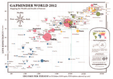
Gapminder World 2012
Here is a very interesting infographic that compares the average life expectancies, per capita incomes, and population sizes of every country in the world in 2012.
Curated OER
Geography of the United States
Students examine the population growth of the United States. In this Geography lesson, students construct a map of the fifty states. Students create a graph of the population of the USA.
Curated OER
The United States and Canada Review Worksheet and Study Guide
In this geography skills activity, students respond to 34 short answer questions about the geographic features and climates found in the United States and Canada.
Curated OER
Bank Loans Money to Start Businesses
After locating Latin American countries on a world map, children read about how microbanks are loaning money to help start small businesses. Involving both current events and economics, the teacher introduces the article with a map...
Curated OER
Globe Skills Lesson 4 The Colonial Period
Students practice their map skills. In this Colonial geography lesson, students complete an activity that requires them to locate English colonial locations using latitude and longitude coordinates.


