Curated OER
CLIMATE AND WEATHER UNIT
Young scholars locate on-line weather source, gathers and interprets weather data, work collaboratively on-line with other schools to collect weather data, and write about the cause of temperature inconsistencies in various locations.
Curated OER
Physical Features
Students draw physical land features using ClarisWorks or Kid Pix, write their definitions, create slideshow, and create class geography book.
Curated OER
Where in the World? :Understanding Latitude and Longitude
Students play a grid-based game and devise clues to help classmates locate spots on the globe in order to recognize the value of using longitude and latitude for identifying locations.
National Endowment for the Humanities
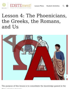
Lesson 4: The Phoenicians, the Greeks, the Romans, and Us
Learners review knowledge gained in the three-part unit on the history of the alphabet. Using maps and images, learners consolidate their understanding of ancient Greece, the Romans and the Phoenicians, and their respective impacts...
Curated OER
Tracking Satellites Using Latitude and Longitude
Students, viewing an Internet site, plot the path of several satellites using latitude and longitude over the course of an hour. They learn the four basic types of satellites and their purpose.
Curated OER
The Amazing Race
Learners improve their directional awareness by locating sites and symbols on a map. They increase their heart rates while traveling to each site and performing the specified task/exercise at each site.
Curated OER
Create a Country
Learners work in small groups to list features and elements found on a variety of grade- appropriate maps. They develop a class list of map features and elements to draw from as they create a map of an imaginary country.
Curated OER
NATO Geography & Language
The class receives background information on NATO, an atlas, and a blank world map. They color the original 1949 countries in red, the 1952 additions in green, and the 1990 additions in blue. This exercise would be a good starting point...
Curated OER
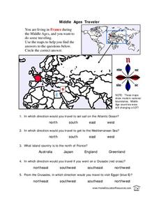
Middle Ages Traveler
In these Middle Ages worksheets, students use the maps to help them find the answers to the questions that help them understand the directions of north, south, east and west. Students also color another map of France according the...
Curated OER
Fun With Pacific Northwest Cities and Towns
Intended for fun only, learners play with the names of cities common to their region or state. This lesson includes a list of cities in Oregon and not much else. What you and your class choose to do with your list of cities is up to you.
Curated OER
Compass Rose Activity
Which direction is which? Use this compass rose labeling instructional activity to practice with basic directions as learners fill in the compass themselves. They use cardinal and intermediate direction abbreviations. Consider using...
Curated OER
Compass Rose
Keep it simple and visual when practicing directions using this compass rose labeling worksheet. Learners fill in the compass themselves, using cardinal and intermediate direction abbreviations. North is done for them. Consider using...
Curated OER
All About the Animals
Whose footprints are those? After reading Janet Halfmann's book, Little Skink's Tail, young scholars use footprints to determine where on a gridded map certain animals have been spotted. They use the map to answer 3 questions, one...
Curated OER
Map Scale
Third and fourth graders are introduced to the concept of map scale. Using an illustration, they discuss if it shows the actual size of the object and why scale is used to represent areas. They use some items in the illustration to...
Curated OER
North, South, East, and West
A basic lesson plan on the teaching of the cardinal directions awaits your class. They are directed to go to different parts of the playground and where they attempt to describe their location in relation to each other by using the...
Curated OER
Shadow Trackers
Young scholars use online websites to inquire about the cycle of day and night. For this web based lesson, students are able to see the movement of the sun and Earth. Young scholars can look at different parts of the Earth as if they...
Curated OER
The Roman Empire-Map Activity
In this Roman Empire worksheet, students complete a map activity in which they label and color civilizations, countries and physical features as instructed. There are no maps included.
Curated OER
Mapping It Out
This PowerPoint provides information about maps. Students discover the functions of legends, compasses, indexes, and scales on maps. Two resources links are provided, however one of them is broken.
Curated OER
Finding My Way
Learners determine a route from their home to the Stones River National Battlefield. In this map work lesson plan, students use a detailed city map of Murfreesboro to locate a route to the Stones River National Battlefield. They follow...
Curated OER
Maps in Kindergarten: Rosie’s Walk
Students are read, Rosie's Walk by Pat Hutchins. In this sequencing lesson, students discover the importance of knowing how to create a map and read it. They listen to the story and complete various map making activities.
Curated OER
Map Studies
Students study maps and use web based activities to develop their mapping skills. In this mapping skills lesson plan, students use the internet to define cartography they make a list of information regarding a typical road map and...
Curated OER
Mapping the Family
Students research the locations where their fathers have lived. In this map skills lesson, students identify the locations their fathers have lived in the world as they create charts and maps that note the information.
Curated OER
Planting Time
Students research crops grown in the United States. In this agriculture instructional activity, students identify various crops cultivated across the United States as they create charts and maps that note the information.
Curated OER
Introduction to Symbols
Students study the concept of picture symbols as a way to express ideas without using words. In this picture symbol lesson, students place symbols on a U.S. map according to meaning. Students then review various symbols...


