Other
Wizhat: How to Design a Great Web Site
Information on Web designing. Includes learning HTML, write what you're good at, color and design are important, and using tables. Includes example pages of techniques.
US Geological Survey
U.s. Geological Survey: Map Your Schoolyard
Lesson plan introduces the concept of maps while providing a forum to practice the skill of navigating using a map.
University of Calgary
European Voyages of Exploration: Henry the Navigator
This site provides a well-written account of Prince Henry's adventurous personality that led him to become one of Portugal's most famous explorers. Discusses the economic benefits of Portugal's exploration and trade. Note: This tutorial...
Microsoft
Microsoft: Map Reading in the 21st Century
Students learn how to make informed use of new digital mapping information and tools. Learners create hands-on learning experiences for understanding the relevance of maps. The lesson plan consists of student activities, resources,...
Other
The Royal Observatory at Greenwich: Homepage
This site from The Royal Observatory at Greenwich is a very historically important astronomical observatory. The site has a combination of information about astronomy, longitude and time. Information written in highly accessible...
TeachEngineering
Teach Engineering: Nidy Gridy
Normally we find things using landmark navigation. When you move to a new place, it may take you awhile to explore the new streets and buildings, but eventually you recognize enough landmarks and remember where they are in relation to...
TeachEngineering
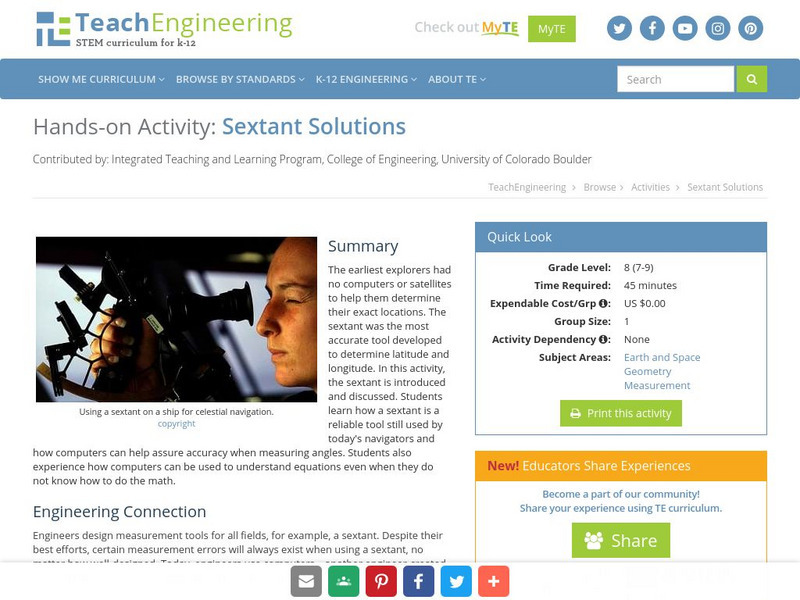
Teach Engineering: Sextant Solutions
The earliest explorers did not have computers or satellites to help them know their exact location. The most accurate tool developed was the sextant to determine latitude and longitude. In this activity, the sextant is introduced and...
TeachEngineering
Teach Engineering: Where Is Your Teacher?
In this activity, students will learn how to take bearing with a compass. They will also learn how to describe a bearing and find an object in their classroom using a bearing.
TeachEngineering
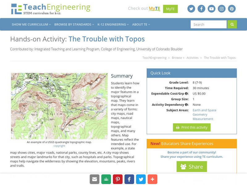
Teach Engineering: The Trouble With Topos
Students learn how to identify the major features in a topographical map. They learn that maps come in a variety of forms: city maps, road maps, nautical maps, topographical maps, and many others. Map features reflect the intended use....
TeachEngineering
Teach Engineering: Topos, Compasses, and Triangles, Oh My!
In this activity, students will learn how to actually triangulate using a compass, topographical (topo) map and view of outside landmarks. It is best if a field trip to another location away from school is selected. The location should...
TeachEngineering
Teach Engineering: Nautical Navigation
In this activity, students explore the importance of charts to navigation on bodies of water. Using one worksheet, students learn to read the major map features found on a real nautical chart. Using another worksheet, students draw their...
TeachEngineering
Teach Engineering: It's About Time
In past times, ocean navigators tossed a piece of wood over the side of their ships and noted how long until the ship passed the wood. They used this time measurement and the length of the ship to calculate their speed and estimate how...
TeachEngineering
Teach Engineering: Gps Receiver Basics
Students familiarize themselves - through trial and error - with the basics of GPS receiver operation. They view a receiver's satellite visibility screen as they walk in various directions and monitor their progress on the receiver's...
TeachEngineering
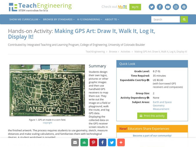
Teach Engineering: Gps Art
Students design their own logo or picture and use a handheld GPS receiver to map it out. They write out a word or graphic on a field or playground, walk the path, and log GPS data. The results display their "art" on their GPS receiver...
TeachEngineering
Teach Engineering: Gps Scavenger Hunt
Students go on a GPS scavenger hunt. They use GPS receivers to find designated waypoints and report back on what they found. They compute distances between waypoints based on the latitude and longitude, and compare with the distance the...
TeachEngineering
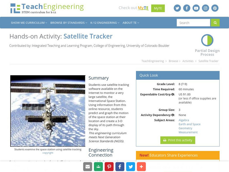
Teach Engineering: Satellite Tracker
Students use satellite tracking software available on the Internet to monitor a very large satellite, the International Space Station. Using information from this online resource, students predict and graph the motion of the space...
TeachEngineering
Teach Engineering: Find It!
In this activity students will learn the basic concept of Global Positioning Systems (GPS) using triangulation and measurement on a small scale in the classroom. Students discover how GPS and navigation integrate mathematic and...
TeachEngineering
Teach Engineering: Where Is Here?
In this instructional activity, young scholars are shown the very basics of navigation. The concepts of relative and absolute location, latitude, longitude and cardinal directions are discussed, as well as the use and principles of a map...
TeachEngineering
Teach Engineering: How to Be a Great Navigator!
In this lesson, students will learn how great navigators of the past stayed on course - that is, the historical methods of navigation. The concepts of dead reckoning and celestial navigation are discussed.
TeachEngineering
Teach Engineering: Navigating by the Numbers
In this lesson, students will learn that math is important in navigation and engineering. Ancient land and sea navigators started with the most basic of navigation equations (Speed x Time = Distance). Today, navigational satellites use...
TeachEngineering
Teach Engineering: Getting It Right!
In this lesson, students will investigate error. As shown in earlier activities from navigation lessons 1 through 3, without an understanding of how errors can affect your position, you cannot navigate well. Introducing accuracy and...
TeachEngineering
Teach Engineering: Topo Map Mania!
Maps are designed to allow people to travel to a new location without a guide to show the way. They tell us information about areas to which we may or may not have ever been. There are many types of maps available for both recreational...
TeachEngineering
Teach Engineering: Getting to the Point
In this lesson plan, students learn how to determine location by triangulation. We describe the process of triangulation and practice finding your location on a worksheet, in the classroom, and outdoors.
TeachEngineering
Teach Engineering: By Land, Sea or Air
In this lesson, middle schoolers learn that navigational techniques change when people travel to different places - land, sea, air and in space. For example, an explorer traveling by land uses different methods of navigation than a...


