EngageNY
TASC Transition Curriculum: Workshop 9
Here's a workshop for teachers that rocks the academic world! Using earthquakes as a medium for instruction, educators learn about crosscutting engineering with science. Fun, hands-on, collaborative exercises encourage participants to...
Centers for Ocean Sciences
Ocean and Great Lakes Literacy: Principle 7
Your mission, should you choose to accept it, is to take your class on an underwater adventure. The final installment in a seven-part series involving salt and freshwater bodies takes junior oceanographers below the surface in...
Consortium for Ocean Leadership
Nannofossils Reveal Seafloor Spreading Truth
Spread the word about seafloor spreading! Junior geologists prove Albert Wegener right in an activity that combines data analysis and deep ocean exploration. Learners analyze and graph fossil sample data taken from sites along the...
NOAA
Water Cycle
Be water wise! Science scholars learn the water cycle on a global scale in part seven of a 13-installment series. The hands-on interactive allows them to explore Earth's water storage, types of precipitation, and the cycling of water...
NOAA
Subduction Zones
Sink into an interactive learning experience about subduction zones! Junior oceanographers examine the earth-shaking and earth-making effects of subduction in the fourth installment in a 13-part series. Hands-on activities include...
NOAA
Mid-Ocean Ridges Interactive
Your class will be on top of their game when it comes to mid-ocean ridges! The second installment in a 13-part series focuses on the 65,000-km underwater ridge system that spans our globe. Junior oceanographers practice placing the...
NOAA
Seamounts
How do chains of islands form? Young oceanographers explore the mountains of the deep in the final installment in a 13-part series. The interactive compares types of seamounts based on their overall height and height under the water, as...
Discovery Education
STEM Camp—Urban Infrastructure
Build a bridge to learning in a STEM-aligned unit about urban infrastructure. Young engineers explore the many aspects of civil planning and design in a five-day unit. Content includes the challenging aspects of balancing building with...
Channel Islands Film
Island Rotation: Lesson Plan 4
Foster's Rule? Allopatric speciation? After watching West of the West's documentary Island Rotation, class members use Venn diagrams to compare endemic species on the Channel Islands with mainland related species. They then create a...
Channel Islands Film
Island Rotation: Lesson Plan 2
Why are Torrey pines only found in La Jolla, California and on Santa Rosa Island? Class members examine images of Torrey pines from these two locations, noting the similarities and differences, and then develop a demonstration model that...
Channel Islands Film
Island Rotation: Lesson Plan 1
How do scientists provide evidence to support the theories they put forth? What clues do they put together to create these theories? After watching West of the West's documentary Island Rotation class members engage in a series of...
Geographer Online
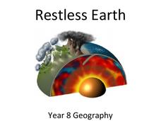
Restless Earth
In less than 25 years, the continent of Australia moved 4.9 feet thanks to plate tectonics. The presentation introduces the idea of the layers of the earth as well as plate tectonics. It goes into why the plates move and where we believe...
NOAA
Where There's Smoke, There's ...
A remotely operated vehicle approaching a volcano was engulfed by molten sulfur where the plumes of fluids contained the highest concentrations of aluminum ever recorded. This isn't science fiction or an April fools joke, though it did...
Columbus City Schools
Constructive and Destructive Geologic Processes
Show the class the world as they've never seen it before—from way above! Learners try to unravel the mysteries presented by rich satellite imagery, learn to interpret topographic maps, and study erosion by constructing their very own...
Columbus City Schools
History Helps When It Comes To Plate Tectonics
Get ready to move, shake, slip, and slide with a well-rounded plate tectonics unit! The engaging resource includes everything you need to inspire eighth grade science scholars, from worksheets to demonstrations. Assess their...
Columbus City Schools
Geological Effects of Plate Tectonics
Don't get your classes all shook up about plate movement, instead use a thorough unit that guides learners to an understanding of plate tectonics. The lessons incorporate a study of the types of plate boundaries and their effects on the...
Science Matters
Earthquakes and Volcanoes Post Assessment
The final lesson in the 20-part series is a post assessment covering earthquakes and volcanoes. Twenty-three questions incorporate each of the previous lessons through multiple choice, justified multiple choice, expanded multiple choice,...
Science Matters
Seismic Activity and California Landforms
By the 19th lesson plan in the 20-part series, scholars realize volcanoes and earthquakes are related to plate boundaries. The lesson plan extends and applies the knowledge by having individuals create a bumper sticker for one specific...
Science Matters
Ring of Fire
Over a period of 35 years, earthquakes and volcanoes combined only accounted for 1.5 percent of the deaths from natural disasters in the United States. The 15th lesson in a 20-part series connects the locations of earthquakes and...
Science Matters
Fault Formations
The San Andreas Fault moves about two inches a year, approximately the same rate fingernails grow—crazy! The third lesson in the series allows for hands-on exploration of various fault formations. Through the use of a Popsicle stick,...
Science Matters
Earth Shaking Events
The world's largest measured earthquake happened in 1960 in Chile, reaching a terrifying 9.5 magnitude on the Richter Scale. The second lesson plan in the 20-part series introduces earthquakes and fault lines. Scholars map where previous...
Scholastic
Lesson Four: The Earth, Layers of Earth
Get your hands dirty with a set of earth science activities! Class members delve into a hard-boiled egg to find the similarities to the earth's layers, create a papier-mâché model of the earth, craft a simulation of the earth's...
Science Matters
Slip Sliding Along
The San Andreas Fault is the largest earthquake-producing fault in California. In the seventh lesson in the 20 part series, pupils create maps of California, focusing on the San Andreas Fault system. The comparison of where California is...
Science Matters
Up and Down Fault Blocks
The Sierra Mountains in Nevada and the Tetons in Wyoming originally formed as fault block mountains. In order to visualize these fault blocks, pupils use construction paper to create layers of earth. They cut the paper models and form...


