Curated OER
Principles of Flight: Where are We?
Students explore the concept of topographical maps. In this topographical map lesson, students discuss how airplanes know where to fly. Students use topographical maps to simulate a field trip on the computer.
Curated OER
From Maps to Models
Students explore watersheds through the use of a topographic map. They observe topographical maps and discuss their characteristics. In groups, students create a model clay island and make a topographical map of it. Afterward, groups...
Curated OER
Planning A Railroad
Students use topographical maps students explain the challenges involved in building the railroad in the Sierra Nevada mountains.
Curated OER
Planning A Railroad Online Lesson
Students plan a route across Donner Summit using topographical maps in order to understand the challenges involved in constructing the railroad in the Sierra Nevada Mountains. In this history lesson, students first discover how to read...
Curated OER
Using Maps to Learn About Antarctic Topography
Learners explore maps and familiarize themselves with features of Antarctica. They utilize a topographical map to create a three-dimensional model of Antarctica. They identify and describe the different regions of Antarctic ice.
Curated OER
Watershed Investigations
Students explore the components of a watershed and the factors that affect it. They read a topographical map and use geometry to determine the area of a watershed. Students estimate the volume of a body of water and perform runoff...
Curated OER
Understanding Topographic Maps
Students are introduced to the characteristics and uses of topographical maps. Using a worksheet, they examine the use of specific terminology and use cutouts to create their own topographical map of an area. They answer discussion...
Curated OER
Listen to the Land
Students discover how we use land. They gain insight into the way we use the land, both for benefit and consequence. Students explore how to 'listen to the land' as they make decisions on how it should be used and the consequences of...
Curated OER
Describing a Landscape
Students identify the geographical features and find them on a map. They describe the continuities and changes in a landscape between 1846 and the present.
Curated OER
Edible Maps
First graders, in groups, identify major geographical features of Texas. They form a topographical map of Texas using edible dough, candy, etc. They present and then eat their maps.
Curated OER
Introduction To Topographic Map Activities
Students discuss different types of maps, their similarities and differences. Using a Topographical Maps CD-rom program students create their own map.
Curated OER
Is Urban Sprawl Causing Us To Lose More Than Ground?
Students map the changes that occur in the land as a result of urban sprawl. They explore the problems that paving and building have on the watershed and the habitats on the Northshore.
Curated OER
Beyond the Tap
Students explain the basic properties of a watershed including how water flows from higher to lower elevations and how watersheds are interconnected. They comprehend how the placement of buildings, roads, and parking lots can be...
Curated OER
Planning a Railroad
Students use a topographical map to plan a route from Doknner Summit to Truckee, then compare it to the route selected by Theodore Judah.
US Geological Survey
Usgs: Finding Your Way With Map and Compass
This resource has a topographic map that tells you where things are and how to get to them. Use this site to help you use a map and compass to determine your location.
TeachEngineering
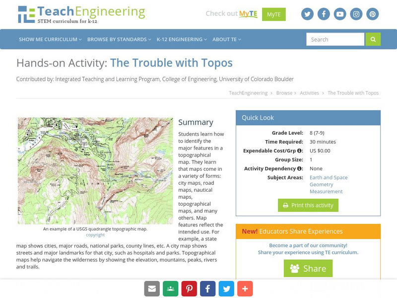
Teach Engineering: The Trouble With Topos
Students learn how to identify the major features in a topographical map. They learn that maps come in a variety of forms: city maps, road maps, nautical maps, topographical maps, and many others. Map features reflect the intended use....
Other
Usgs: The National Map: Us Topographical Map
Use this map to explore the topography of the United States.
Other
Ontario Topographic Map
Features a topographical map of Ontario. Click on different options to edit the map.
Math Science Nucleus
Math Science Nucleus: Topographic Maps
For a picture of a topographical map, go to this page. There is some information to help you understand what they are.
PBS
Pbs Teachers: Water Use: Tragedy in the Owens River Valley
Map the geographical area of a watershed, evaluate watershed use and describe land use practices of the people within one. Investigate the events surrounding the war over the Owens River in California at the turn of the 20th century.


