Curated OER
What Do Maps Show?
This teaching packet is for grades five through eight, and it is organized around geographic themes: location, place, relationships, movement, and regions. There are four full lessons that are complete with posters, weblinks, and...
EngageNY
Reading Maps: Locating the Countries We Have Been Reading About
Show your class how to read a map and decipher all of the markings and features. Start out by connecting maps to their homework from the night before and their current reading, in this case That Book Woman, and a related informational...
Space Awareness
Let's Map the Earth
Before maps went mobile, people actually had to learn how to read maps. Pupils look at map elements in order to understand how to read them and locate specific locations. Finally, young cartographers discover how to make aerial maps.
University of Texas
Essential Reading Strategies for the Struggling Reader
Beneficial for beginning readers, struggling readers, and those in need of review, a set of language arts activities is a great addition to any foundational reading unit. Focusing on phonological awareness, fluency, instructional...
Curated OER
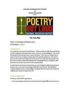
The Tone Map
Poems are meant to be heard. Hearing a poem being read enriches one’s understanding of the tone and mood of the piece. Introduce your class to the sounds of poetry with a packet that not only details how to use poetry recordings in the...
Novelinks
Where the Red Fern Grows: Graphic Organizer, Story Map
How do you grow a goal from a dream to reality? You make a plan! After reading chapters two and three of Where the Red Fern Grows, learners map how Billy earns his dogs by completing an organizer in pairs and then discussing answers in...
Academy of American Poets
Teach This Poem: "Maps" by Yesenia Montilla
After examining a physical map of the world, learners conduct a close reading of Yesenia Montilla's poem "Maps." They note the interesting words and phrases, the way the poem is structured, and list questions they might have. After...
Polar Trec
Playground Profiling—Topographic Profile Mapping
The Kuril islands stretch from Japan to Russia, and the ongoing dispute about their jurisdiction prevents many scientific research studies. Scholars learn to create a topographic profile of a specific area around their schools. Then they...
1 plus 1 plus 1 equals 1
I Can Read! Sight Words Set #4
Perfect for a unit on Mother's or Father's Day, a set of activities based on the sight words love, mom, dad, and at is sure to engage your young readers. From bingo boards to matching maps, kids can spot their sight words in many...
Kate Stickley
Reading the World: Latitude and Longitude Lesson latitude and longitude, maps, coordinates on a map, prime meridian, reading maps, equator, globes
Find five activities all about longitude and latitude! Use oranges to show the equator and prime meridian, plot birthdays on a map using coordinates, and plan a dream vacation.
Curated OER
Orienteering - Lesson 8 - Map and Compass
Put your high schoolers' orienteering skills together. Reading a compass and reading a map. In this assignment the class will use their compass and the map scale to determine the distance of a given route. If they finish their...
Scholastic
Reading Characters
Philip Pullman's The Golden Compass provides the text for a study of how writers bring characters to life. Using the provided character mapping worksheets, readers respond to questions and then write a short character sketch.
EngageNY
Reading Closely to Expand Understanding of Adaptations
Third graders work to determine the main idea, recall key details, and answer questions using an informational text on the topic of animal adaptations. Using the non-fiction text "Staying Alive: Animal Adaptations" (provided) the teacher...
EngageNY
Mid-Unit Assessment: Close Reading of Bullfrog at Magnolia Circle: Bullfrog Life Cycle
The sixth lesson plan in this Bullfrog at Magnolia Circle unit assesses your third graders' ability to read and understand informational text. The included assessment asks learners to take notes about the main idea and supporting details...
EngageNY
Close Reading of Bullfrog at Magnolia Circle: Text-Dependent Questions, Main Ideas, and Key Vocabulary about the Bullfrog
As your 3rd grade class finishes reading Bullfrog at Magnolia Circle, the eighth lesson plan of this unit helps readers from an understanding of the very specific information on the final page of the book. As with the entire unit,...
Texas State Energy Conservation Office
Investigation: Concept Mapping Fuels
After reading an article, "Fuels for Everything," collaborative groups create a concept map poster of the transportation and non-transportation fuels. This makes a strong introduction to the different types of fuels used for transportion...
Just Health Action
Environmental Justice Matters: Mapping Environmental Justice Impacts (Part 1)
A case study of Seattle, Washington permits class members to compare and rank how different areas of Seattle are impacted by environment burdens. Groups investigate different zip codes, collect data on five categories, and color-code a...
Newspaper Association of America
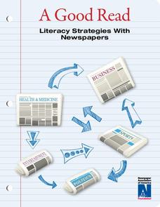
A Good Read
Teach your readers strategies for breaking down informational texts. Pupils develop and implement the tools they'll need to decode texts for the rest of their lives with an informational resource that focuses on the structure and...
Curated OER
Geography and Culture of China
Take out a map, a paper, a ruler, and those coveted colored pencils for a activity on Chinese culture and geography. This is a multifaceted approach to basic geography skills that incorporate story telling, class discussion, primary...
KOG Ranger Program
Fire Behavior in Forests
Understanding the ways a fire will act is a key factor in fire safety and fire prevention. Young campers focus on how the weather and terrain can affect the behavior of a fire with topographic maps and different scenarios.
Curated OER
Orienteering - Lesson 1 - Maps & Map Scales
Lesson 1 of 10 lessons in this orienteering unit is about maps and map scales. After all, orienteering is all about maps, compasses, and finding ones' way around. It is imperative to be able to read maps and understand the relevance of...
Curated OER
Orienteering - Lesson 2 - Topographical Maps
One of the most important skills in orienteering is being able to read a topographical map. Understanding the contour lines and symbols and the scale of the map will make planning your route so much better. In this lesson, partners get...
National Endowment for the Humanities
On This Day With Lewis and Clark
Walk in the footsteps of Lewis and Clark as they discover the wonders, beauty, and dangers of the American frontier. After gaining background knowledge about Thomas Jefferson and the Louisiana Purchase, young explorers use primary...
Ontario
Reading Graphic Text
Do students really need to be taught how to read cartoons, comic books, and comic strips? Yes. Just as they need to learn how to read other forms of graphic text such as diagrams, photos, timetables, maps, charts, and tables. Young...
Other popular searches
- Map Reading
- Map Reading Skills
- Earth Science Map Reading
- Esl Map Reading
- Map Reading Activities
- Basic Map Reading
- Map Reading Powerpoint
- Topographic Map Reading
- Map Reading Grade 6
- Reading Maps and Globes
- Lessons on Map Reading
- Elements of Map Reading


