Curated OER
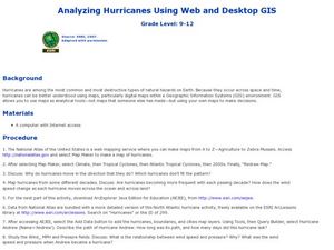
Analyzing Hurricanes Using Web and Desktop GIS
Students analyze hurricanes. In hurricanes activity, students use the Internet and GIS to analyze hurricanes. Students view the National Atlas of Maps to discuss the direction hurricanes move. Students study the wind and pressure fields...
Curated OER
GIS and Agriculture
Students are introduced GIS systems and how they operate. Using a GIS system, they locate and map the various types of agricultural products grown in Oregon. They rank each county based on the amount of agricultural products produced and...
Curated OER
Arc GIS Project: Visualizing the Holocaust
A cross-curricular lesson for middle schoolers that covers language arts, social studies, geography, and math, this is a great extension activity if your class is reading The Diary of Anne Frank or learning about the Holocaust....
Curated OER
Mapping Lab and Lead Poisoning
Students are introduced to GIS and its uses. They make predictions before viewing the actual lead poisoning cases by location of Dade County. Pupils use actual Miami-Dade County spatial data to explore basic principals. Students
Curated OER
Using Maps to Make Public Health Descisions Case Study: Harmful Algal Blooms in the Gulf of Mexico
High schoolers are introduced to GIS and its uses. Students participate as public health scientists to deliberate a course of action to explore possible research questions. Pupils interpret spatial data, and make predictions based on GIS...
Curated OER
Data Processing
Students explore the application of Geographic Information Systems (GIS) in a variety of businesses and organizations. They present proposals, representing different businesses and organizations, that support how GIS technology could...
Curated OER
Image Classification
Students explore what are "multi-spectral" or "multi-band" images? They investigate how landscapes change over time- at least over the time-span of satellite imagery, particulary due to human influences. Students explore how to train...
Curated OER
Can You Give Me Directions To the Game?
Students become familiar with the use and capabilities of GIS and use it for research and mapping purposes. They heighten their ability to estimate travel times by incorporating distance, mode of travel and urban congestion into the...
Curated OER
Indiana Tornado Project
High schoolers become familiar with the use of GIS for research, natural phenomena in Indiana, and analyzing collected information.
Curated OER
Rivers And Capitals
High schoolers become familiar with the use of GIS for research and become aware of the importance of rivers to cities. They also analyze the placement of cities and learn the names of rivers in the United States.
Smithsonian Institution
The Soldier’s Experience—Vietnam versus World War I
The Vietnam War and World War I were two very important—and different—wars. To understand the differences, and similarities, class members watch videos, examine primary source documents, and then create a newscast that examines the...
Curated OER
The Hajj: Muslim Pilgrimage in a Geographic Perspective
Young scholars read information on the Hajj. They discuss pilgrimage and ways it differs from going to a church, mosque or synagogue. Students discuss logistical problems that might be posed for the host country of a pilgrimage. Young...
Curated OER
Donde en el mundo estas?
Students give & follow directions given in Spanish, using oral, written and graphics. They use maps, globes, atlases, and remote sensing, GIS, and GPS to acquire and process information about places.
Curated OER
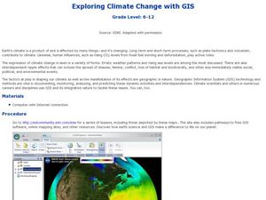
Exploring Climate Change with GIS
Students investigate climatological changes that are occurring to the Earth. In this climate change lesson, students access an assigned web site to view maps and lessons that show how climate change makes a difference to life on Earth.
Curated OER
Exploring Folk Traditions and Folk Beliefs
Ninth graders work together to brainstorm an idea to focus on the similiarties and differences between various cultures. Individually, they interview family members using questions they created based on their topic. They use their...
Curated OER
Central America and the Caribbean
Use the library or Internet to find resources on a chosen topic. The class will comprehend the collected information, structure the information with texts and graphics for a presentation. Each presentation focuses on Hispanic culture and...
Curated OER
Comparing Kwakiutl, Cheyenne and Navajo tribes
Third graders study the difference between the Kwakiutl, Cheyenne and Navajo tribes. They identify the people, resources, lifestyle and beliefs of the Kwakiutl, Cheyenne, and Navajo Indians. Afterward, they present their projects on each...
Judicial Learning Center
The Players in the Courtroom
Courtrooms are complicated. In addition to the many rules, there are a number of people whose jobs are not very clear to the casual courtroom observer. With the resource, individuals identify some of these roles and review more...
Curated OER
GI's, Gals & Gardens
Students, in groups, design a war participation campaign for a specific audience during WWII. They design posters and prepare an oral presentation for the class.
Pulitzer Center
The Crisis in the Ivory Coast
Through reading a variety of news articles and other informational texts, learners discover the political turmoil and intense ethnic and religious tensions that envelop the Ivory Coast today. Class members research the historical...
Gymnázium Karviná
Australia and New Zealand
Send your learners off on a research adventure with a worksheet on essential facts about Australia and New Zealand. It includes 18 short-answer response questions, as well as a map activity where pupils locate a variety of...
Curated OER
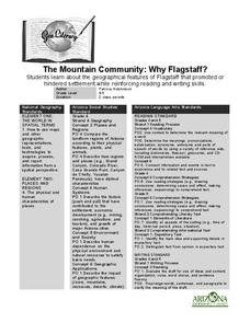
The Mountain Community: Why Flagstaff?
Learners identify geographical features that hindered or promoted settlement in the city of Flagstaff, Arizona. For this settlement lesson plan, students write a summary of what they learned and identify geographical features on a map.
Curated OER
Famous Afro-Americans Historical Sites Recognized by the National Park System
Students use the library to find historical information about each Afro-American. They use magazines, articles from newspapers, and oral histories from video tapes and slide presentations to write biographical sketches about each...
Curated OER
Is Urban Sprawl Causing Us To Lose More Than Ground?
Students map the changes that occur in the land as a result of urban sprawl. They explore the problems that paving and building have on the watershed and the habitats on the Northshore.
Other popular searches
- Gis Data
- Gis Map
- Gis Software
- Gis Environment
- Gis and Gps Technology
- Gis Gps
- Gis and Remote Sensing
- Gis Data Map
- Geography, Gis
- Gis Lesson Plans
- Gps/gis
- Gis Water


