Curated OER
Changing Planet: Permafrost Gas Leak
Pair earth scientists up to use an amazing online arctic portal mapping tool and Google Earth to analyze permafrost changes. They compare changes to data on atmospheric concentrations of methane to see if there is a correlation. Then...
Curated OER
Applications of GIS
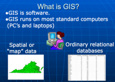
Don't be concerned that the title slide of this presentation mentions Virginia's Geospatial Extension Program; this slide show is very informative for any technology-focused curriculum when considering global information systems. It...
Curated OER
Practical GPS Applications in Forestry & Agriculture
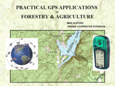
An explanation of the Global Positioning System (GPS) and the Geographic Information System (GIS) is given in this presentation. Uses and applications are considered. How it works and sources of error are also touched upon. A large...
Curated OER
Fostering Geospatial Thinking: Space to Earth: Earth to Space (SEES)
Students locate and access data to help them with their science inquiry. In this geographical positioning lesson students evaluate and compare data sets.
Curated OER
Analyzing Hurricanes Using Web and Desktop GIS
Students analyze hurricanes. In hurricanes lesson, students use the Internet and GIS to analyze hurricanes. Students view the National Atlas of Maps to discuss the direction hurricanes move. Students study the wind and pressure fields to...
Curated OER
Image Classification
Students explore what are "multi-spectral" or "multi-band" images? They investigate how landscapes change over time- at least over the time-span of satellite imagery, particulary due to human influences. Students explore how to train...
Curated OER
TE Lesson: Habitat Mapping
Learners examine the current technologies used in mapping resources in the marine environment. They look at remote sensing, sounding, and underwater vehicles. They examine image from the benthic habitat produced by the GIS in order to...
Curated OER
Calculating Impervious Cover in the City of Austin
Students use GIS to calculate park impervious cover in Austin, TX. They consider that there are different types of impervious cover from hard, packed dirt to cement paving. Students consider the limitations of data in several areas...
Curated OER
Using Maps to Make Public Health Descisions Case Study: Harmful Algal Blooms in the Gulf of Mexico
Students are introduced to GIS and its uses. Students participate as public health scientists to deliberate a course of action to explore possible research questions. Pupils interpret spatial data, and make predictions based on GIS data,...
Curated OER
Mapping Lab and Lead Poisoning
Students are introduced to GIS and its uses. They make predictions before viewing the actual lead poisoning cases by location of Dade County. Pupils use actual Miami-Dade County spatial data to explore basic principals. Students
Curated OER
Data Processing
Students explore the application of Geographic Information Systems (GIS) in a variety of businesses and organizations. They present proposals, representing different businesses and organizations, that support how GIS technology could...
Curated OER
Where to Live?
Learners decide where they want to live in US. In this geography lesson, students select their residential preferences. Using GIS, they determine the location that meets their preferences.
Curated OER
Where to Live?
Pupils examine types of spatial data found in a GIS. In this geography lesson students use a GIS to facilitate analysis and decision making.
Curated OER
GIS Mapping: Special Instructions for Using Digital Orthophotos
Students practice cartography using GIS technology. They create a map of Austin using GIS and aerial photos.
Curated OER
GIS: Mapping Watersheds of the Edwards Aquifer in Travis County
Students manipulate existing GIS data to create and map a new layer of information that shows that watersheds in Travis County that are on top of Edwards Aquifer. They create and map that shows the watersheds in Travis County that are on...
Curated OER
GIS and Agriculture
High schoolers are introduced GIS systems and how they operate. Using a GIS system, they locate and map the various types of agricultural products grown in Oregon. They rank each county based on the amount of agricultural products...
Curated OER
What Is That Bubblin' In My Back Yard?
Students are introduced to the GIS system. They create a map plotting local sites the Environmental Protection Agency has on its EPA Regulated Sites list. They identify a list of schools that are near potentially hazard sites.
Curated OER
Geographic Information Systems
Students examine the concept of geographic information systems (GIS) and its basic components. They explore an application program using GIS technology and list the various uses for GIS.
Curated OER
Mapping Your Neighborhood
Young scholars define and outline their neighborhoods using GIS (geographic information systems) or a regional map and relate their neighborhoods to the principles of Smart Growth.
Curated OER
Rivers And Capitals
High schoolers become familiar with the use of GIS for research and become aware of the importance of rivers to cities. They also analyze the placement of cities and learn the names of rivers in the United States.
Curated OER
Indiana Tornado Project
High schoolers become familiar with the use of GIS for research, natural phenomena in Indiana, and analyzing collected information.
Curated OER
Can You Give Me Directions To the Game?
Students become familiar with the use and capabilities of GIS and use it for research and mapping purposes. They heighten their ability to estimate travel times by incorporating distance, mode of travel and urban congestion into the...
Science Buddies
Science Buddies: Science Careers: Mapping Technician
Mapping technicians, also called surveying technicians, as their name suggests, use many different tools to make maps of many kinds. This Science Buddies site lays out the requirements needed to become a mapping technician, as well as...
Wikimedia
Wikipedia: Geographic Information System
Gives in-depth information about GIS - its history, what it is, techniques and tools, applications, etc.


