AGSSS
World Regions
Help your learners to visualize where historical events have taken place around the globe with a map that details the major regions of the seven continents.
Curated OER
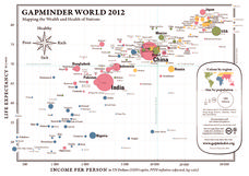
Gapminder World 2012
Here is a very interesting infographic that compares the average life expectancies, per capita incomes, and population sizes of every country in the world in 2012.
Curated OER
People Change the Landscape
Young scholars examine ways in which humans have brought change to the natural environment. In this ecology and literacy lesson, students listen to the book Island Boy by Barbara Cooney. Young scholars observe and define map-reading...
Curated OER
Where In the World?
In this where in the world worksheet, students determine locations of continents on a world map. In this cut and paste worksheet, students identify continents' locations on a world map.
Curated OER
Identifying Biomes
In this biomes worksheet, students will use an atlas to find the location of 12 cities listed on a graph onto their world map. Then students will use the cities' annual precipitation to figure out what biomes that city is found.
Curated OER
Continents and Oceans Quiz
Here is a simple quiz you can give your geographers. In it, they must list the world's seven continents and five oceans. They color the landforms green and oceans blue.
Curated OER
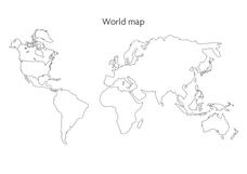
World Map
In this social studies worksheet, students use the unlabeled world map for any geography activity. The individual countries are not marked with border lines.
Curated OER
Continents
Young scholars investigate World Geography by researching the different continents. In this Asian Geography lesson, students discuss the continent of Pangaea and color a worksheet of the continents. Young scholars locate China on the map...
Curated OER
World Pacific Map
In this world Pacific projection outline map worksheet, students examine boundaries of each of the countries in the world. This map not is labeled.
Curated OER
World: Continents
In this blank outline map worksheet, students note the political boundaries of the continents of the world on a Robinson projection map.
Curated OER
World Climate Map
In this world climate map activity, students examine the tropical, dry, warm temperate, cool temperate, polar and subartic, and highland climate regions of the world.
Curated OER
World: Continents Map
In this World outline map activity, students note the political boundaries of the continents of the world on this Robinson projection map.
Curated OER
World Political Map
In this blank outline map instructional activity, students note the political boundaries of the nations of the world on a Mercator projection map.
Curated OER
World: Continents Map
For this outline map worksheet, students note the political boundaries of the continents of the world. The map is labeled with the names of the 7 continents.
Curated OER
Introduction to the World Globe
Students examine a globe and the world map to see what constitutes the differences. In this world map introductory lesson, students discuss what they see when they view the globe. Students then, look at a world map and compare the...
Curated OER
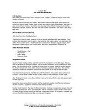
The Globe and World Map
Students explore how to use maps for travel. For this map skills lesson, students read the text, With Love from Gran and discuss the places the character traveled. Students list the names of each city and country on chart paper.
Curated OER
Google Earth
In this Google Earth activity, students access the Google Earth website and find the latitude, longitude, and elevation for their house and school. Then they do the same for a variety of world locations. This activity has 10 fill in the...
Curated OER
World Map
In this world map worksheet, students practice their geography skills as they label the 7 continents and 5 oceans. A word bank in included.
Curated OER
Where Do Hurricanes Happen?
In this hurricanes instructional activity, students label the 6 different regions that hurricanes and tropical cyclones occur around the world.
Curated OER
How Would You Travel To Sydney, Australia?
In this travel planning learning exercise, students use a blank world map to draw a line indicating their route to Sydney, Australia from their own hometowns.
Curated OER
World Map PDF
In this social studies worksheet, 1st graders practice creating the letter "J". They use the example in the lesson plan in order to draw the letters correctly.
Curated OER
World Map and Globe
Students explore symbols. In this beginning map lesson, students identify common picture symbols. Students place post-it notes with symbols drawn on them in the appropriate place on a map.
Curated OER
World Map and Globe
Pupils locate and identify continents and countries. For this world map lesson, students locate and identify one country on each continent.
Curated OER
World Map and Globe - Four Main Directions
Students study the four main directions on a map. For this map lesson, students locate the North and South pole, and learn the four cardinal directions. They use the compass rose on a map to help with the directions. (Map is not included...


