Curated OER
Political Legends and Map Symbols
Students identify the legend and map symbols. In this map skills lesson, students use a world map to find various locations using a map key.
Curated OER
Mapping the Past
Middle schoolers study historical maps to view how the world evolved from medieval times through the Renaissance. They work in groups to examine the maps and present a report on one of the listed maps.
Curated OER
Find a Cave
Students locate their own communites and the nearest caves on a United States map. They calculate the distance to the nearest cave using rough scale.
Curated OER
Water Creates a Cave
Students study the role of water in limestone cave formation and create a cave on karst-like grid on paper.
Curated OER
Cave Diagram
Students examine limestone cave geology and hydology. They study cave vocabulary.
Curated OER
Motivating Activities for Geography Week
Here is a great way to pique your students' interest in geography, and help them learn about their world.
Curated OER
Too Hot to Handle
Students read an online article and research the ten most active volcanoes in the world. They devise an independent public service announcement for evacuating people living near a volcano.
Curated OER
Tracking Satellites Using Latitude and Longitude
Students, viewing an Internet site, plot the path of several satellites using latitude and longitude over the course of an hour. They learn the four basic types of satellites and their purpose.
Curated OER
A Child: Past And Present, Rich And Poor
Ninth graders analyze universal human rights. They examine their causes, consequences, and possible solutions, and discuss selected global issues. They plan and evaluate age appropriate actions to support peace and sustainability in our...
Curated OER
Geography for Life: Using Five Skills
Students use the five skills of geography to reflect on a favorite learning activity. They consider if the activity had all five skills and if it didn't what could have been done to include those that weren't in it. The five skills are...
Curated OER
World Projections
Learners identify map projections and examine polar maps. In this map skills lesson, students use a flat world map to identify various projections and calculate the distances between locations by using a map scale.
Curated OER
Diary of a Worm Secret Agents
Second graders explore the geography of Washington D.C. and President Bush's hometown of Crawford, Texas. They read the book, Diary of a Worm, determine the best route to go to Texas from Washington D.C., and throw a birthday party for...
Curated OER
Learning About the Equator, The Seven Continents and the Four Oceans
Students use a globe or map to locate the equator, oceans and continents. Using the internet, they spend time surfing through predetermined websites on continents and oceans. They write facts on different parts of the globe on index...
Curated OER
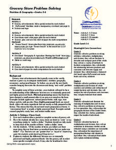
Grocery Store Problem Solving
Students use multiple math skills to complete grocery story problems. In this grocery math lesson plan, students study grocery ads to learn about the cost of foods. Students investigate food types and the costs of processed versus raw...
Curated OER
Turin, Geography, Culture And Sports
Students study why certain locations are suitable to host the Winter Olympics. They research the characteristics of Turin, Italy, plan a trip and create a multimedia scrapbook of the trip.
Curated OER
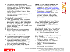
Harvest
Students research the harvest period in Afghanistan. In this harvest lesson plan, students learn about Afghanistan's weather, games children play, rug designing, harvest songs, and more about the harvest time.
Curated OER
Map Study
For this geography worksheet, students study the United States. Students respond to 6 multiple choice questions about the map.
Curated OER
Wild Habitats
Students research and Illustrate the natural habitats of giraffes and other animals imported into ancient Rome. They draw a map of Europe, North Africa, and West Asia and draw the animals that come from each region in their proper places.
Curated OER
Deep Ocean Currents
Students observe the interactions of different temperatures of water using colored ice and a thermometer and then compare the results with global ocean current solar heating. They identify where floating ice would be found in the ocean,...
Curated OER
The Early History of Haiti
Seventh graders make list of places Columbus explored on his first journey to Americas, locate island of Hispaniola on map, examine groups of people who have inhabited island, complete blank map and key of Hispaniola, and research early...
Curated OER
Animal Invasion
Middle schoolers research and illustrate the natural habitats and evolution of giraffes and other animals imported into ancient Rome. They draw a map of Europe, North Africa, and West Asia and draw the animals from each region in their...
Curated OER
Geography and Social Sciences
Students identify and explain how geography is connected to other academic areas and historical events.
Curated OER
Dirty Water: A Case Study
Students identify the causes of arsenic contamination. They list the world organizations involved in ensuring sanitary water supplies. Students describe various methods to mitigate arsenic contamination.
Curated OER
Water, Water Everywhere, and Nary a Drop to Drink!
Students sing the continent song and locate oceans between the continents on a map. They read "They Earth is Mostly Ocean" and copy notes into their journals. They watch a demonstration of water and saltwater evaporated to see what is...
Other popular searches
- China Geography Activity
- U.s. Geography Activity
- Geography Activity Europe
- World Map Activity
- World Geography Activity
- Us Geography Activity
- Greek Geography Activity
- Orange Geography Activity


