Mr. Printables
Map of The USA Jigsaw Puzzle
Encourage young learners to explore the United States with this printable map puzzle. A fun activity that engages children in learning US geography.
Curated OER
Basic U.S. Geography
Provide your 11th graders with a basic understanding of U.S. Geography. They label the state, regions, and boundaries found in the contiguous U.S. as well as Hawaii and Alaska. Then, they complete two Internet related activities.
Curated OER
Geography A to Z: The Letter F
The geography letter of the day is F! The class needs to determine the answer to each of the seven clues with a world location that starts with letter F. Wonderful for a daily warm up or as an exit-card activity.
New York State Education Department
US History and Government Examination: August 2010
Geography has played a complex role in America history. The Atlantic Ocean has served as a buffer to protect the United States from European Wars, but its proximity to Cuba, however, left it vulnerable to nuclear war during the Cuban...
New York State Education Department
US History and Government Examination: August 2011
Using primary source documents, pupils consider how the United States' democratic story has evolved over time. A second essay question examines the role of geography in history, and multiple-choice questions sharpen test-taking skills.
Curated OER
California's Golden History: 1848-1880
Using a variety of online resources, learners study life and society in California during the gold rush. They use a map to identify area where gold was located, explore pre-selected websites, describe mining practices, and create an...
College Board
2003 AP® Human Geography Free-Response Questions
What role has tourism played in changing the landscape of a country? How do human migration patterns affect a nation? To what extent can urban development patterns help us understand our cities? Learners explore these ideas and more...
Curated OER
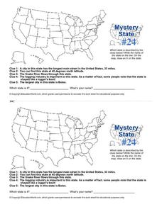
Mystery State # 24
Prepare those brains for a rousing day of learning with a fun geography activity. Your pupils use five different clues to determine the name of mystery state number 24. Where do all those potatoes come from? Idaho!
Curated OER
Discovering American Symbols
Help youngsters get to know their states and capitals, explore their own country, and study American symbolism. They take a "trip" across America collecting symbols, images, and information about each state as they go (through text and...
Curated OER
Geography Application: The Cuban Missile Crisis
A complete activity! The class reads the provided text, then answers the 7 critical-thinking questions. Topics covered are interpreting informational text, reading comprehension, the Cuban Missile Crisis, and US Policy.
Curated OER
Mystery State #32
There is no better way to start a lesson, than with a good problem-solving activity. Give your class the chance to see if they can use each of the five clues to determine the name of mystery state number 32. Hint: It's the eastern most...
Richmond Community Schools
Map Skills
Young geographers will need to use a variety of map skills to complete the tasks required on this worksheet. Examples of activities include using references to label a map of Mexico, identify Canadian territories and European...
Teach Engineering
What's Wrong with the Coordinates at the North Pole?
Here is an activity that merges technology with life skills as individuals use Google Earth to explore the differences between coordinate systems and map projections. The self-guided instructional activity is the fourth segment in a...
Curated OER
Introduction to Canada
Ninth graders investigate the country of Canada by examining their media in this geography instructional activity. They use the Internet to research Canadian newspapers and analyze a topic covered by both US and Canadian media sources....
California Polytechnic State University
Australian Geography Unit
At the heart of this resource is a beautifully detailed PowerPoint presentation (provided in PDF form) on the overall physical geography of Australia, basic facts about the country, Aboriginal history, and Australia culture and lifestyle.
Curated OER
U.S. Geography: The South
Young geographers complete a research project. They list the physical features found in the American South. They then discuss the economy, culture, and geography found in the South. They work in groups to research one of the five...
Curated OER
European Elevation Sort
Given a prepared database of European countries, sixth graders sort the countries in ascending order by elevation and identify the five countries with the highest elevations. This cross-curricular lesson combines elements of computer...
Council for the Curriculum, Examinations and Assessment
Victorian Historians
Take the class back in time to the Victorian Era! The resource provides a plethora of activities that create experiences for scholars in class. Some activities include a fun fair, viewing the starry-night painting, and even experiencing...
Curated OER
Maps Can Help Us
First graders explore the geography of Montana by analyzing geographic maps of the area. In this Native American reservation lesson, 1st graders discuss the similarities and differences between reservations in the state of Montana....
Sharp School
US Geography Landmark Commercial
Experience famous geographical landmarks around the United States right from the comfort of your very own classroom. Learners research national landmarks, such as the Grand Canyon, Yellowstone National Park, and Niagara Falls, and then...
Curated OER
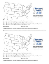
Mystery State # 44
Problem solving comes in all shapes and sizes. Here is a short problem-solving activity that requires learners to use five clues to determine the name of mystery state number 44. Do you know from which state Elvis hails?
Curated OER
Mystery State #2
Which is the mystery state for today? Using five super clues, your class will work to uncover which state is being described. They'll have no problem remembering facts about Nevada after this fun warm-up activity.
Curated OER
Landforms of Illinois
Fifth and sixth graders are introduced to the primary landforms of Illinois and discover how they were created. Landform cards are made for each pupil. They use the twenty-questions format until they have identified each one. Then,...
Teach Engineering
Where Are the Plastics Near Me? (Mapping the Data)
The last activity in a nine-part series has teams create a Google Earth map using the data they collected during a field trip. Using the map, groups analyze the results and make adjustments to the map to reflect their analysis. A short...


